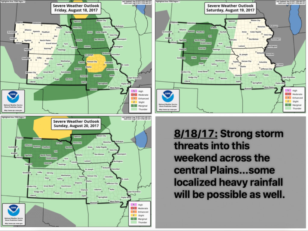
Key Points – Friday, August 18, 2017:
Synopsis: Good Friday morning! Today we discuss the unsettled weekend ahead regarding multiple storm threats across the central Plains, some of these storms will be strong to severe with localized heavy rainfall possible as discussed in the video. We touch on the latest solar eclipse forecast and a continued active storm threat working into next week as well…touching on more threats of heavy rainfall and severe storm risks. If you have any questions please let us know, have a blessed weekend!
Today’s video (7 min):
Strong storm threats into the weekend:
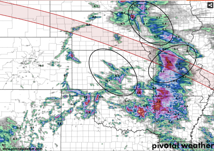
Precipitation guidance through the weekend. I circled the areas where I think rainfall will be most enhanced, watching the western half of Iowa into central Missouri this afternoon through tonight, then far southern Nebraska into central Kansas Saturday night. (The red line on the map overlays the solar eclipse path on Monday).
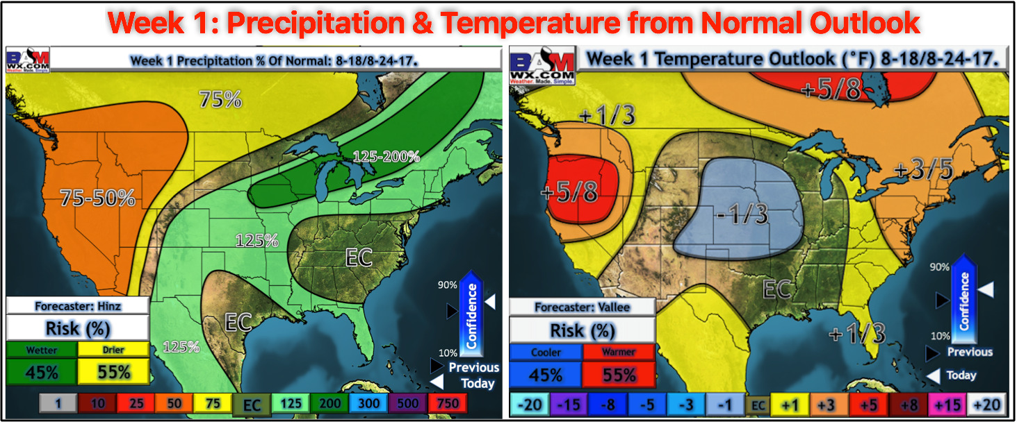
Updated week 1 precipitation and temperature outlooks issued this morning:
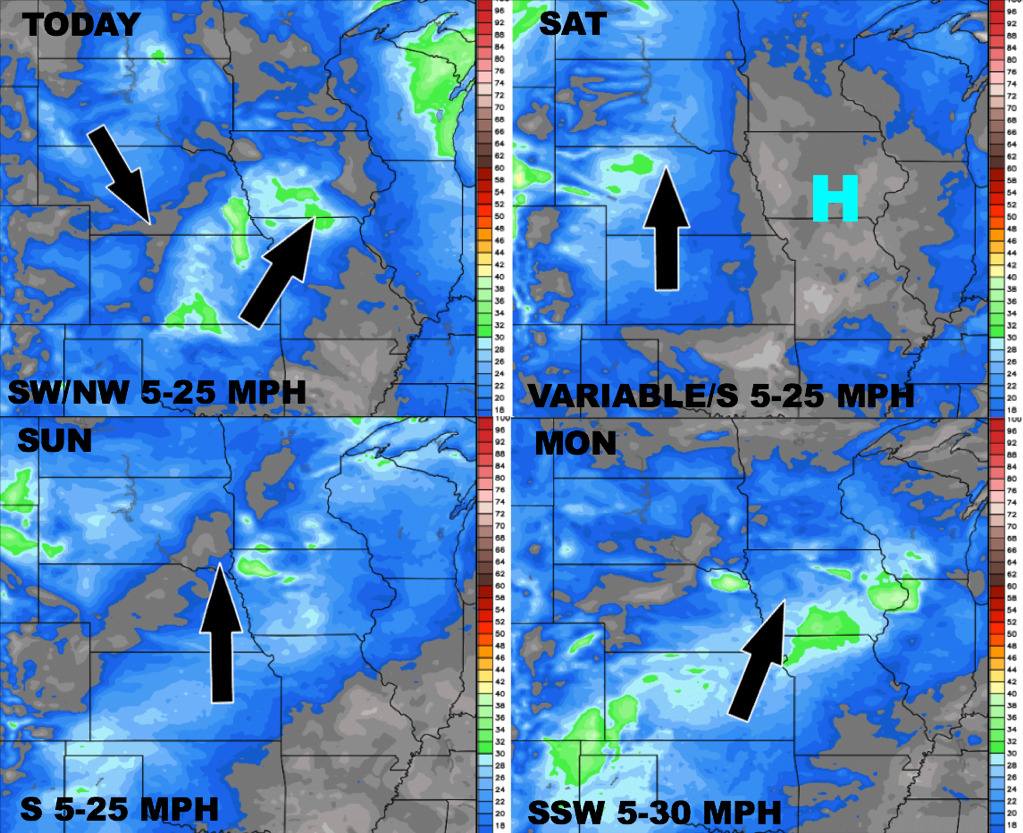
Wind forecast over the next 4 days:
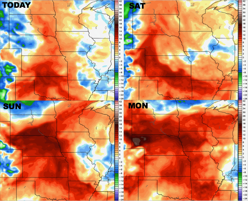
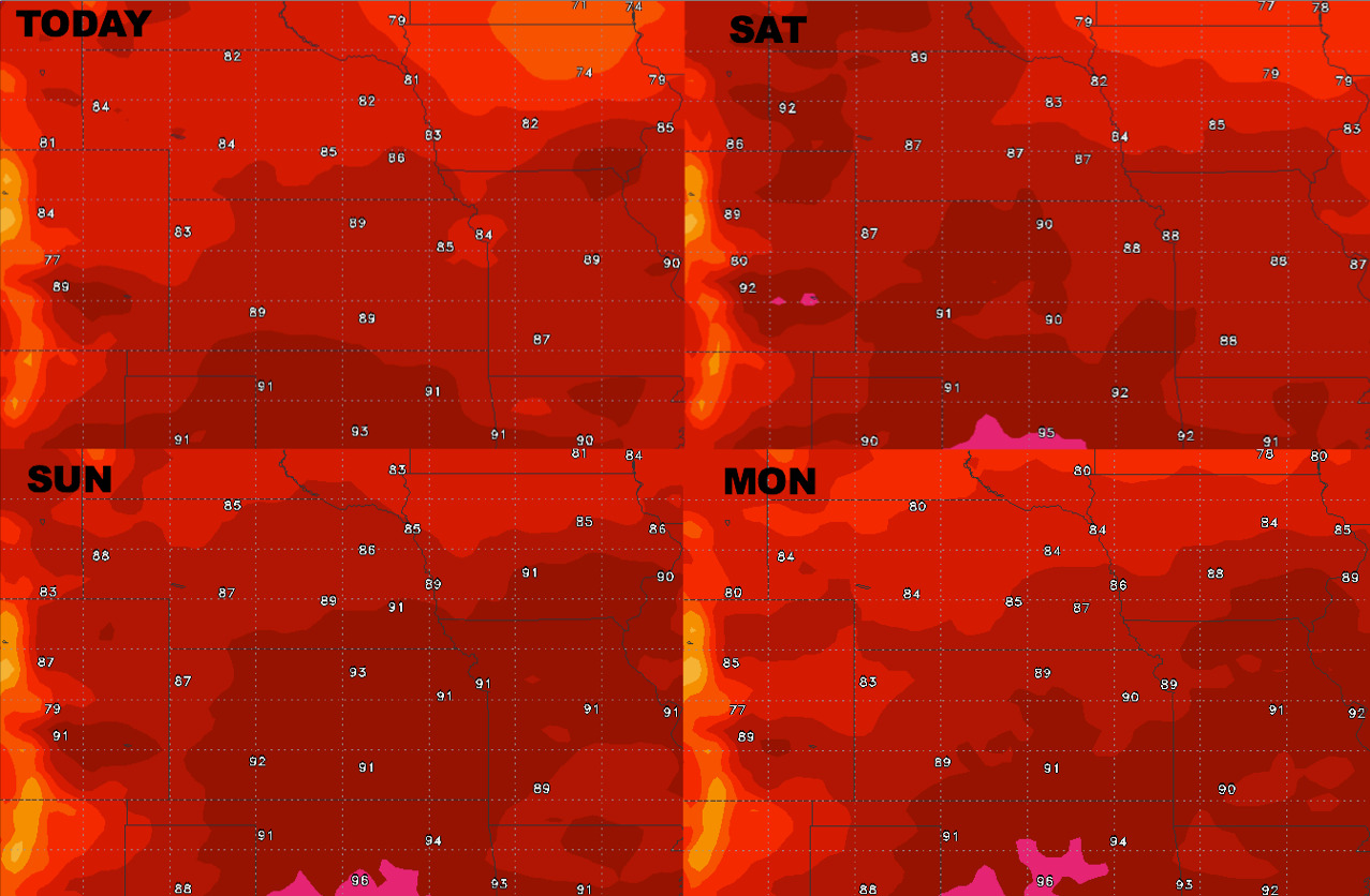
High temperature guidance into early next week:
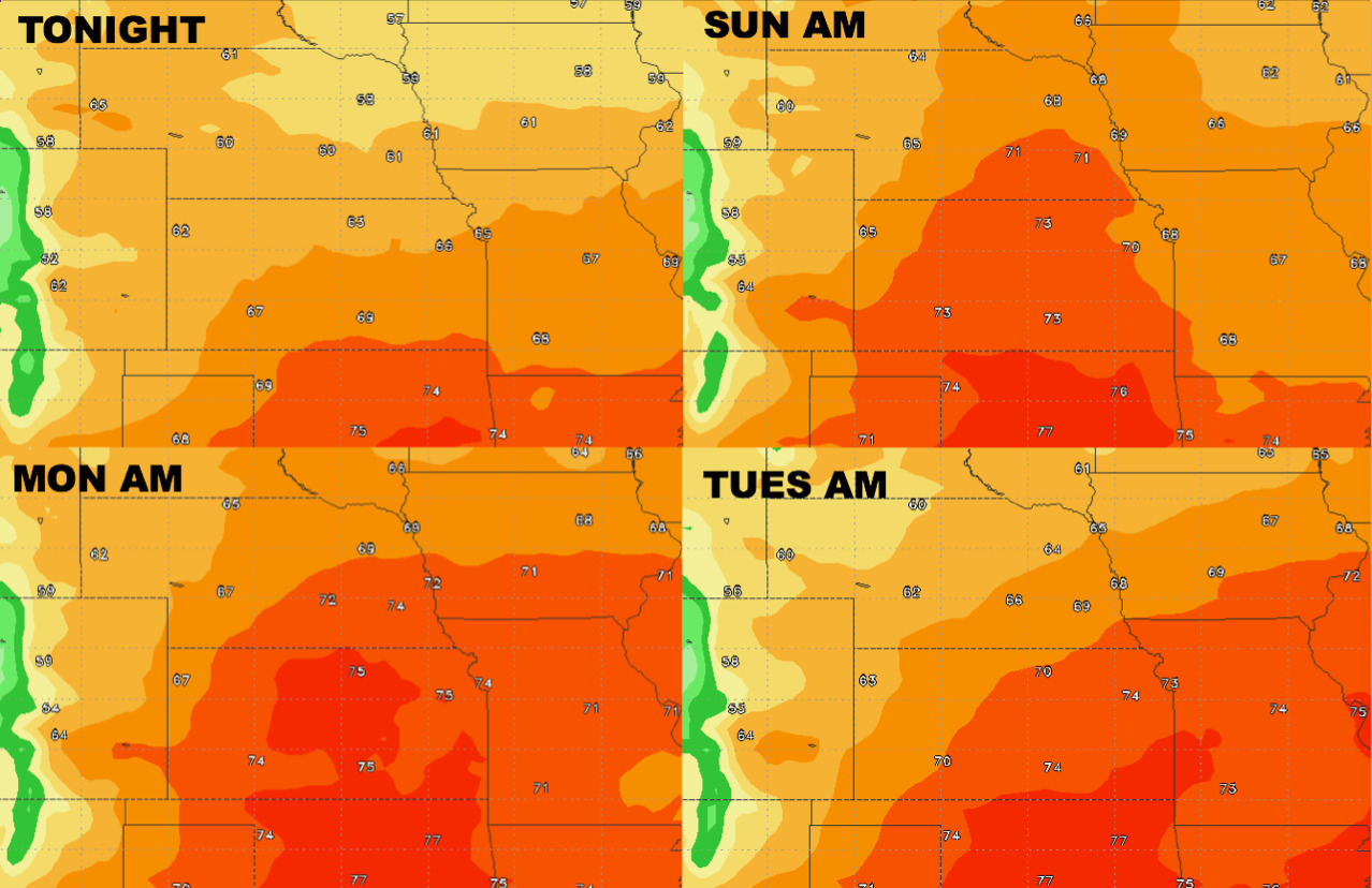
Overnight low temperature guidance over the next 4 days:
Dew points from normal into early next week is below: