Key Points – Friday, August 11, 2017:
Synopsis: Good Friday morning! The southern portions of the area have picked up some healthy rain totals over the past 24 hours. Storm threat continues to shift south of the area for much of the day as high pressure settles in behind a cold front, leading to a very nice day overall. Storm chances start to creep into western Kansas/Nebraska heading into tonight, with storm chances increasing this weekend mainly across the Nebraska and Kansas. Overall it is an active pattern going into next week especially south and west, with drier risks continuing in Iowa.
Today’s video (8 min):
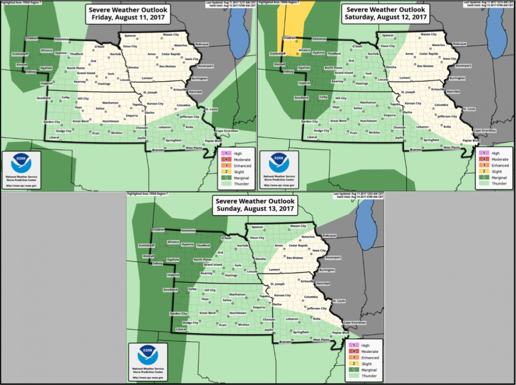
Here are the Storm Prediction Center storm outlooks today through Sunday. Marginal risk over northwest Nebraska this evening/tonight, with marginal risks through the weekend across central/western Nebraska into western Kansas. Note a slight risk in far northwest Nebraska on Saturday for wind/hail potential.
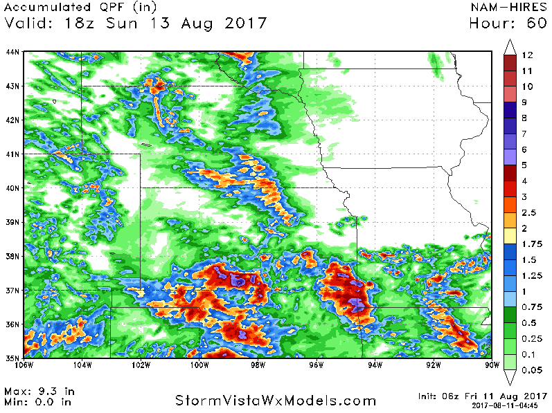
Rainfall forecast over the next 60 hours… locally heavy rain amounts across Nebraska and Kansas. *(Note that a lot of the heavy amounts in southern Kansas/Missouri are from the storms that have already moved through this morning).*
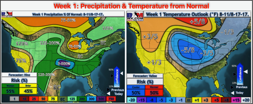
Here is our week 1 temperature and precipitation from normal outlook:
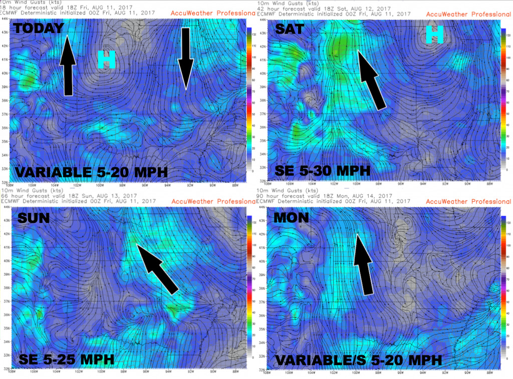
Wind forecast over the next 4 days is shown below.
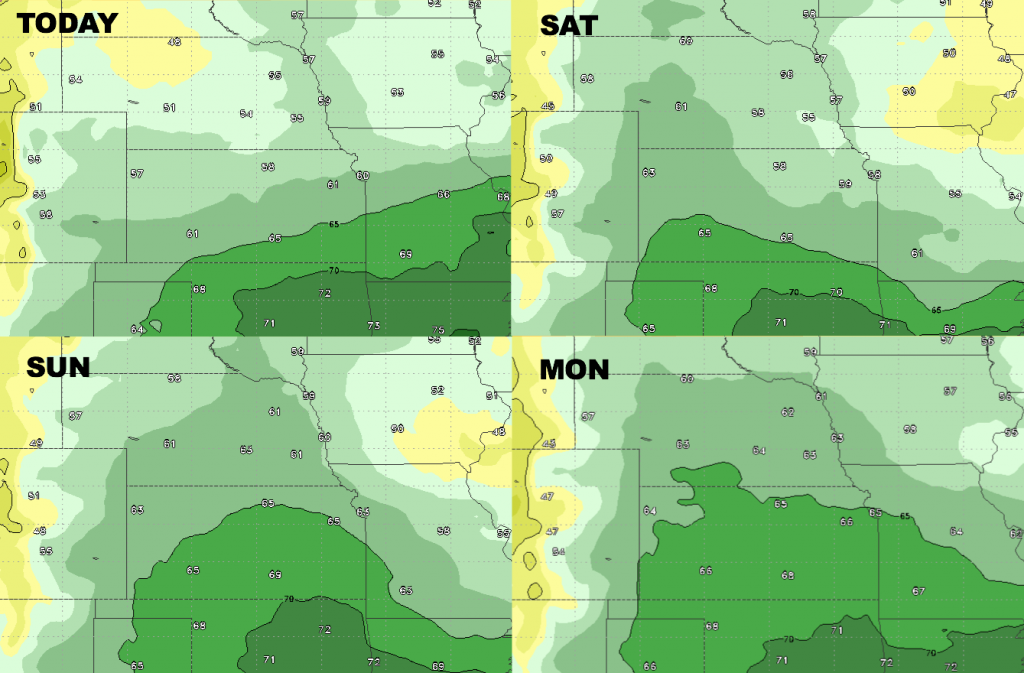
High temperature guidance over the next 4 days.

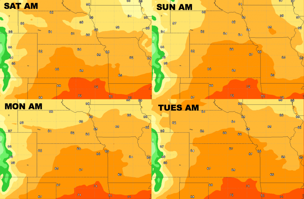
Low temperature guidance over the next 4 days.
Dew points from normal. Dry air builds in behind a cold front today, with increasing moisture levels over the western/southern half of the region through the weekend.