Key Points – Monday, September 25, 2017:
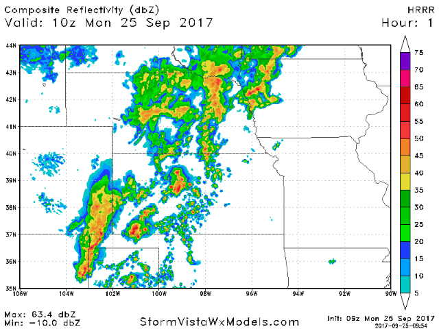
Synopsis: Good Monday morning! A stalled front brought heavy rains to central Nebraska and western Kansas through the weekend. This front is slowly starting to push to the east and continues to deliver heavy rain across the central portions of the region this morning. These rains will continue throughout the day, shifting slightly further east with time. However, we expect the rains to decrease in intensity and coverage as this front gets pushed off the the east Tuesday into Wednesday. Mainly quiet with pleasant and seasonal air mid-late week. Targeting another decent rain chance late next weekend. More details in today’s video. Have a blessed day, and let us know if you have any questions!
Today’s video (7 min):
Unsettled forecast today with rain and storms becoming most focused across the central portions of the region. Also watching for increasing coverage of scattered storms further east across Iowa developing this afternoon into tonight with locally heavy rains.
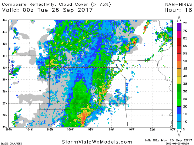
The front will finally get pushed further east on Tuesday, with the focus of moisture really decreasing along the boundary meaning less coverage and intensity of these showers. The animation below from the hi-res NAM model goes from 7pm this evening all the way to 7am on Wednesday.
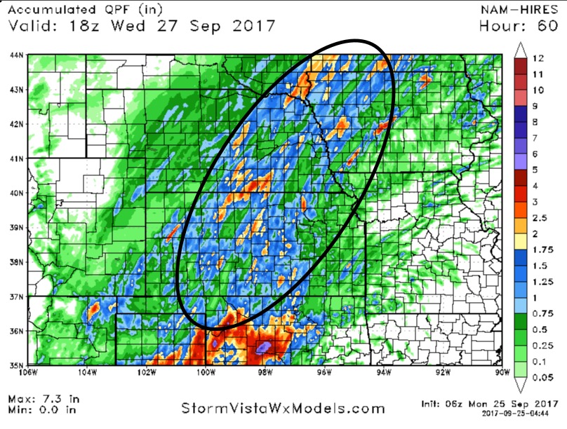
Much of Kansas, eastern Nebraska, and western Iowa will still pick up decent rains over the next couple of days, with a general 1-3″ in the black circled area below. Many areas of Missouri miss out on these rains, only scattered coverage and generally lighter amounts.
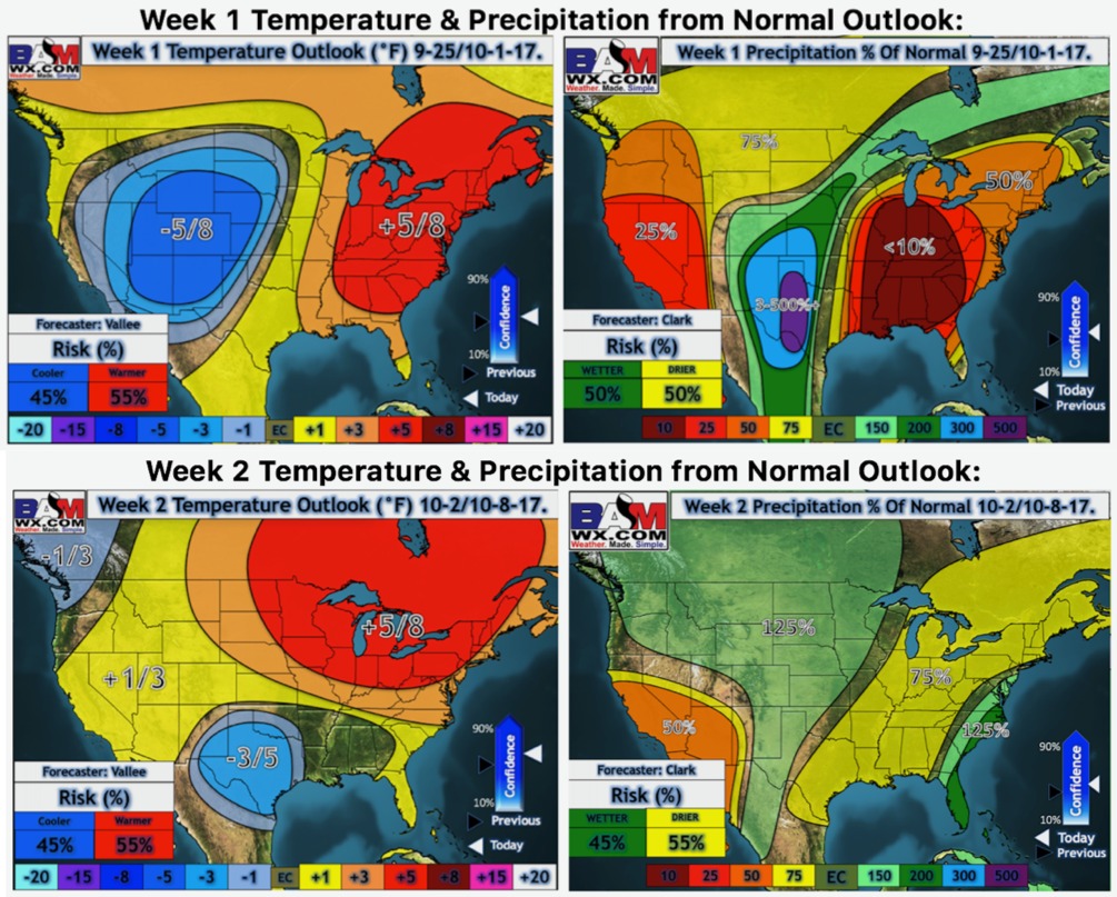
Latest weeks 1 and 2 temperatures and precipitation from normal outlooks:
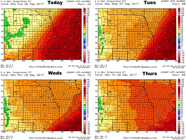
High temperatures over the next 4 days are shown below. Much cooler air gradually shifts east into mid-week.
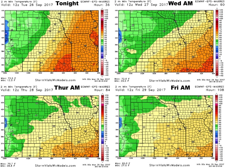
Low temperature guidance over the next 4 nights:
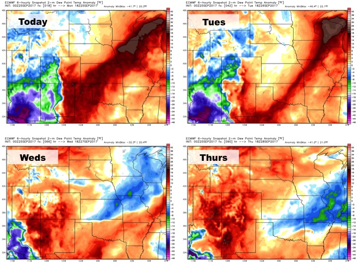
Dewpoints from normal:
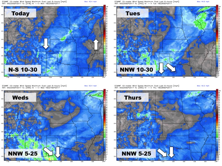
Wind forecast over the next 4 days: