Synopsis: Good Monday morning! A disturbance continues to move eastward across the region this morning, bringing heavy rainfall across eastern Kansas, southeast Nebraska, and western Iowa. This disturbance will continue to move east though the day, with areas west drying out. A strong system will move across the northern Plains late Tuesday into Wednesday, which will bring some storm activity into the northern portions of the region. The upcoming weekend looks active as a front looks to set-up across the region, bringing heavy rainfall risks to portions of the region. Details in today’s video. Have a blessed day, and let us know if you have any questions.
Today’s video (6 min):
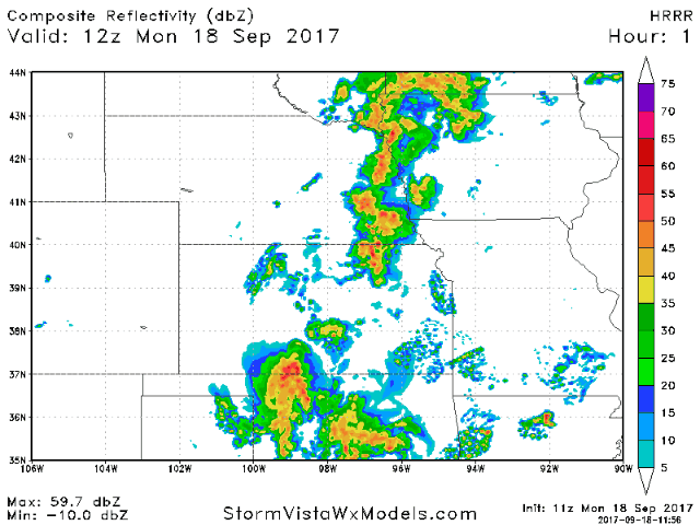
Latest HRRR future radar going through the day is posted below. Not anticipating any severe weather, but locally heavy rains will be a good bet as this system slowly works east.
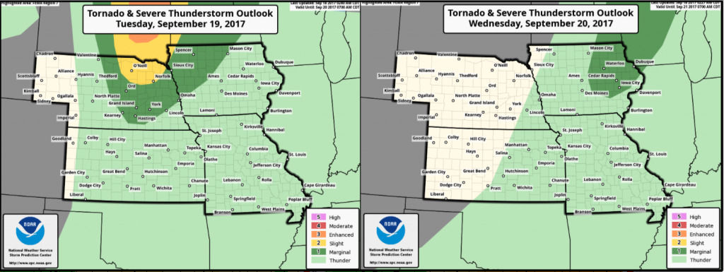
Severe storm risks for Tuesday and Wednesday are posted below. The majority of severe weather stays into the Dakotas, but watching for those storms to extend into Nebraska/Iowa late Tuesday night into Wednesday.
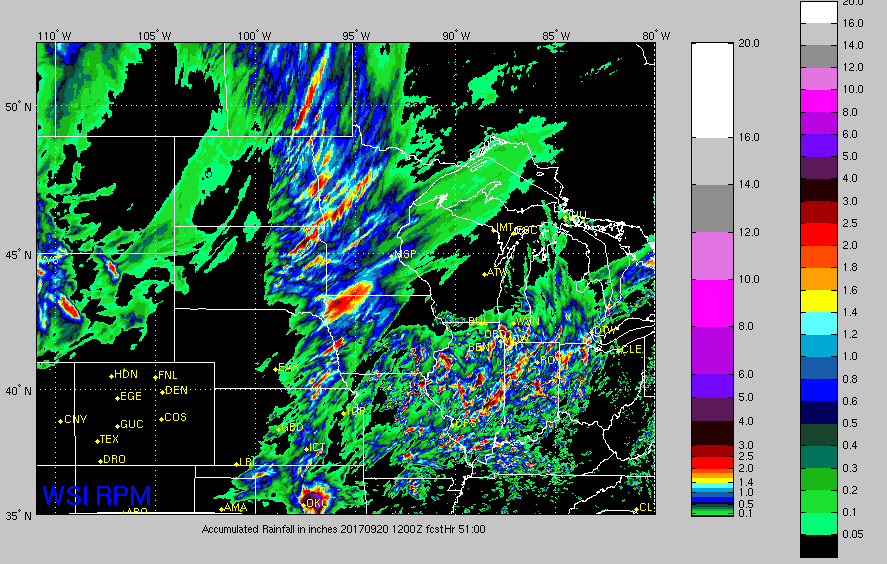
Rainfall guidance through 7am Wednesday:
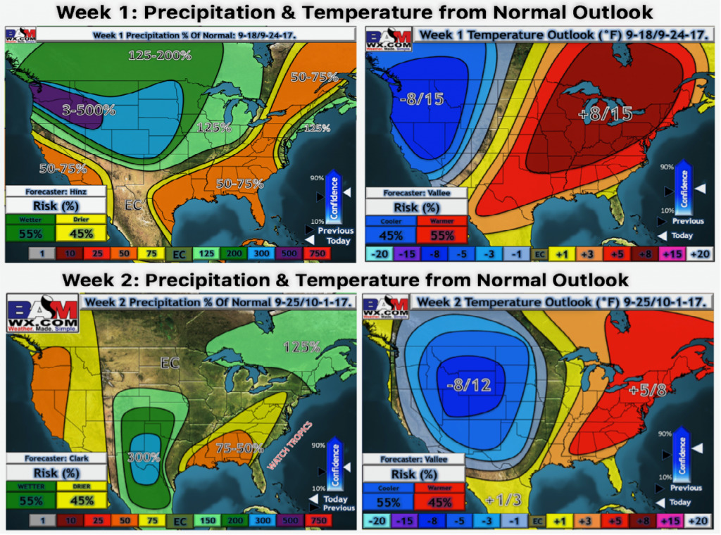
Latest weeks 1 and 2 temperatures and precipitation from normal:
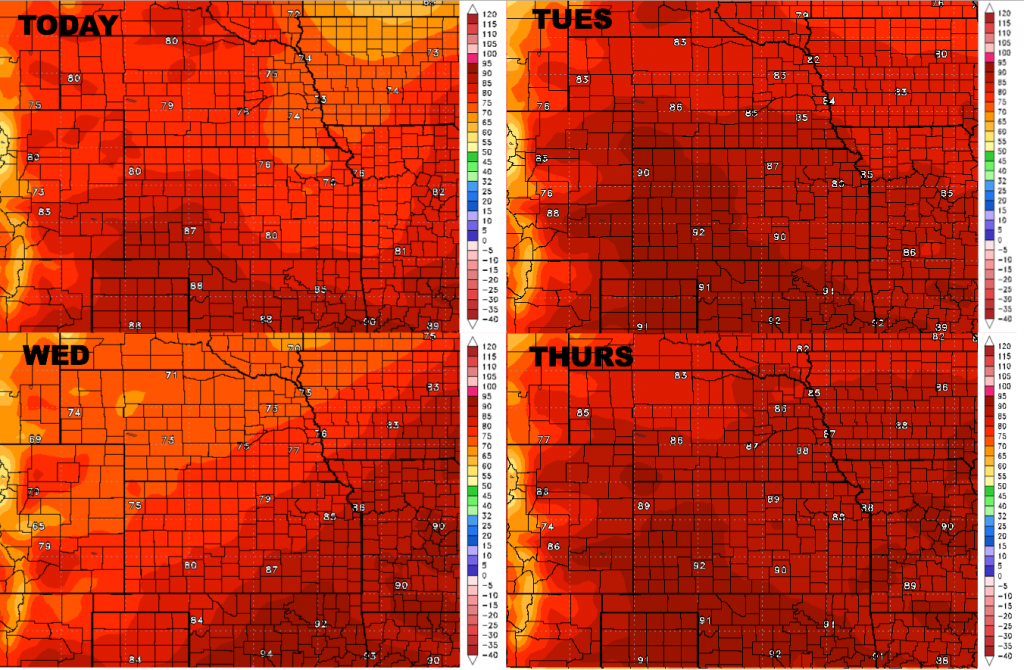
High temperatures over the next 4 days:
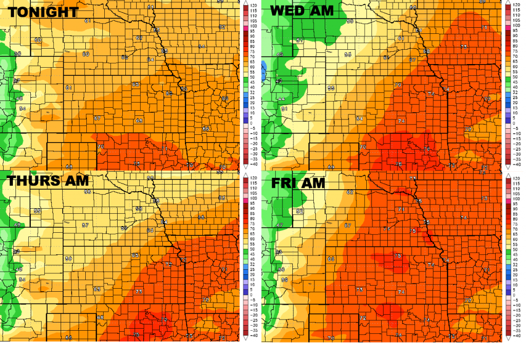
Low temperatures over the next 4 days:
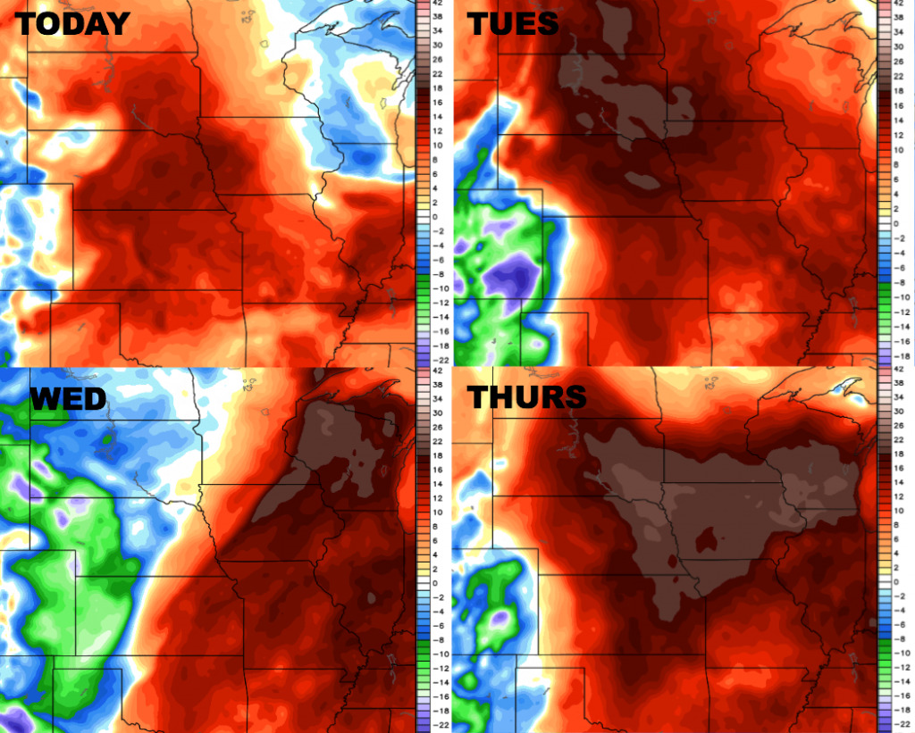
Dew points over the next 4 days:
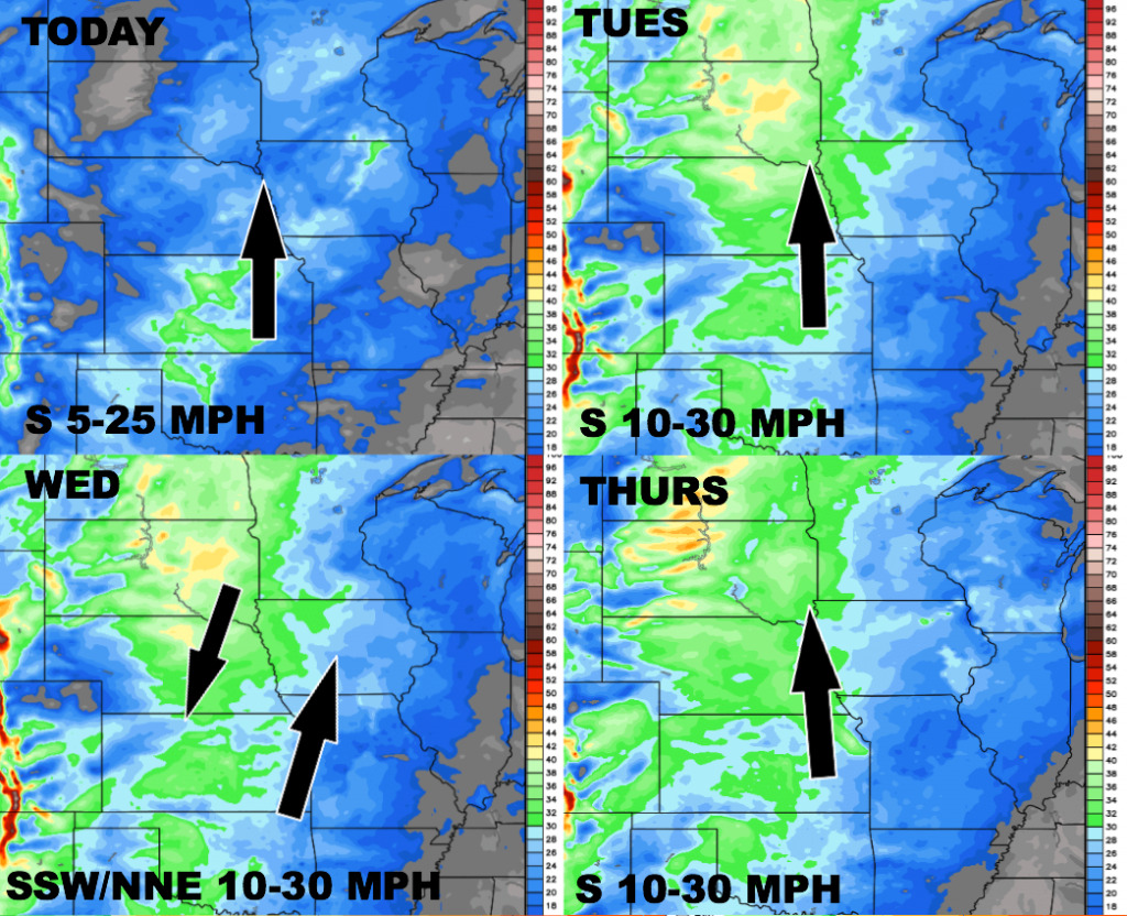
Wind forecast over the next 4 days: