Key Points – Wednesday, October 4, 2017:
Synopsis: Good Wednesday morning! Very active weather pattern will remain in place for the rest of the week, with heavy rainfall concerns increasing as we go through late week. A strong storm system works through Friday night, and we need to watch this time-frame for severe weather concerns. The good news here is that briefly drier and nicer weather conditions build in going through most of the weekend, but rains increase heading into Monday as a strong front works through the region. This will be followed by sharply colder temperatures into the middle of next week with frost and freeze threats. Detailed analysis on where these heavy rains look to set-up in today’s video. Have a blessed day, and let us know if you have any questions!
Today’s video (7 min):
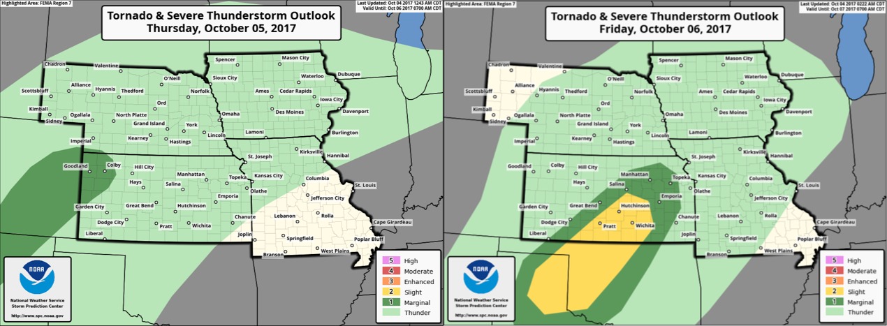
Here are the Storm Prediction Center Outlooks for Thursday and Friday. Marginal severe threat in far western Kansas Thursday, then a marginal and slight risk for severe storms across central and southern Kansas on Friday.
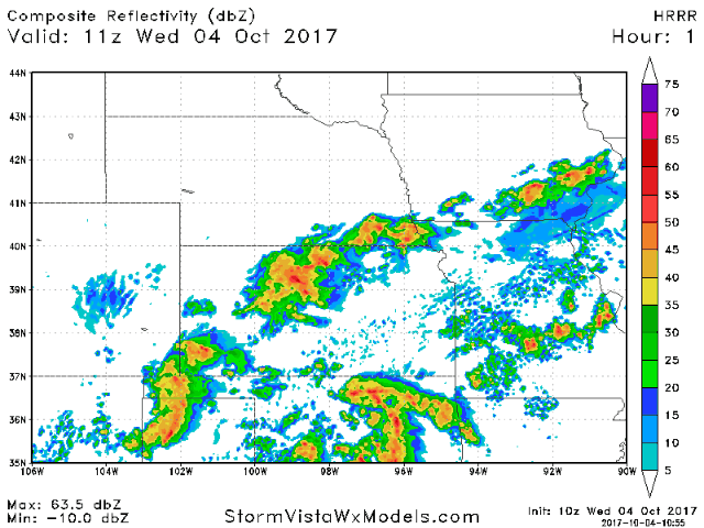
Scattered showers and storms with locally heavy rain will continue across Kansas and increase across Missouri as we go through the morning into early afternoon, then the activity should gradually diminish heading through the evening hours.
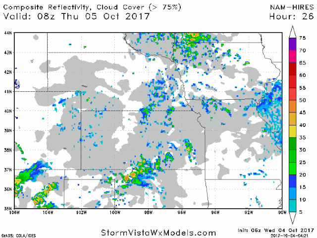
All eyes are on heavy rains expected to set-up Thursday and continue through Friday. Here is the latest hi-res NAM as we through Thursday into mid-day Friday:
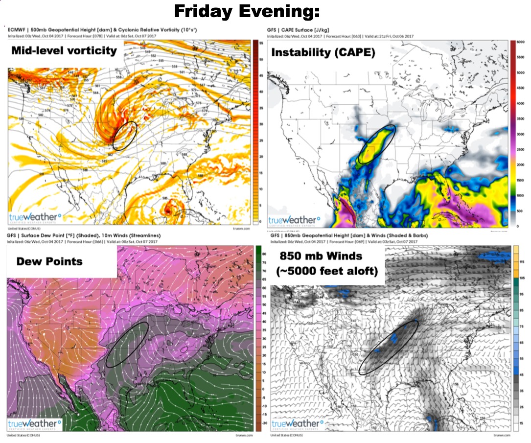
A strong upper low will move across the region late Friday, and conditions look to become favorable for some severe storms especially across portions of Kansas with decent instability, moisture, and wind shear:
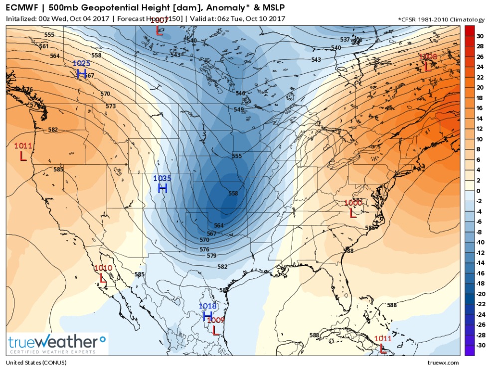
A strong upper level trough moves through the region early next week, bringing additional rains followed by a MUCH cooler air mass. We need to watch for frost and freeze potential early to mid-week.
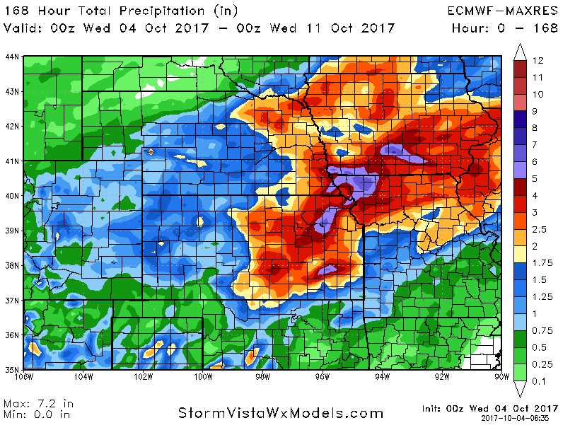
Here are the 7-day rainfall numbers off the European model:
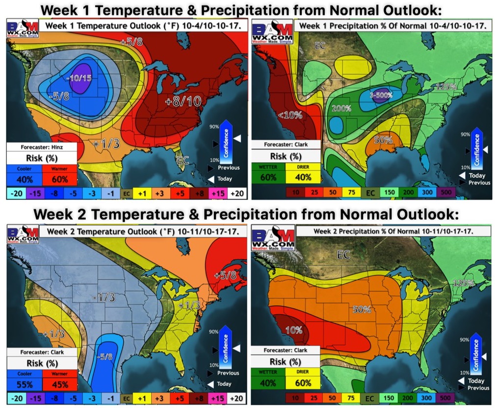
Latest weeks 1 and 2 temperature and precipitation outlooks:
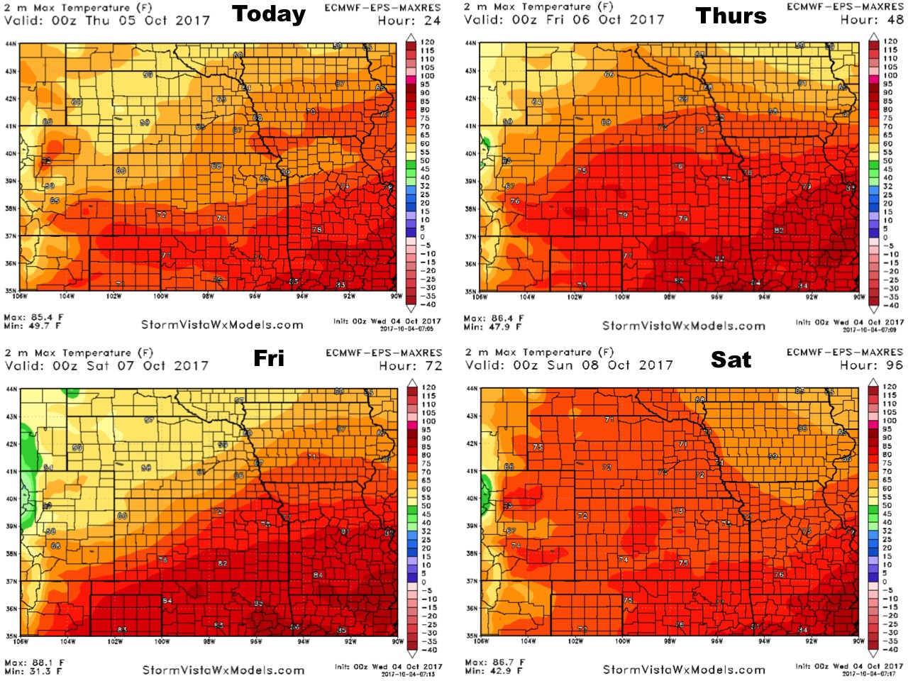
High temperatures over the next 4 days:
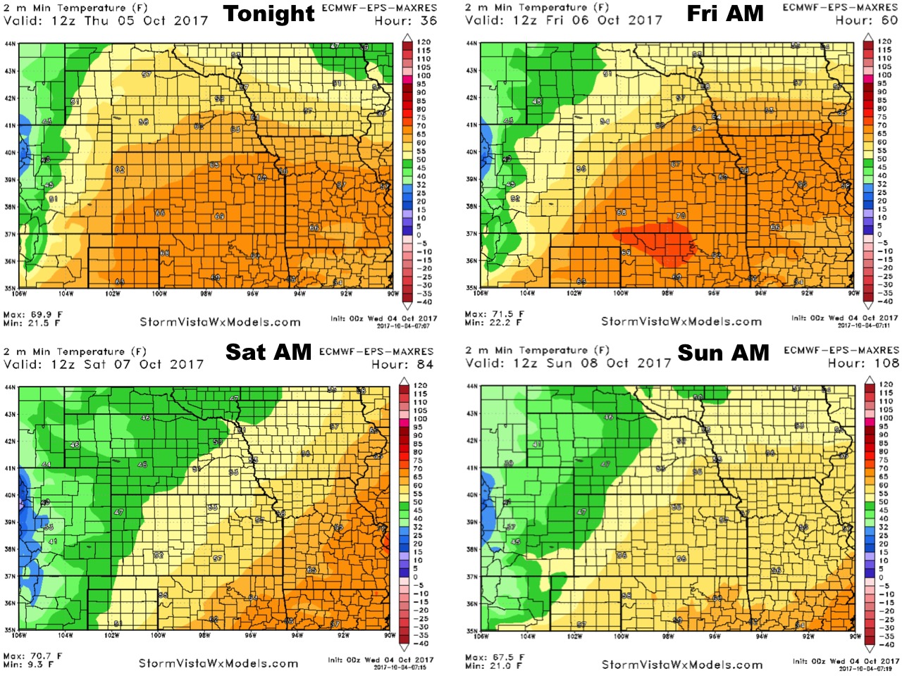
Low temperatures over the next 4 mornings:
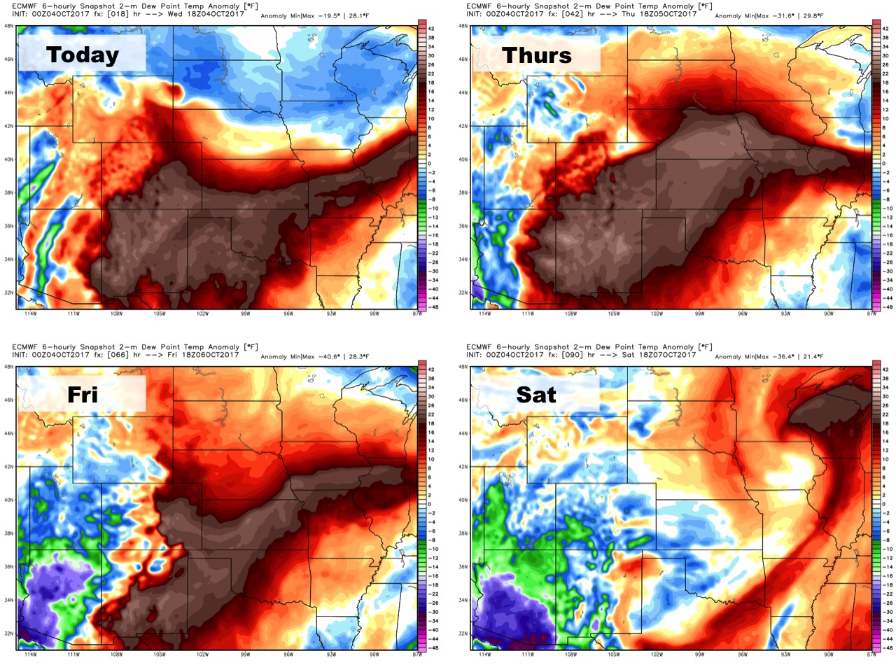
Dew points from normal:
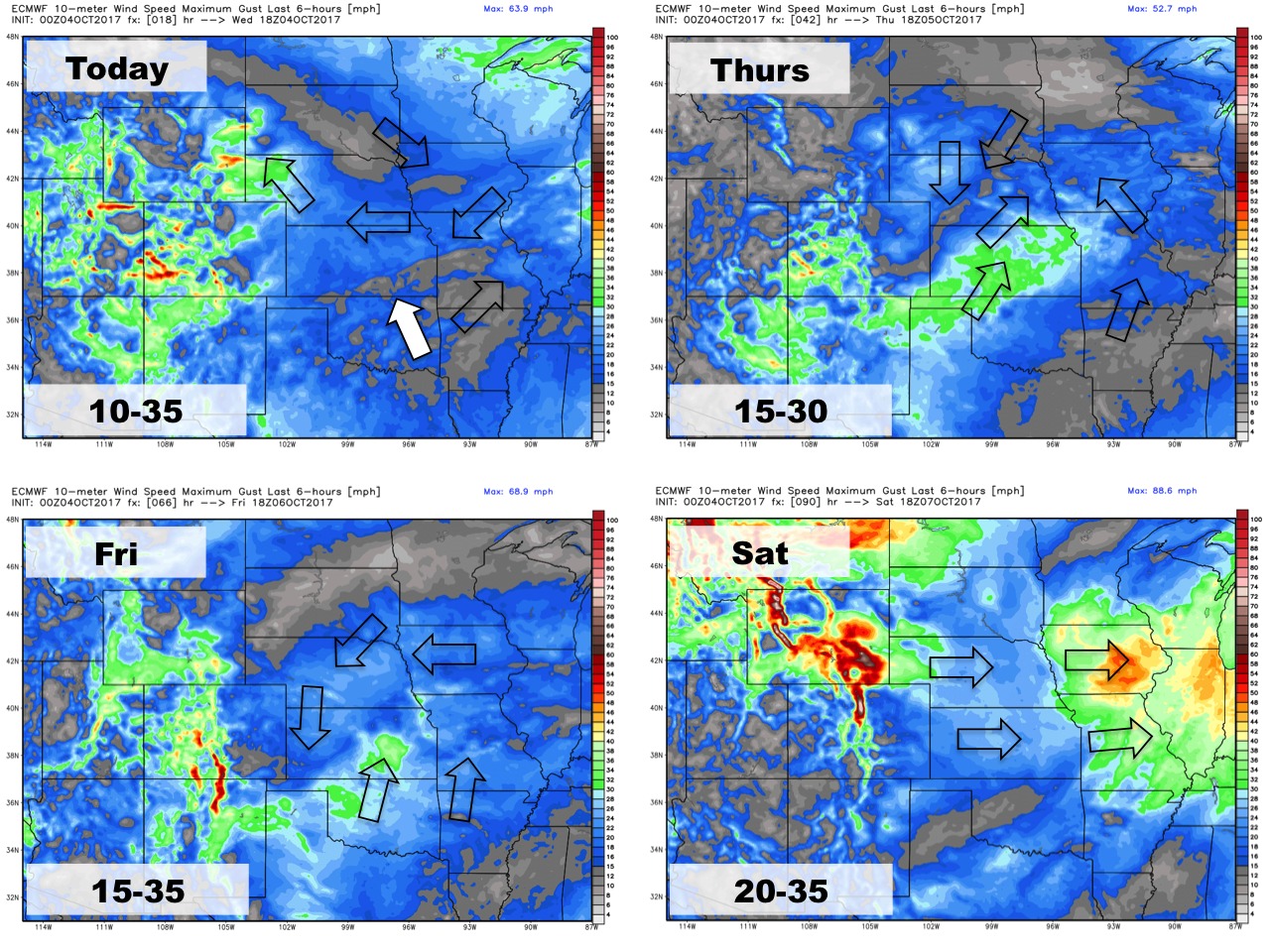
Wind forecast over the next 4 days: