Key Points – Friday, October 6, 2017:
Synopsis: Good Friday morning! Very active day ahead of us with potential for very heavy rains in portions of the area along with the threat for severe storms – especially from late this afternoon through the overnight hours. We clear things out as we go through the weekend, with an overall drier and cooler forecast shaping up next week. Detailed discussion and timing on today’s heavy rain/severe threat in the video below. Have a blessed day, and let us know if you have any questions!
Today’s video (7:45):
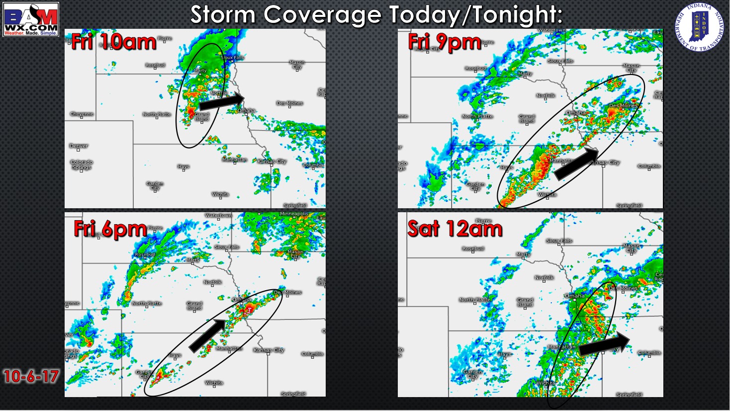
Storm coverage forecast today into tonight is shown below. Expecting storms to fire up along a frontal boundary late this afternoon and through the evening hours, severe storm threat grows across Kansas.
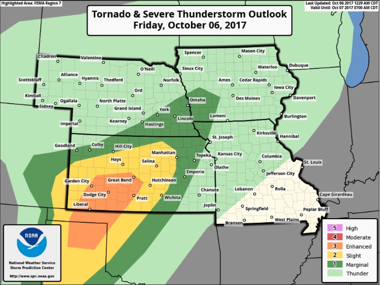
Check out the latest severe storm outlook from NOAA. A slight and enhanced severe storm threat covering much of central, western, and southwest Kansas. Large hail, damaging winds, and a few tornadoes possible.
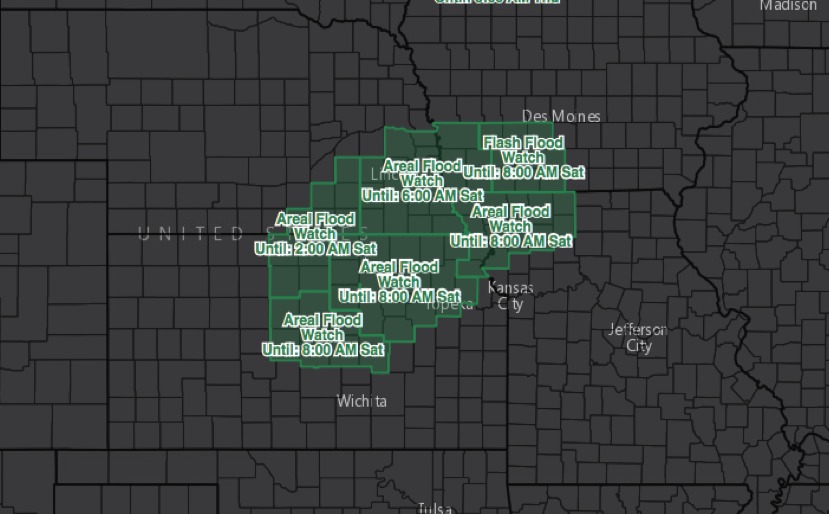
Flood watches are in effect for much of central/northeast Kansas, southwest Iowa, northwest Missouri, and southeast Nebraska through tonight for very heavy rains. Widespread 2-3″ likely with locally 5″.
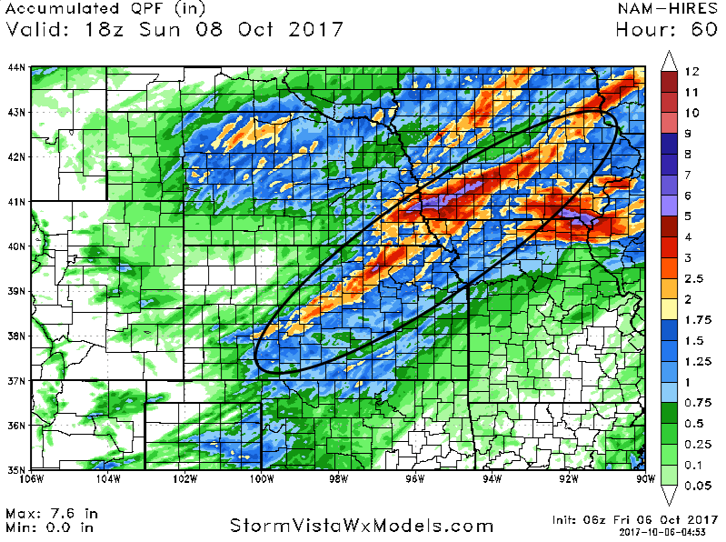
Latest forecast rainfall through Saturday is shown below. Band of very heavy rains set up this evening and overnight in the circled area. Widespread 1-3″ – locally 5″+ in this zone.
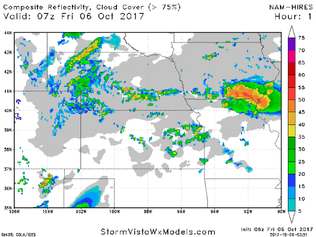
Animated radar over the next 60 hours is shown below. After a stormy night, we clear things out west to east on Saturday with dry conditions on Sunday.
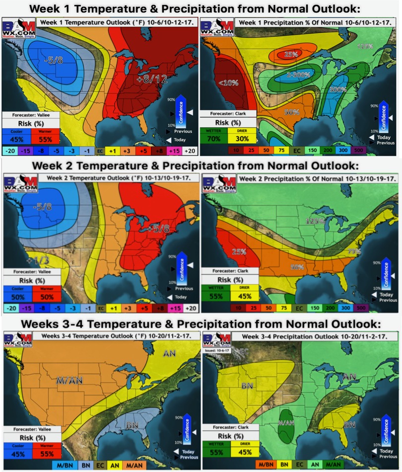
Latest weeks 1 through 4 outlooks:
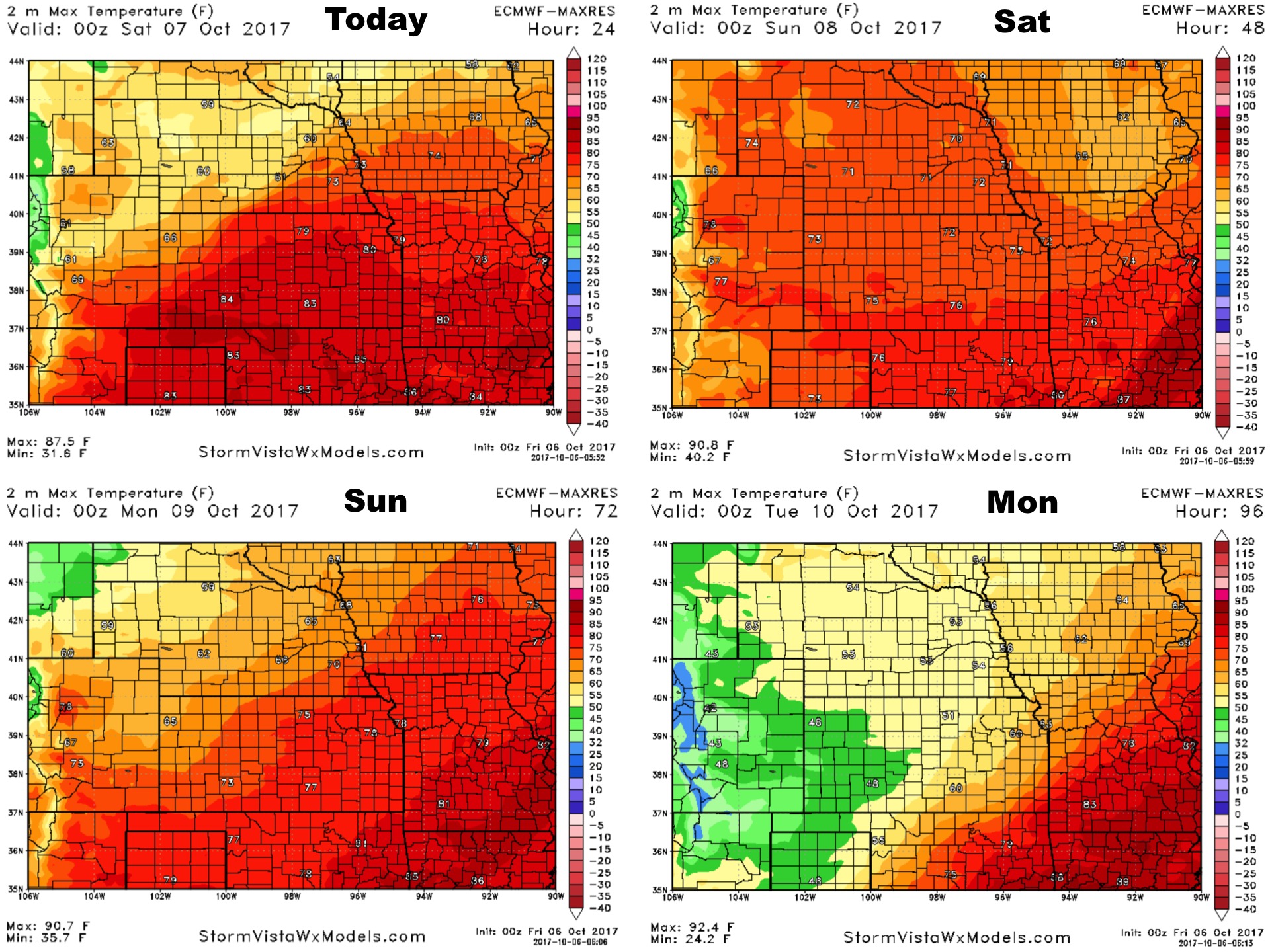
High temperatures over the next 4 days:
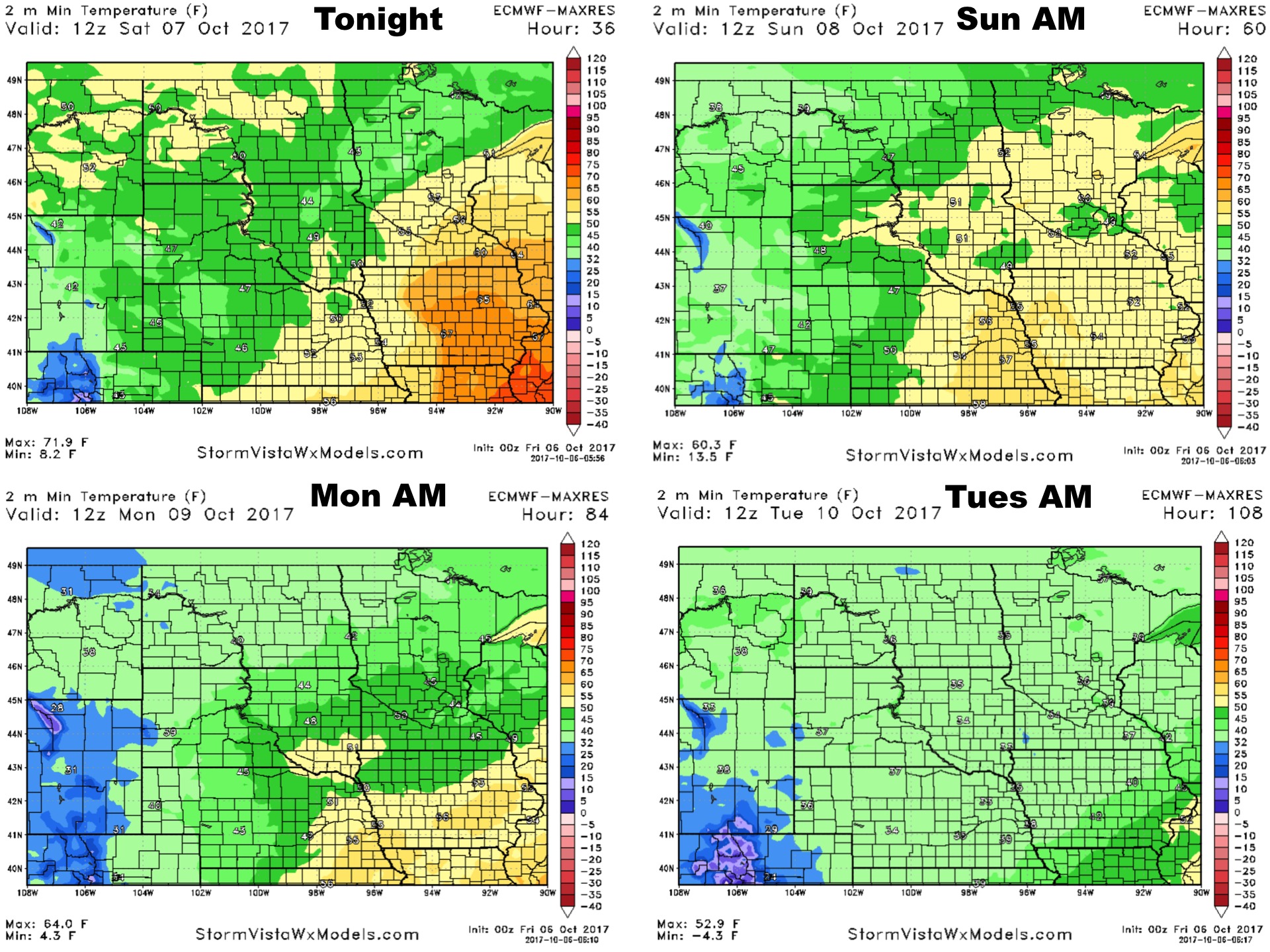
Low temperatures over the next 4 nights:
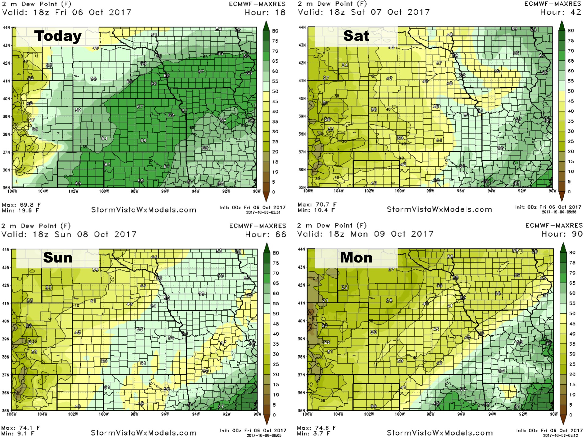
Dew points over the next 4 days:
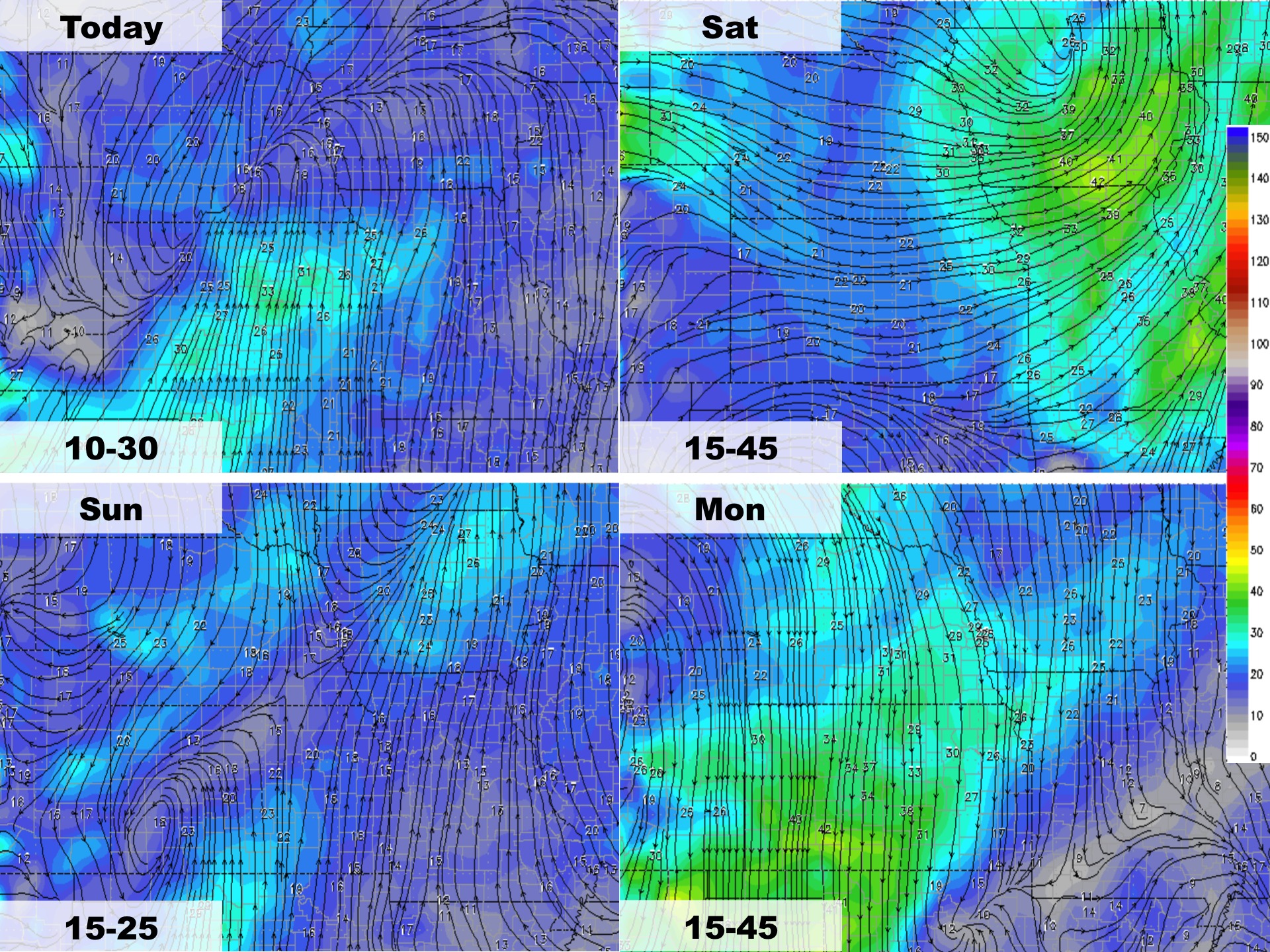
Wind forecast over the next 4 days: