Key Points – Wednesday, September 13, 2017:
Synopsis: Good Wednesday morning! The weather pattern will be quite hot through late week with gradually building storm chances. Best focus for storms through late week will be to the northwest, increasing area-wide by this weekend as a front moves through the region. The pattern becomes much more active next week. Details in today’s video. Have a blessed day, and let us know if you have any questions!
Today’s video (6:39):
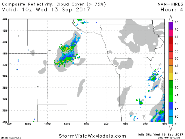
Here is the future radar animation off the NAM hi-res model from today through Friday morning. Most areas stay mainly dry through the day with our next disturbance bringing scattered showers and storms into western Nebraska and northwest Kansas late this afternoon working eastward tonight. Thursday will feature a similar theme, with once again the greatest focus for storm chances across Nebraska heading into Thursday night.
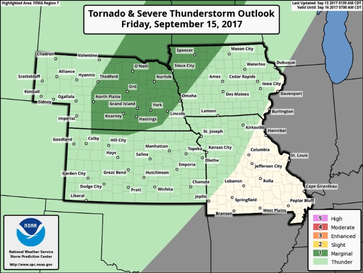
There is a marginal risk for severe storms on Friday from extreme north-central Kansas, central Nebraska, and northwest Iowa. Marginally severe wind and hail will be the main threats.
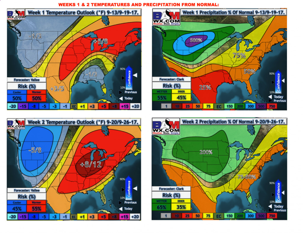
Here is our latest weeks 1 and 2 outlooks. The pattern continues to become more active in week 2, with the region seeing above normal rains.
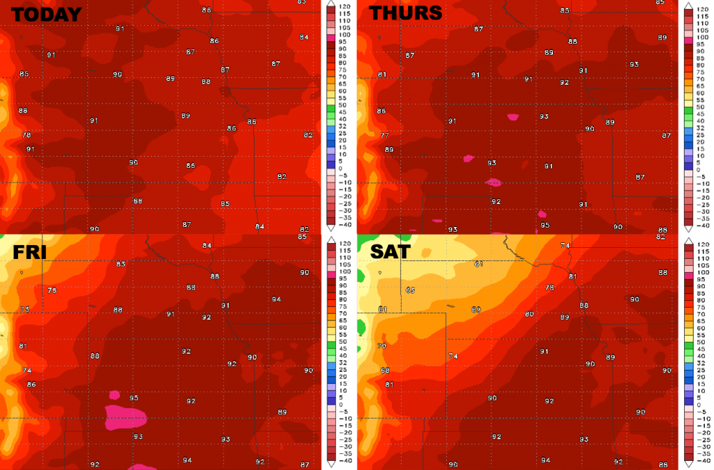
High temperatures over the next 4 days:
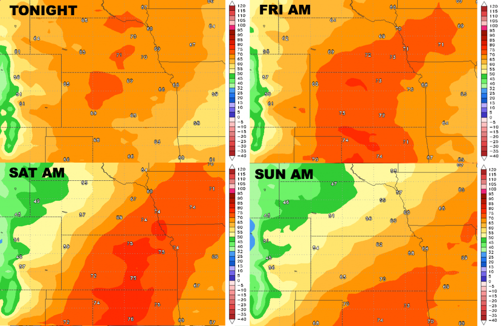
Low temperature guidance over the next 4 nights:
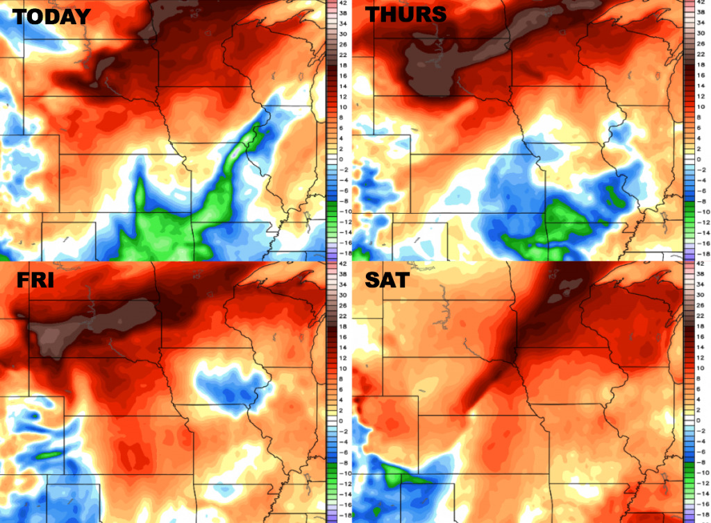
Dew points from normal over the next 4 days:
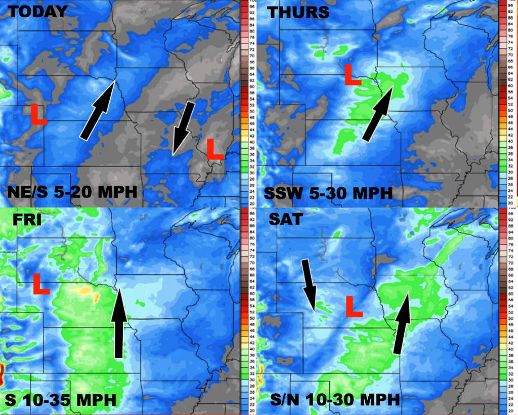
Wind forecast over the next 4 days: