Key Points – Tuesday, October 3, 2017:
Synopsis: Good Tuesday morning! Wet pattern for the rest of the week as a frontal boundary will remain situated across the forecast area with numerous rounds of rain and storms. The weekend does feature some dry time before a strong cold front moves through late Sunday into early week with renewed rain and storms followed by sharply cooler air. Details in today’s video. Have a blessed day, and let us know if you have any questions!
Today’s video (7:55):
Here is a look at storm coverage over the next 2 days. Scattered storms this evening along the front in Iowa, Kansas, and Missouri. Locally heavy rains will be possible. The front will become draped more west to east mid to late week, with another decent wave moving in Thursday.
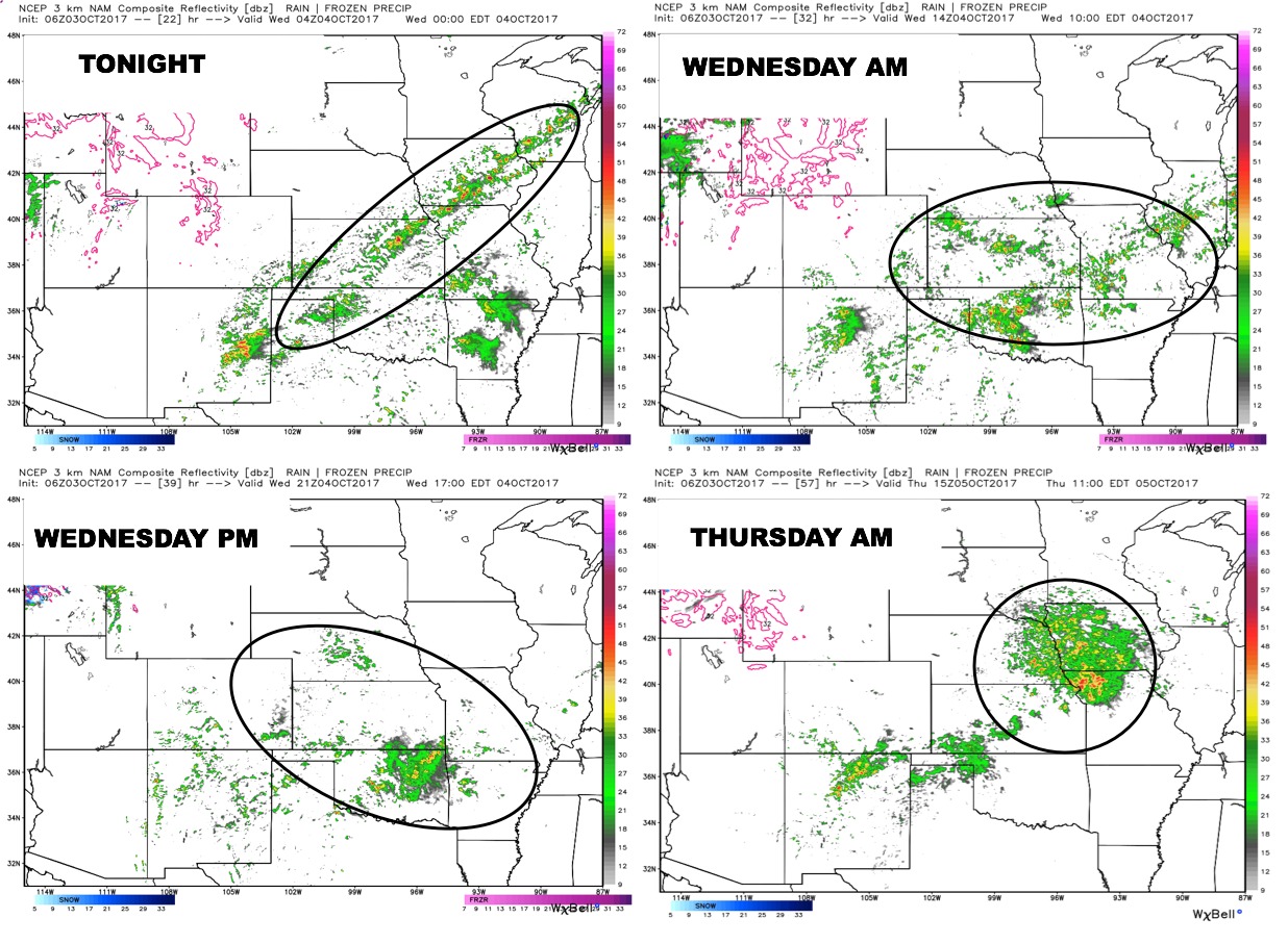
A potent wave will move across the Plains late Friday, and will allow the front to push through the area on Saturday leading to drier and cooler conditions.
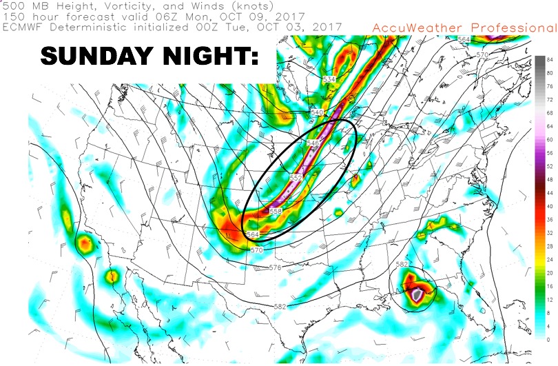
After a brief break, a potent trough swings down late Sunday into Monday, bringing additional rain and storm chances followed by a sharply cooler air mass.
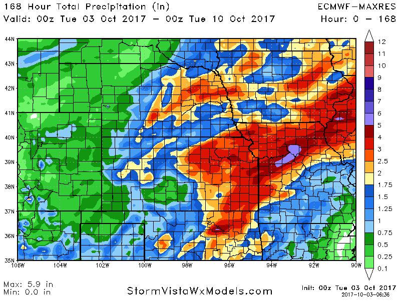
7-day rainfall numbers continue to show impressive rainfall amounts in areas that need it:
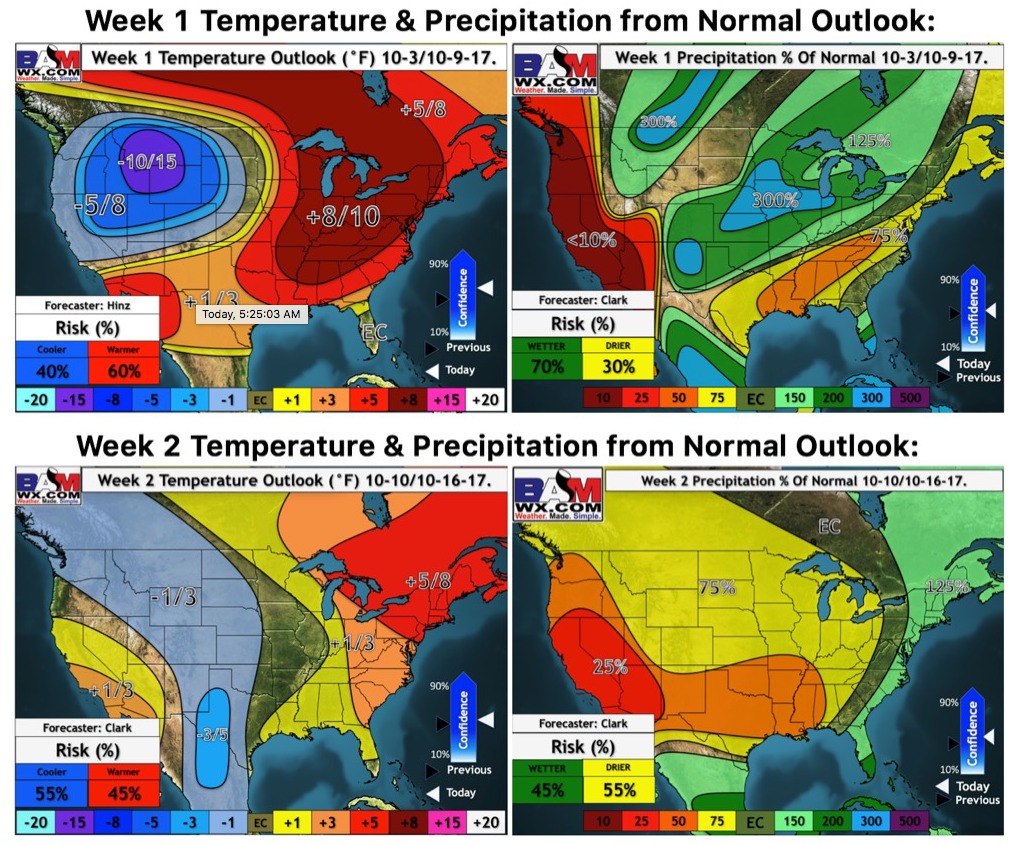
Latest weeks 1 and 2 temperature and precipitation outlook:
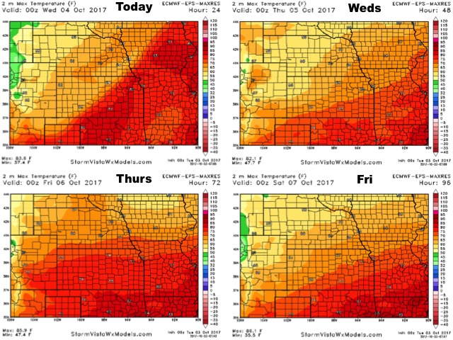
High temperatures over the next 4 days:
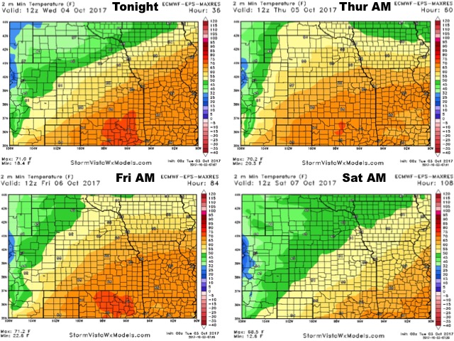
Low temperature guidance over the next 4 days:
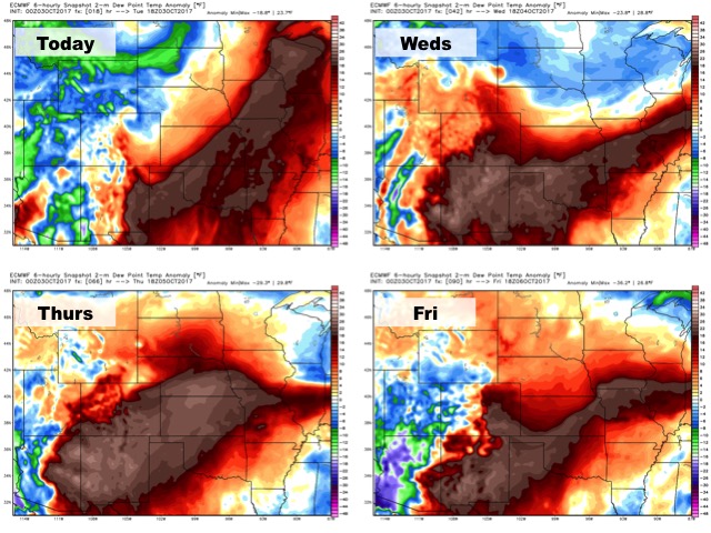
Dew points from normal over the next 4 days:
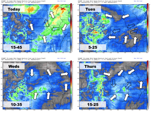
Wind forecast over the next 4 days: