Key Points – Monday, October 2, 2017:
Synopsis: Good Monday morning! We have a very active pattern ahead with daily storm chances this week. The video below goes into all the details as well as more information in the text below. Have a blessed day, and let us know if you have any questions!
Today’s video (7:45):
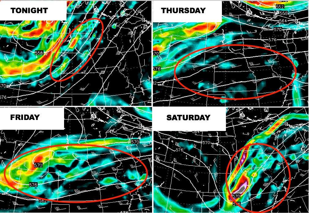
Very active week ahead for the region! A frontal boundary will hang out across the region, becoming oriented west to east mid to late week as multiple pieces of energy track along the front bringing daily rain and storms. Models indicate a strong upper-level low tracking through Friday night into Saturday, which could bring severe storms as well as more heavy rainfall. Posted below is a look at the mid-level vorticity this week indicating multiple disturbances that will produce rain and storms.
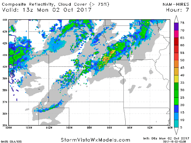
Watching the potential for a few strong/severe storms as well as “training” storms to produce heavy rain and flash flooding concerns tonight, especially across Nebraska. The hi-res NAM times everything out for you. These type of set-ups could dump narrow, localized 2-4″+ in a short period of time, likely in many of the same areas that saw heavy rains last night.
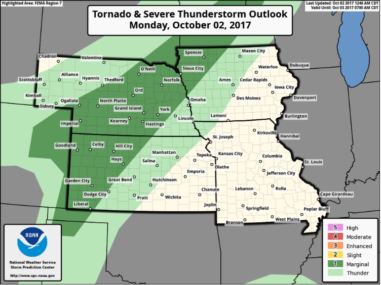
Here is the day 1 outlook from the NOAA Storm Prediction Center, which places a marginal severe risk across northwest Iowa, central Nebraska, and western Kansas. Time-frame for this should be mainly this evening through the overnight hours.
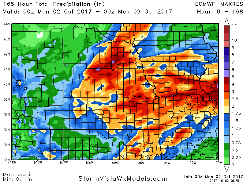
The 7-day rainfall numbers are rather impressive with many 2-4″ amounts. Note that the areas across Kansas/Missouri that have been very dry lately also get in on the rains this time.
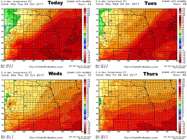
High temperatures over the next 4 days:
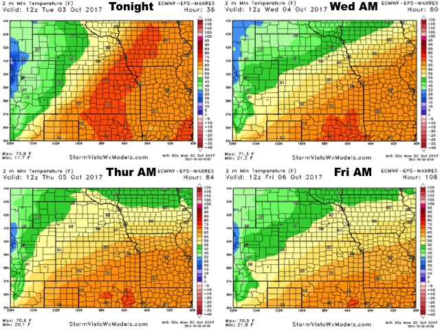
Low temperature guidance into late week:
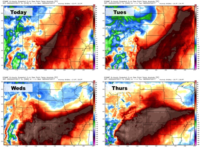
Dew points from normal over the next several days…plenty of moisture in the air this week (especially south)!
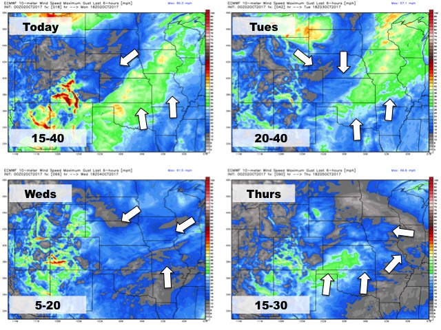
Wind forecast over the next 4 days: