Key Points – Thursday, August 31, 2017:
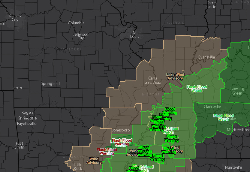
Synopsis: Good Thursday morning! Rain will impact extreme southeast Missouri thanks to the remains of Harvey for today through Friday, with the heavy flooding rains staying just south and east of the Missouri boot heel. A weak disturbance will bring a few scattered showers/storms to Nebraska later today into tonight, with this disturbance working eastward on Friday, bringing widely scattered rainfall across Nebraska, Kansas, and western Iowa. Overall quiet forecast for the Labor Day weekend with a brief warm-up before it turns much cooler by the middle of next week. Have a great day, and let us know if you have any questions!
Today’s video (6 min):
Wind advisory across southeast Missouri today through Friday evening for wind gusts up to 40 mph at times.
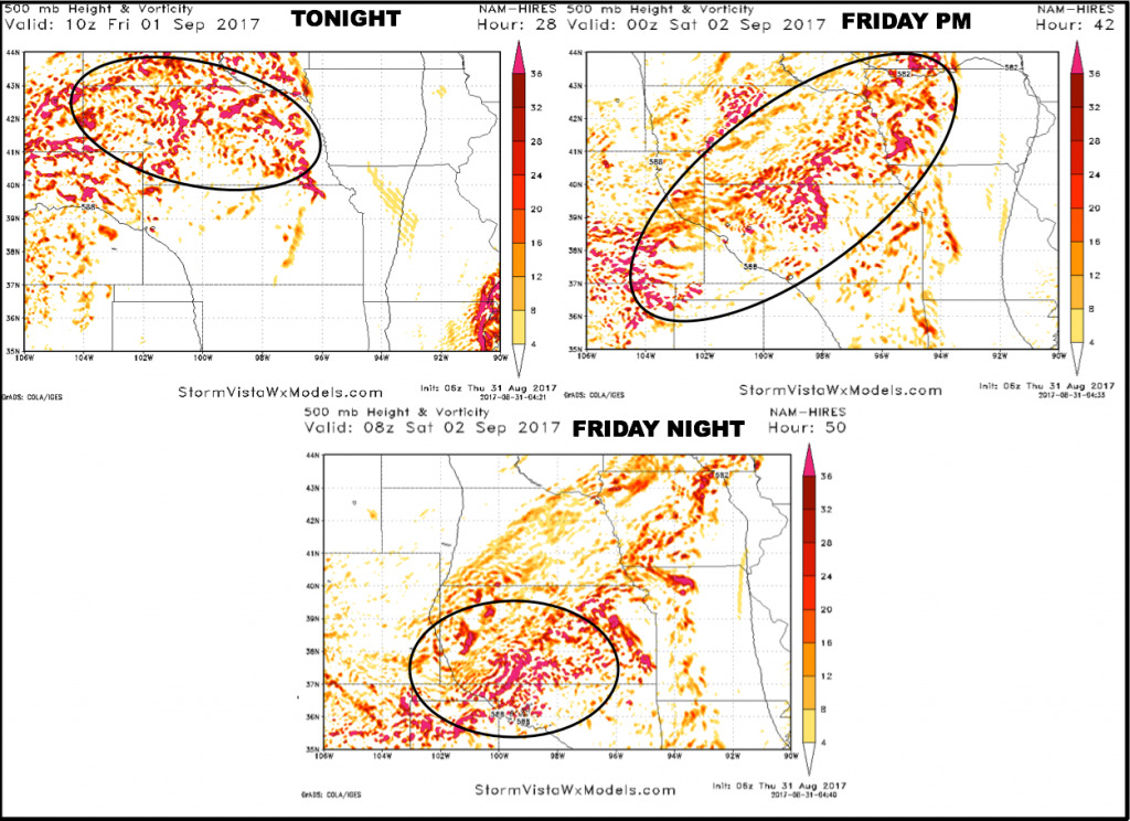
Upper-level energy forecast tonight through Friday night, showing where the best focus for scattered storms will be:
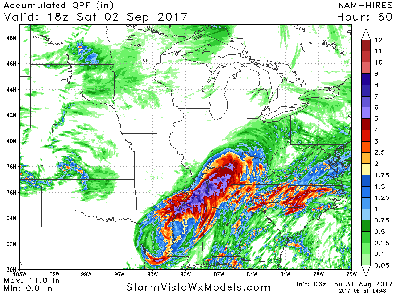
Rainfall will not be impressive for most through Saturday morning, but watching for a better rainfall chance across west-central Kansas Friday night.
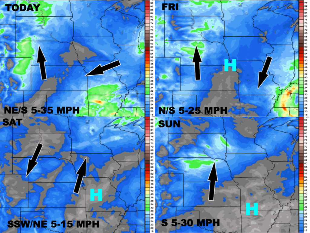
Wind forecast over the next 4 days:
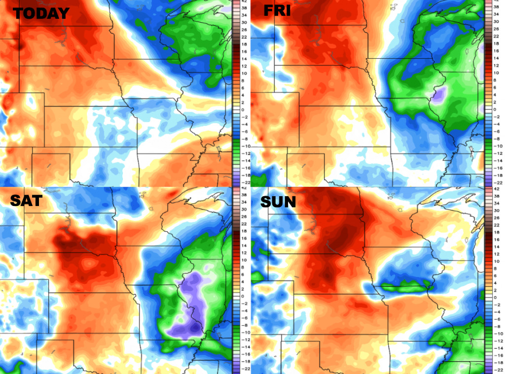
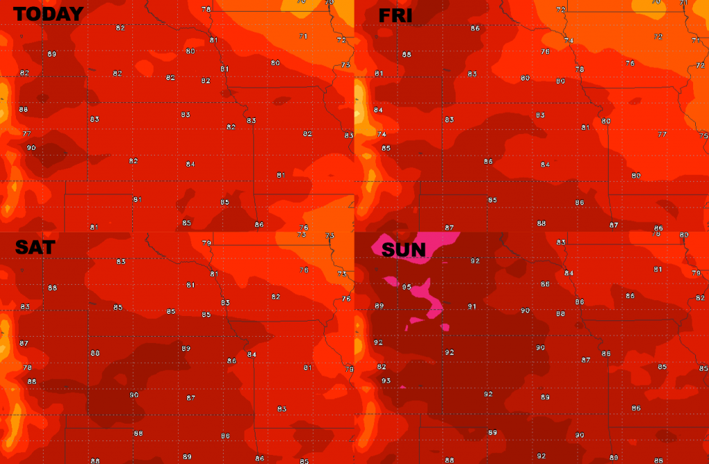
High temperatures over the next 4 days: heating up through the weekend.
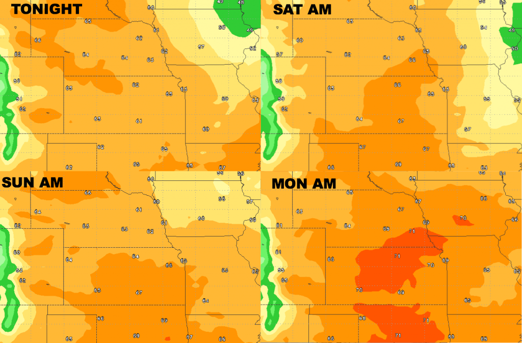
Low temperature guidance over the next 4 nights:
Dew points from normal..moisture levels remain higher off to the west, increasing through the weekend. Drier air to the east.