Key Points – Wednesday, September 27, 2017:
Synopsis: Good Wednesday morning! It is a quieter forecast overall going through the next few days. Rain chances will linger across south/east Kansas into Missouri today, then tomorrow we expect showers to target the western Plains. The pattern becomes more unsettled going through the weekend into early next week. We also expect temperatures to heat back up as we go through the first week of October! Detailed analysis in today’s video. Have a blessed day, and let us know if you have any questions!
Today’s video (8 min):
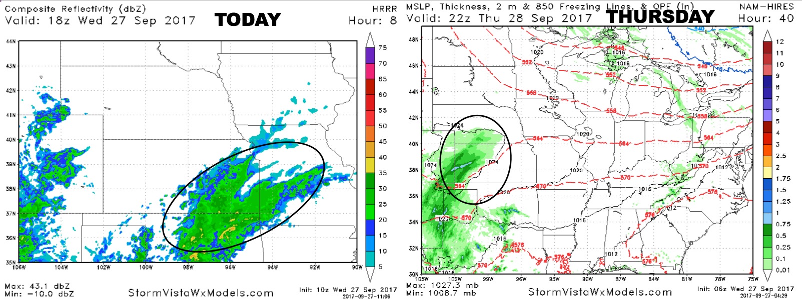
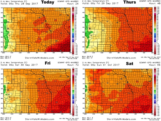
Expect showers to linger in southeast Kansas through the day, with some of those showers creeping into the western half of Missouri. On Thursday, rain chances across southwest Nebraska and western Kansas, dry conditions expected to the east.
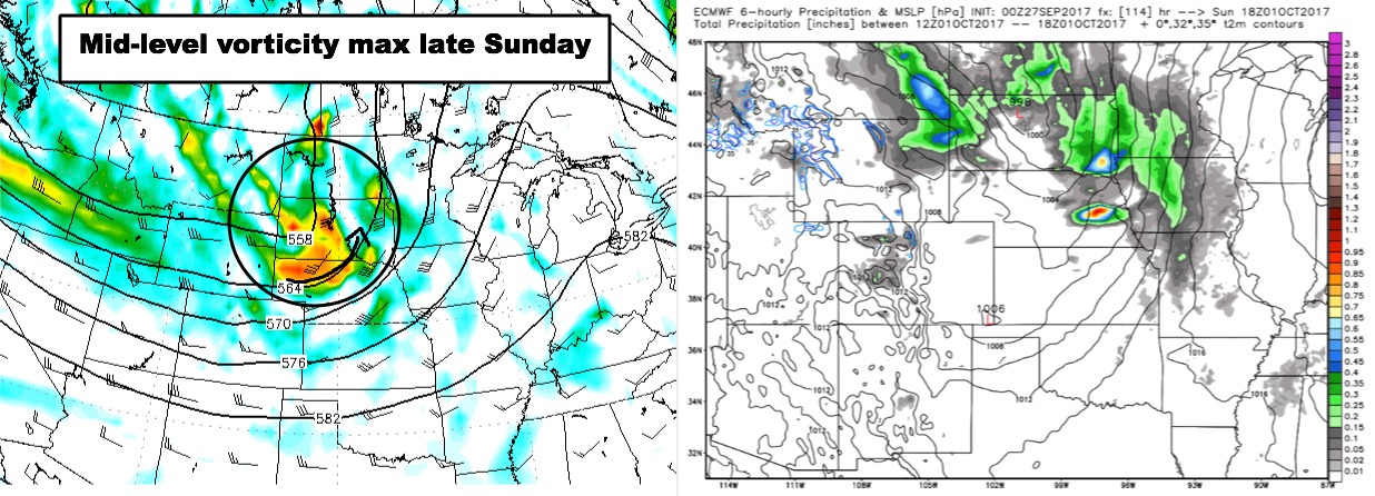
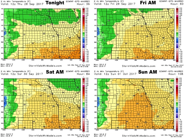
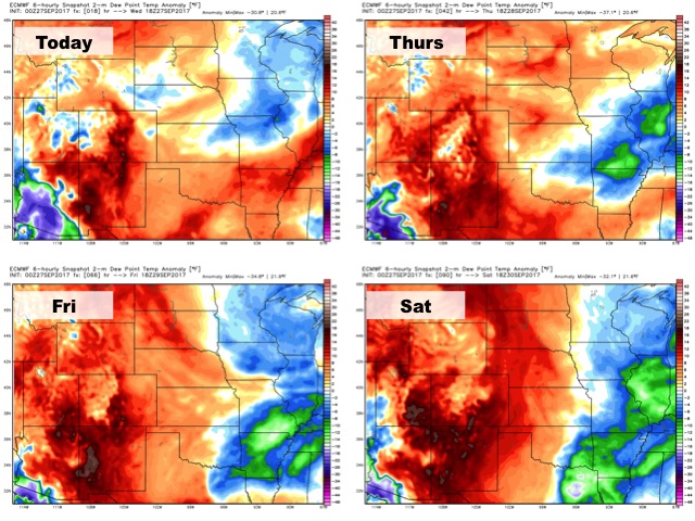
May see a few showers in southwest Kansas on Friday, outside of that it should be dry with cool high pressure building in from the northern Plains. As this high shifts east to the Great Lakes this weekend, return southerly flow will bring in more moisture and an increasingly unsettled forecast. A few scattered showers/storms increase on Saturday, then better chances arrive Saturday night and linger through early next week. Cannot rule out a strong/severe storm risk to the north towards Nebraska and western Iowa on Sunday.
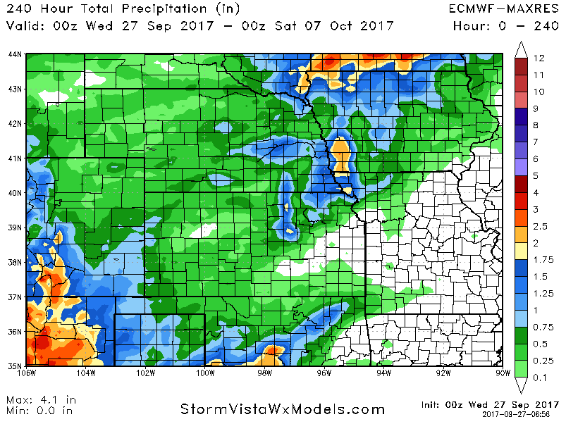
Here are the 10-day rainfall numbers off the European model:
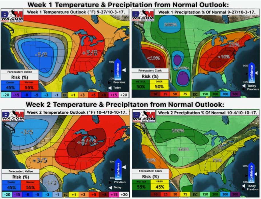
Updated weeks 1 and 2 outlooks are shown below. Above normal warmth rebuilds across the region going through next week thanks to an expanding upper-level ridge. Along the edge of that ridge, we may see an axis of more unsettled weather to the west and north next week, becoming mainly dry outside of that.
High temperatures over the next 4 days:
Low temperature guidance through the weekend:
Dew points from normal over the next 4 days:
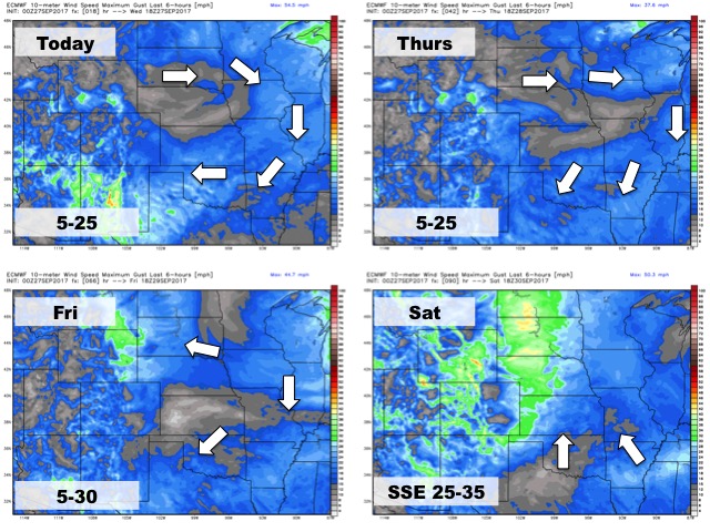
Wind forecast over the next 4 days: