Key Points – Wednesday, September 20, 2017:
Synopsis: Good Wednesday morning! A weak frontal boundary will stall out across areas from Iowa into Missouri and eastern Kansas, and we expect this front to spark scattered storms late this afternoon through tonight. A few strong storms cannot be ruled out. Hot temperatures will be the story for most areas late week through the weekend, with a front stalling out this weekend across central Nebraska into western Kansas with a heavy rain/severe storm threat, while areas further east remain dry under a ridge of high pressure. Much cooler temperatures move back in as we go throughout next week. Details in today’s video. Have a blessed day, and let us know if you have any questions!
Today’s video (8 min):
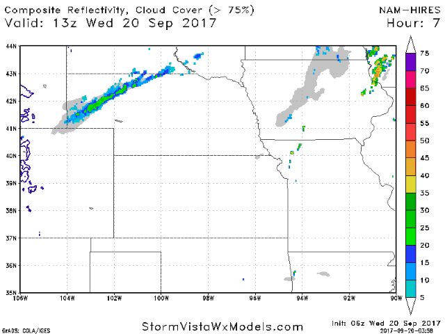
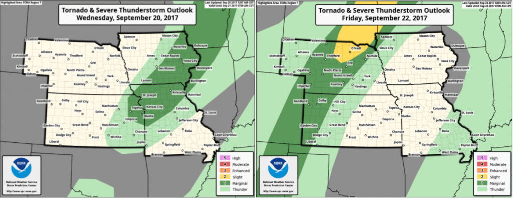
Expect a few scattered storms mainly this evening into the overnight hours along a weak frontal boundary from Iowa to Missouri and eastern Kansas. Areas further west and north stay sunny and dry today with a brief drop in temperatures and humidity behind this front.
Isolated strong to severe storms cannot be ruled out in this area tonight, then we will watch the western Plains for severe storms Friday night:
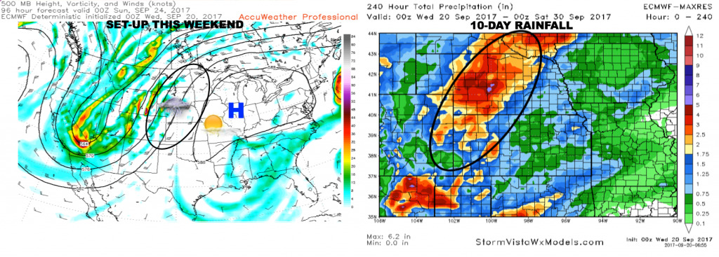
An upper-level ridge will keep the eastern half of the region mainly dry through the weekend, meanwhile areas further west across Nebraska and western Kansas likely experience heavy rain through the weekend, possibly 2-4″ through early next week (circled below).
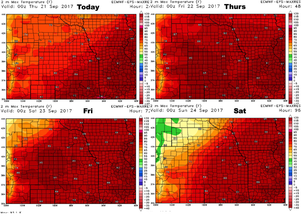
High temperatures over the next 4 days:
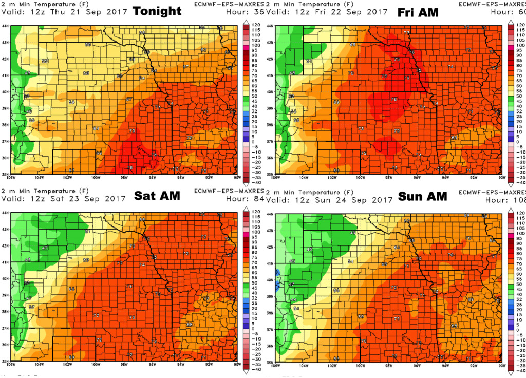
Low temperatures into the upcoming weekend:
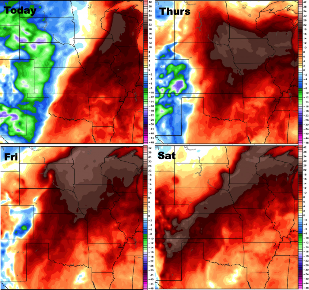
Dew points over the next 4 days:
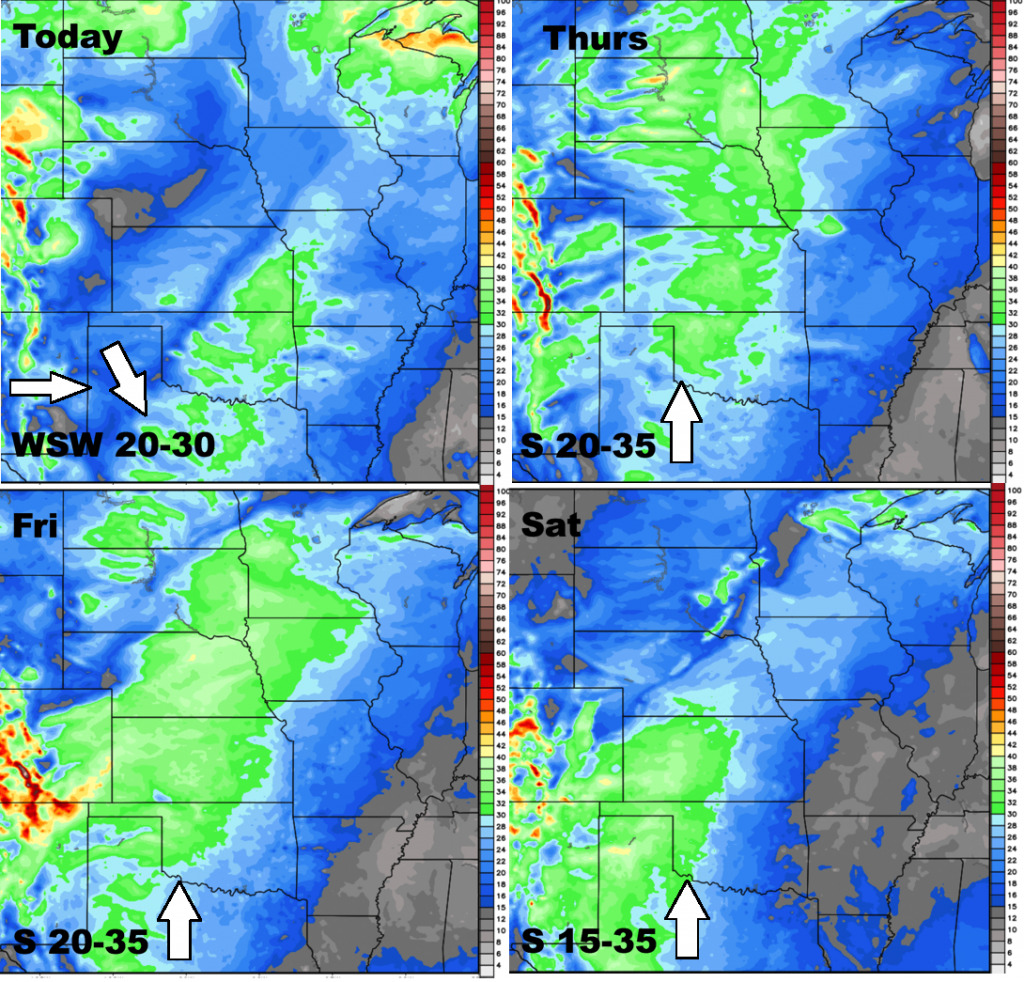
Wind forecast over the next 4 days: