Synopsis: Good Friday afternoon! This short-term update covers the latest thoughts on timing/coverage of storms this afternoon through Sunday across the central and northern Plains. Currently, a quasi-stationary front is draped from Nebraska into Minnesota with sharply cooler temperatures north of the front (across the Dakotas), and much warmer south and east. The main area of low pressure will work northeast along this boundary from Nebraska into Minnesota tonight through Saturday, with the actual front working east and south this weekend. This will aid in another line of strong to severe storms Saturday evening. Details in the video below. Have a great afternoon, and let us know if you have any questions!
Short-term video (6:37):
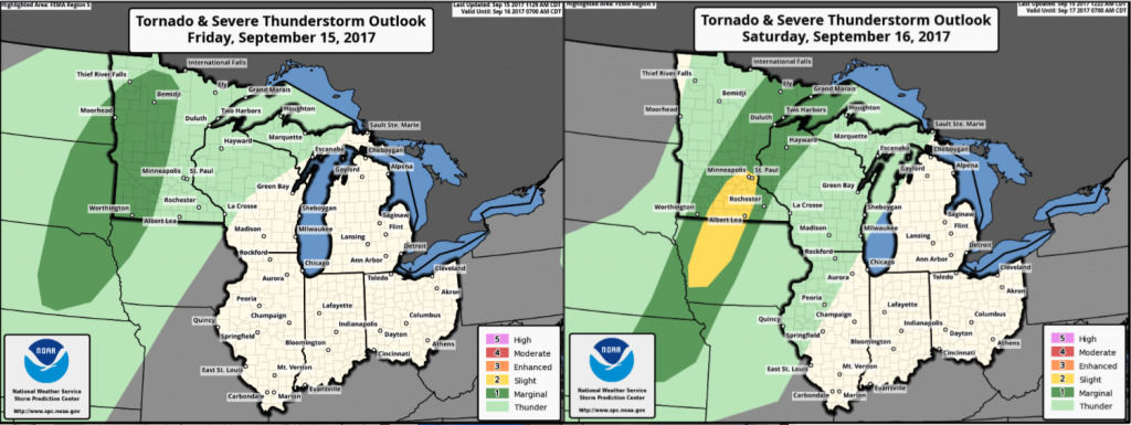
Latest severe storm outlooks for today and Saturday:
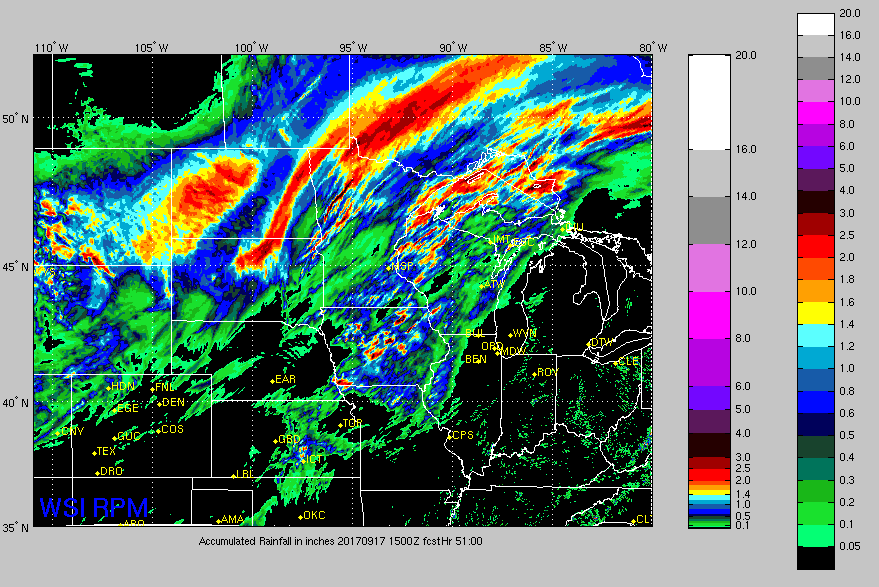
Rainfall guidance through Sunday morning: