Good afternoon! No major changes to the forecast here this afternoon. All in all, a MAJOR winter storm is going to impact the Northeast late tonight through the day on Tuesday. Start times and worst of the storm will be the following:
- Pittsburgh: 3-5 AM, 7am-3pm
- Scranton: 2-4am, 6am-5pm
- Philly: 11pm-1am, 3am-1pm (flip to sleet/rain possible)
- NYC: 1-3am, 7am-3pm
- Hartford, CT: 5-7am, 10am-4pm
- Boston: 6-9am, 12pm-7pm (flip to sleet/rain possible)
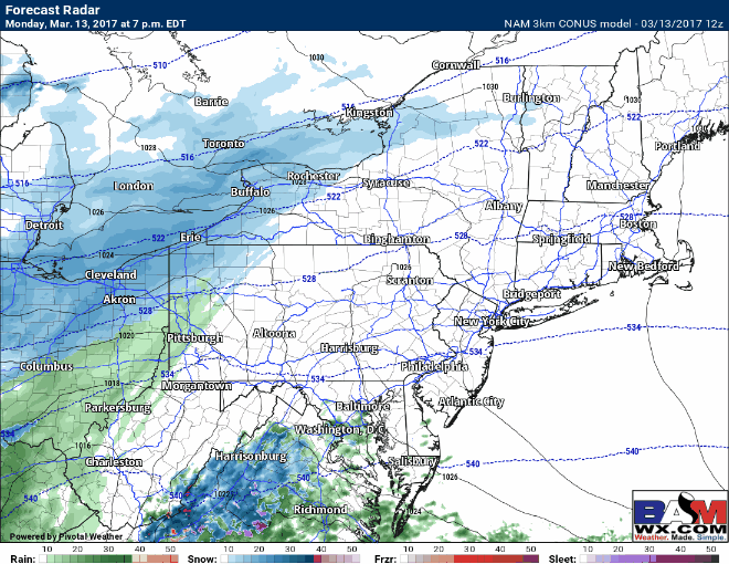
Here’s the latest 3km NAM to time it all out for you (note when precipitation moves in, it will initially not reach the ground due to very dry air). Mixing is a very real threat from coastal NJ to coastal New England including Long Island.
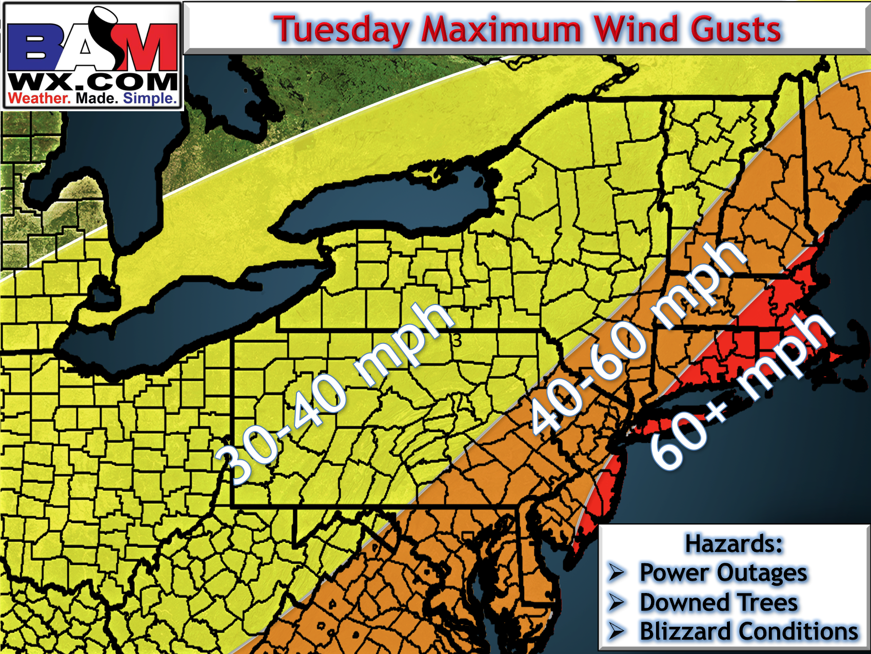
Winds will also be a huge issue, causing widespread power outages along the coast. Here’s the latest thinking for wind gusts. Some places along the immediate coast may gust past 70mph!
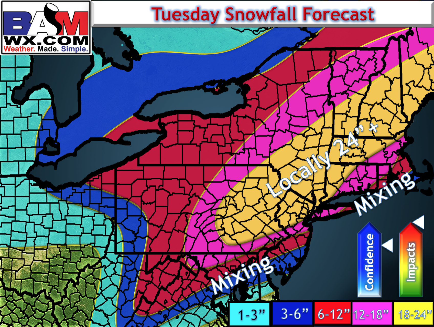
Here’s the latest snowfall map, updated at 3:30 PM. Some places in NE PA may see 25-27″.
The video below highlights the details and timing of the event and what risks are associated with the forecast.