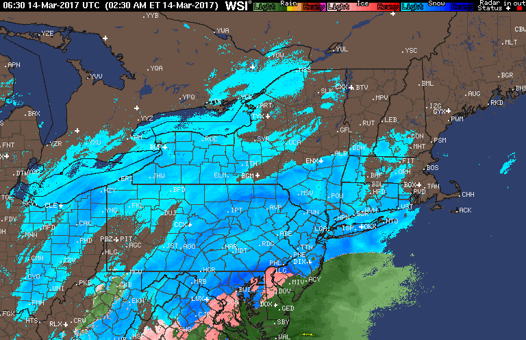
Good morning! We are tracking the rain/snow line along with what is being dubbed the “Blizzard of 2017”. Here’s the radar as of 4:30 AM.
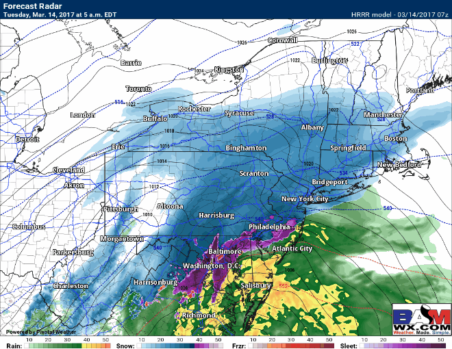
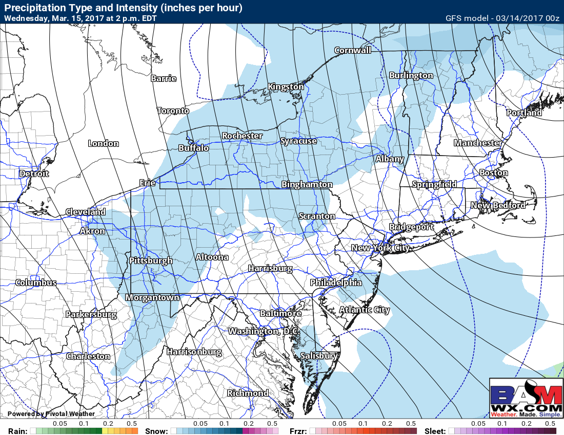
Here’s the projected radar throughout the day. Watch the rain/snow line creep north with incredibly heavy snowfall across eastern PA and the Hudson Valley. Precipitation will wind down this afternoon and evening from south to north.
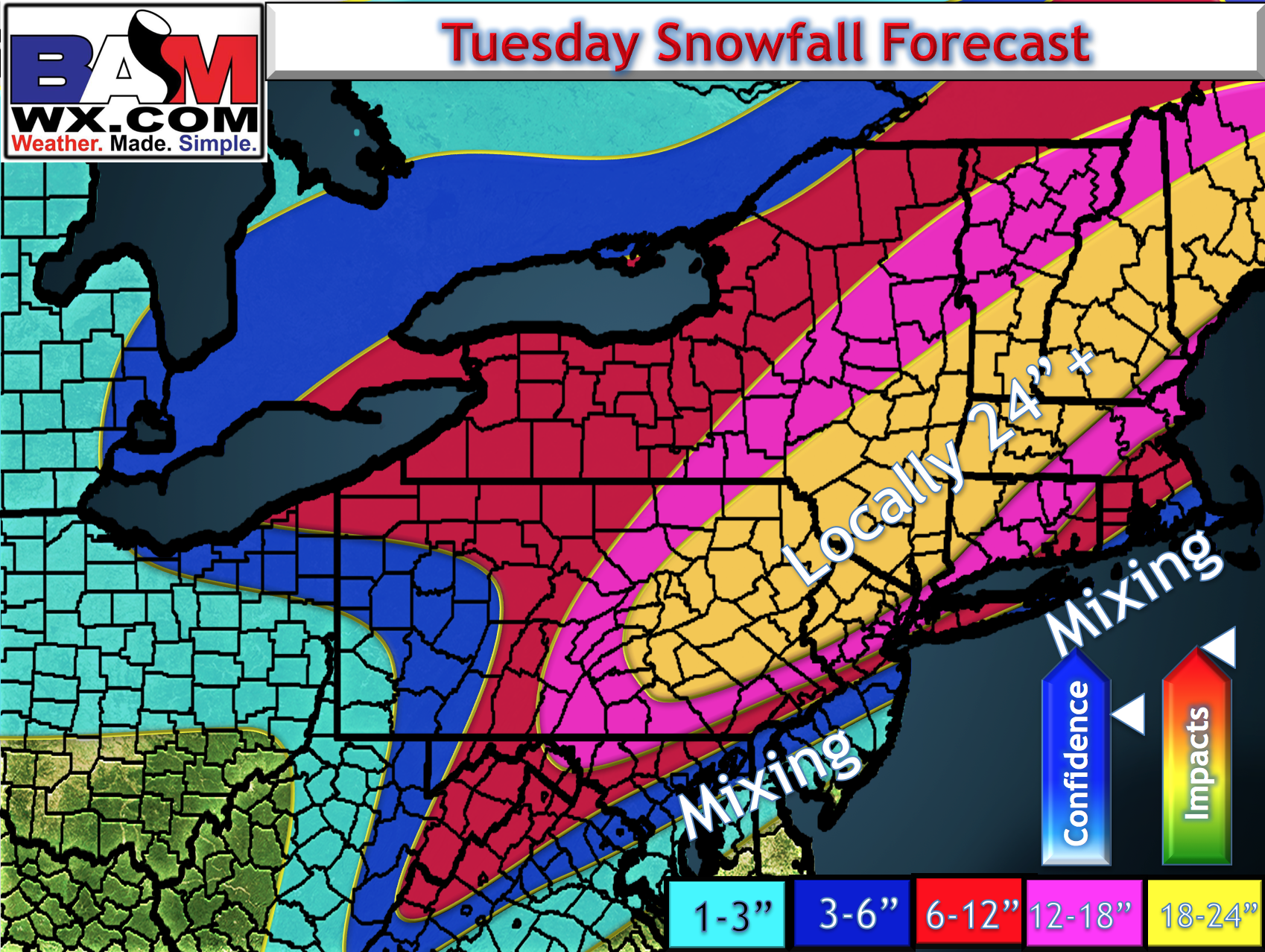
Our refined snow map takes into account additional mixing along the coast. Heaviest snows will be in northeast PA, the Catskills, and the Berkshires.
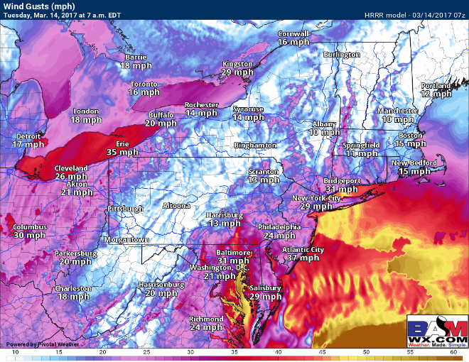
Winds will becoming strong and damaging near the coast with gusts past 60mph! 30-50 mph gusts elsewhere.
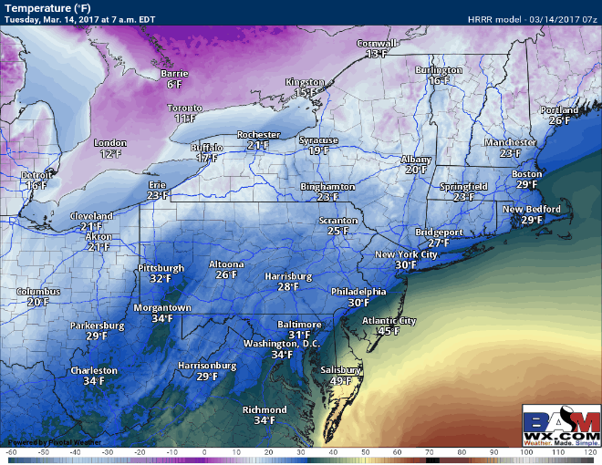
Temperatures this afternoon get very warm in southeastern New England (close to 50 for a bit) while areas north and west remain in the 20s and 30s. This is an incredibly dynamic storm system!
I want to stress that *any small movement in the storm track will influence snowfall totals*. There will be a very tight gradient between not much and over a foot of snow near I-95. I will likely update the snow map again later this morning after monitoring radar trends.
Weather the following the storm: windy with a few snow showers across the interior Northeast.
The video (5 min long) below explains it all.