#SDwx #NDwx #MNwx #WIwx Very Active Pattern Expected Leading Up to #Plant17. Details Here! E.
Synopsis: We are dealing with widespread temperatures below freezing this morning thanks to high pressure settled across the region. The next opportunity for some rainfall across southern portions of the forecast area will occur Wednesday into Thursday as an area of low pressure approaches from the west. Another threat of rain exists for Friday into Saturday across much of the region. Behind this system, colder conditions will return for early next week ahead of yet another system Tuesday. Needless to say, it’s quite an active pattern ahead!
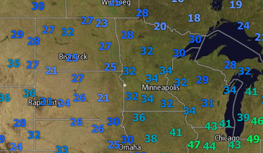
This morning, temperatures are below freezing across the entire region.
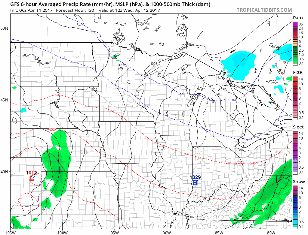
Our first precipitation chance in southeastern areas will be Wednesday night into Thursday. Here is the latest GFS model.
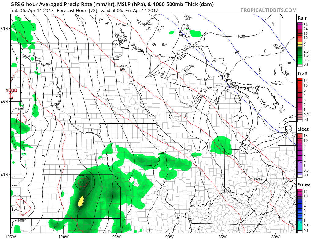
The active pattern (especially southeast) looks to continue through the weekend as another system moves in Friday through Sunday.
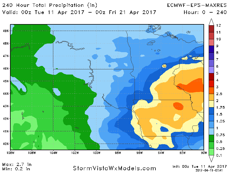
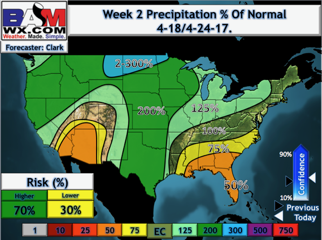
10 day rainfall will be impressive in southeastern areas, tapering as you head northwest across the Dakotas. This will make it hard to get in the fields through week 2.
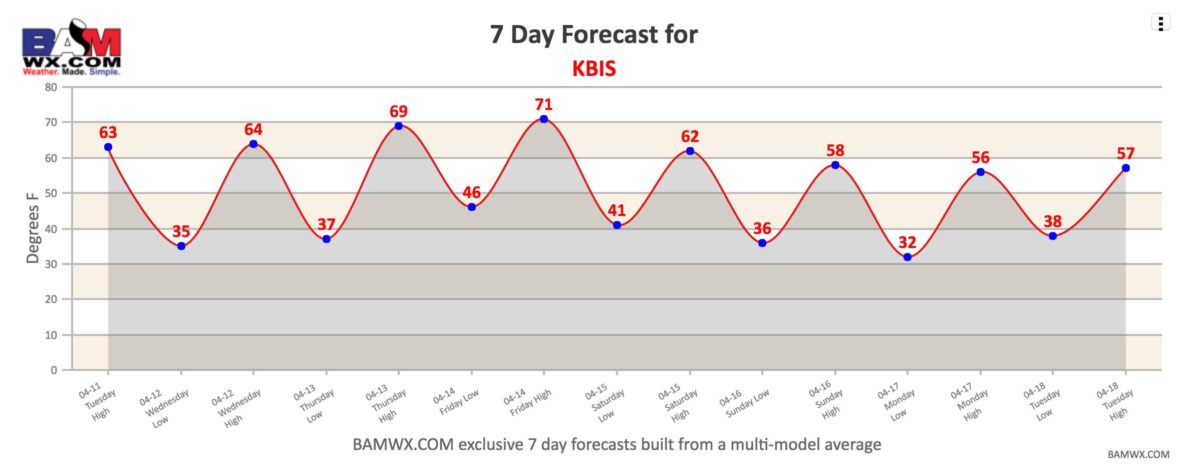
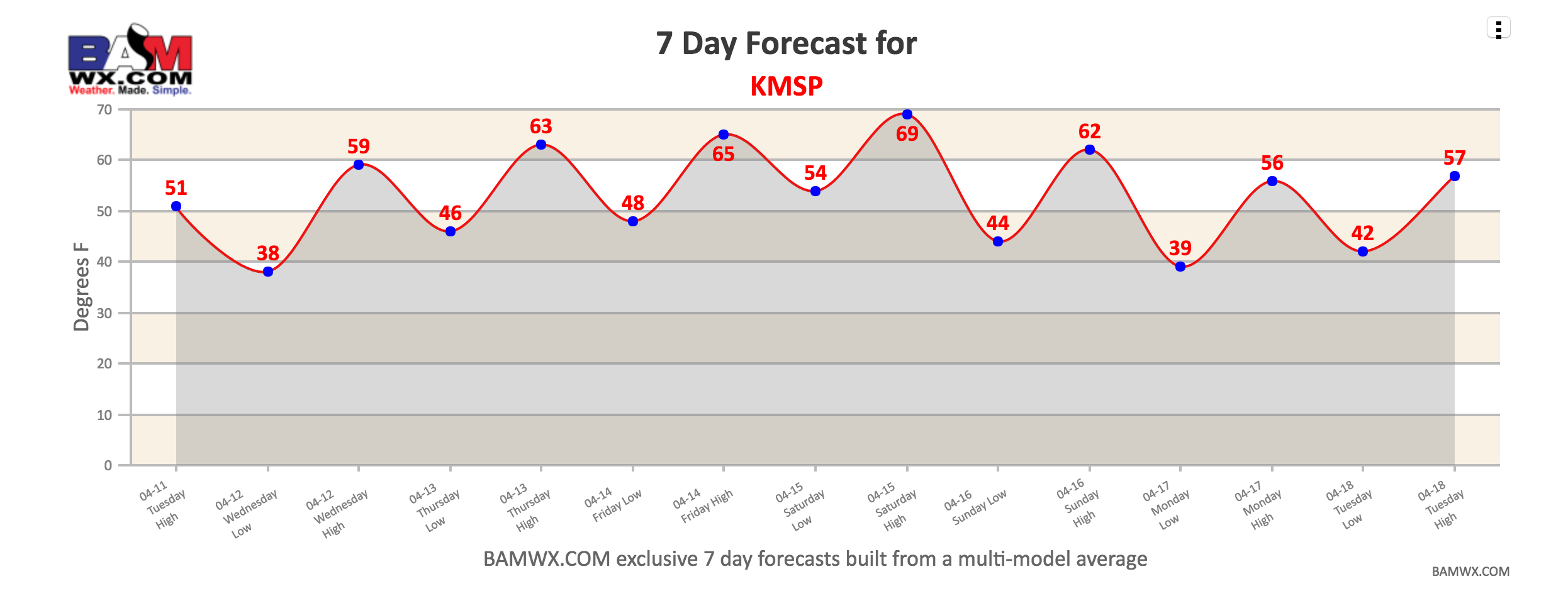
Temperatures for the most part will be above normal, but a return to near normal with a threat for freezes returns early next week, particularly north. Here is a look at our exclusive 7 day forecast for Bismarck, ND (KBIS) and Minneapolis, MN (KMSP). You can access these under the “7 day forecasts tab”.
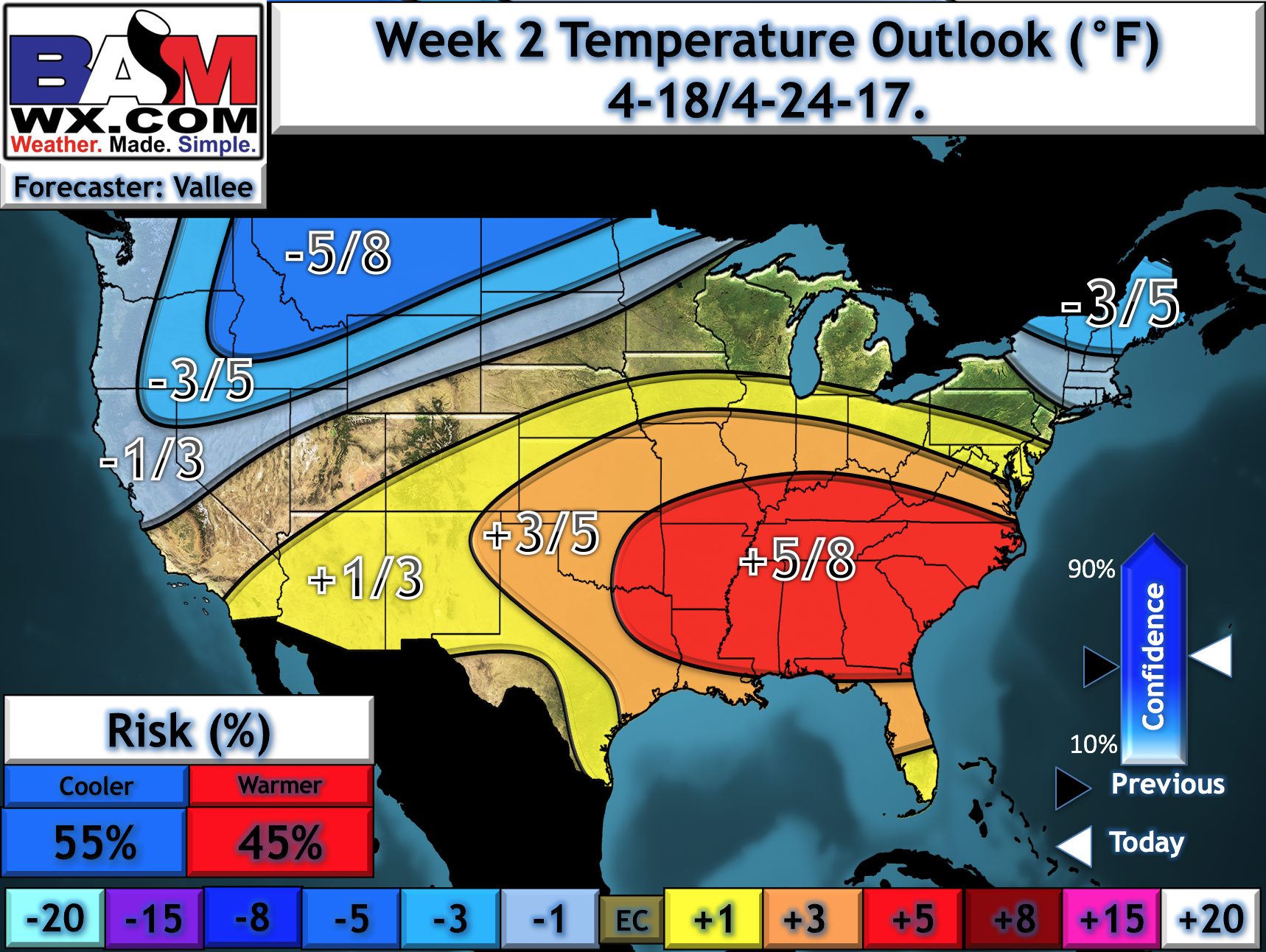
Overall, we are expecting colder and wetter than normal conditions to set in for week 2 as numerous disturbances move through the region. Here’s a look at our week 2 temperature and precipitation departures from normal.
Confidence and Risk:
- Above average confidence in an active regime continuing over the next 2 weeks and likely through the beginning of May.
- Above average confidence in warm temperatures through the weekend, with colder conditions returning early next week. This will include frost and freeze threats north.
Today’s video (6 minutes):