#AGwx #SDwx #NDwx #MNwx #WIwx Severe Risks This Week. E.
Key Points: June 27, 2017
Synopsis: Good Tuesday morning! Today will be largely quiet, but we are targeting a severe threat this evening and overnight across the Dakotas, then tomorrow across Wisconsin and Minnesota. Active conditions look to continue into Thursday as cooler air is ushered into the region for the weekend. Drier and warmer conditions are expected next week as a broad ridge of high pressure moves in from the west. Have a blessed day!
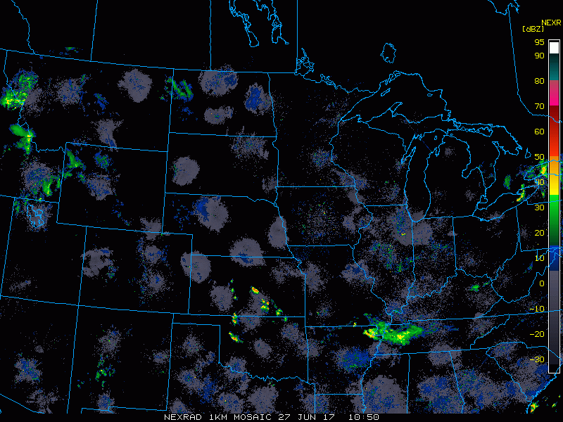
A few showers are across North Dakota this morning, but much of the region is quiet.
A severe threat does exist later this afternoon into tomorrow as a disturbance moves through. Here are the latest SPC outlooks.
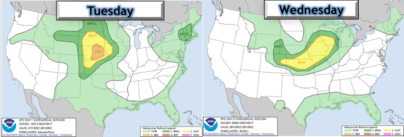
Timing looks to be overnight into early Wednesday, shown below and discussed more in the video.

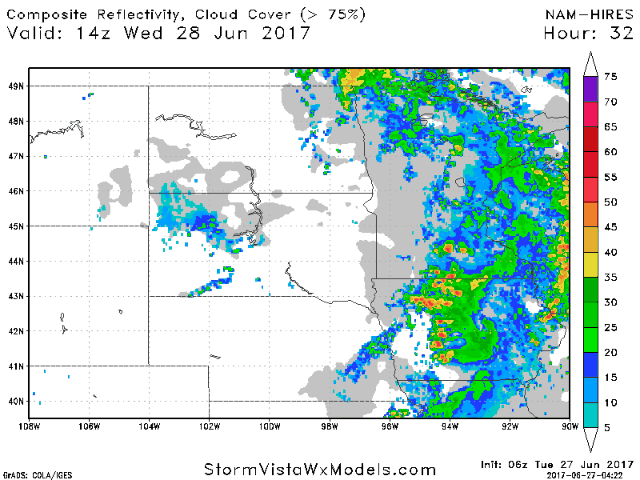
This active regime looks to continue into Thursday as a cold front moves through.
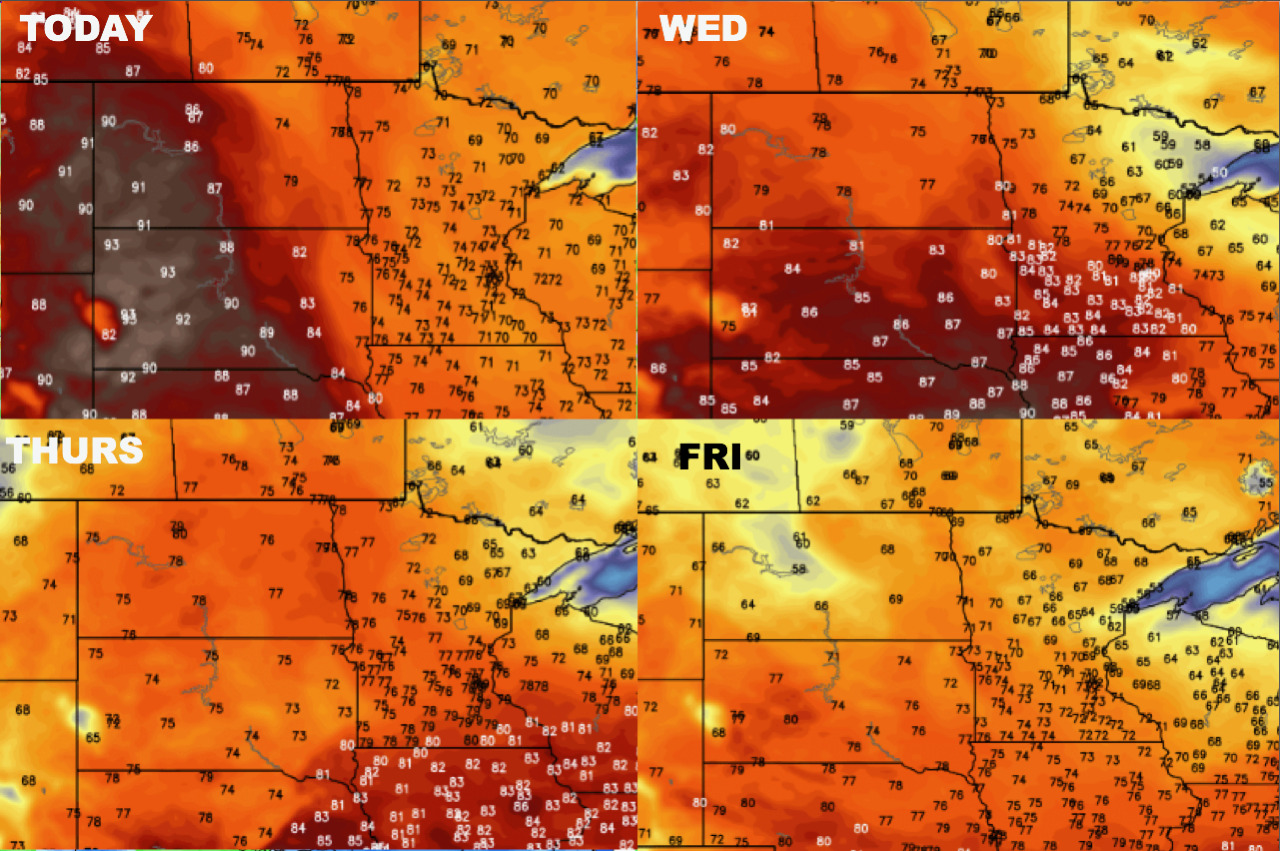
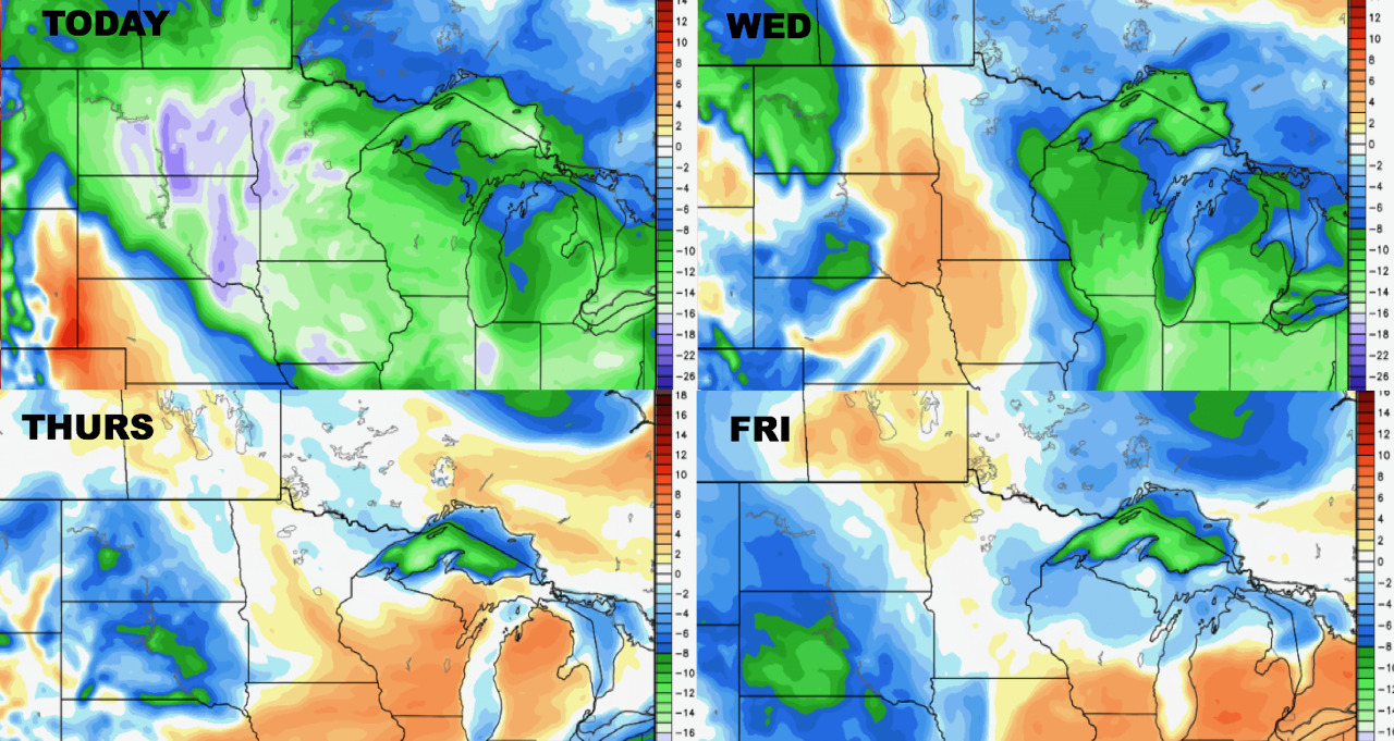
Temperatures will be up and down over the coming days.
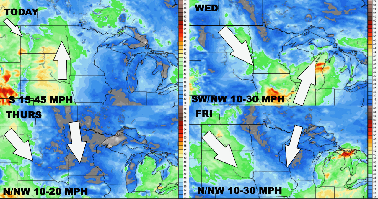
Winds next 4 days are shown below.
Humidity will also be up and down through the week.
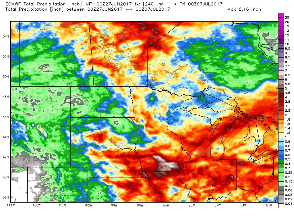
Total rainfall over the next 10 days will be very storm dependent and heaviest east.
Risks and Confidence:
- Above average confidence in severe risks this week with warmer weather giving way to cooler conditions this weekend.
- Above average confidence in a broad ridge of high pressure developing in week 2 leading to warmer conditions once again.
Today’s Video (6 minutes):