Key Points – Friday, May 5, 2017:
Synopsis: Good Friday morning! Today we discuss the continue heavy rains possible across portions of Indiana and Ohio, a brief shot of showers on Saturday, the continued threat for a hard frost, even freeze late weekend into early next week and the active return to the pattern mid to late next week. Have a wonderful weekend!
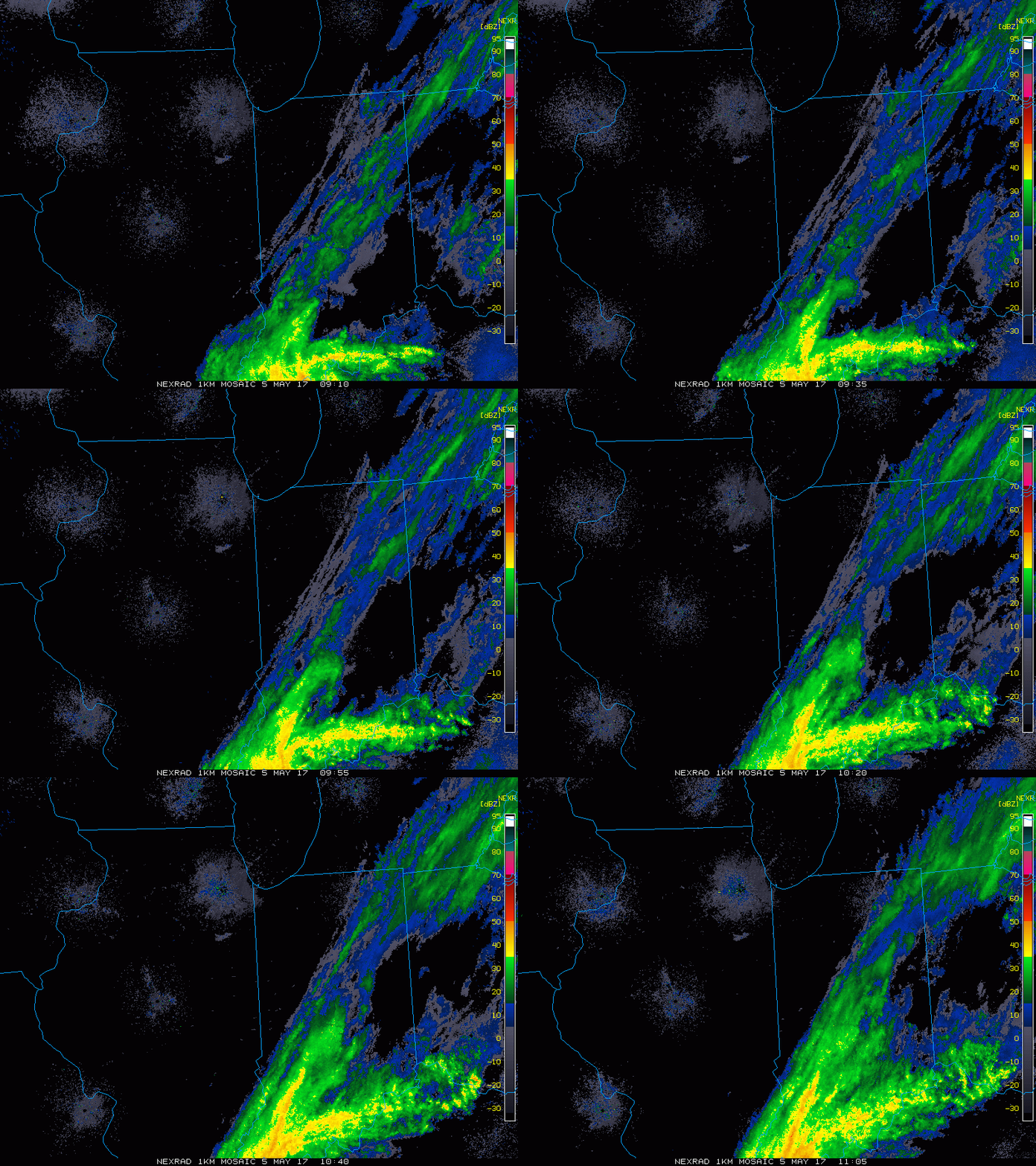
Current Radar:
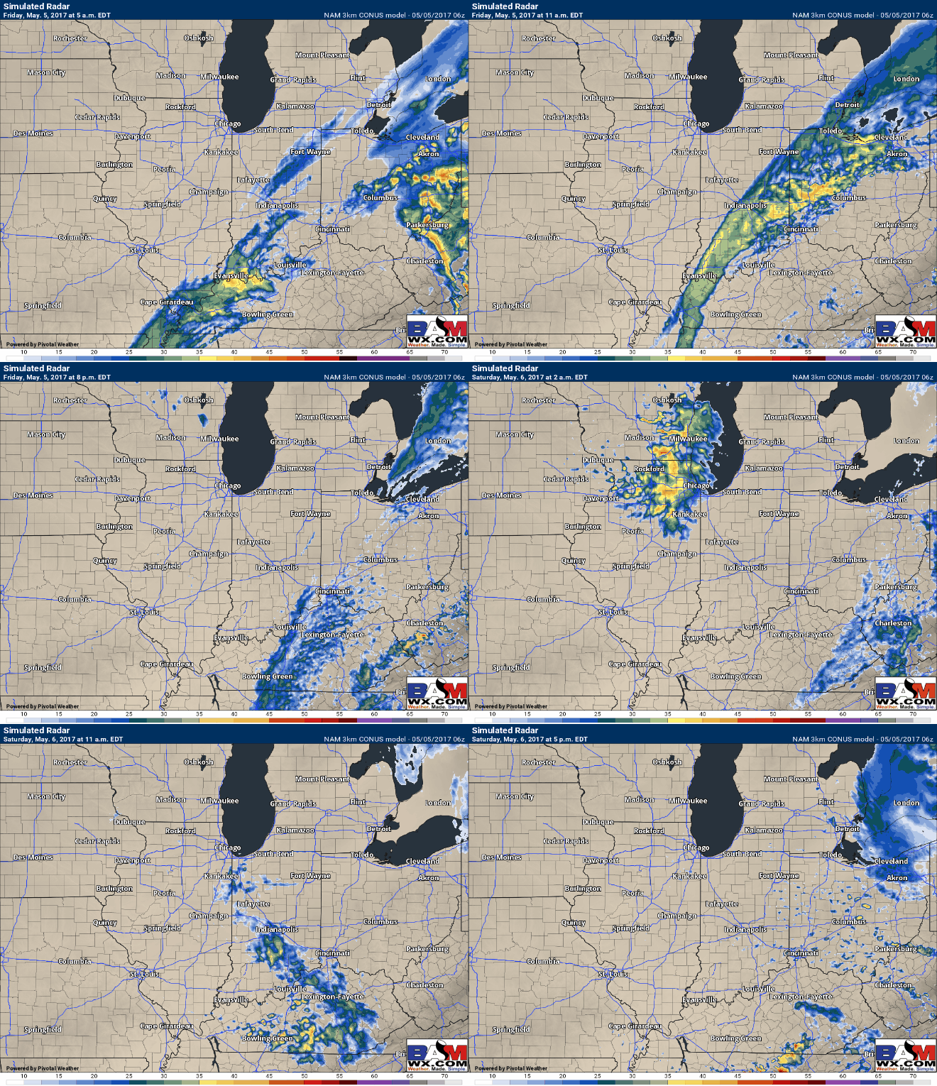
Simulated Radar through Saturday…heavy showers continue from Evansville to Ft. Wayne and areas east this morning, moving off to Ohio later this afternoon into the evening. Additional showers move south to north early Saturday as well, coverage ~40%. Likely will see some sunshine popping out the second half of the day on Saturday.
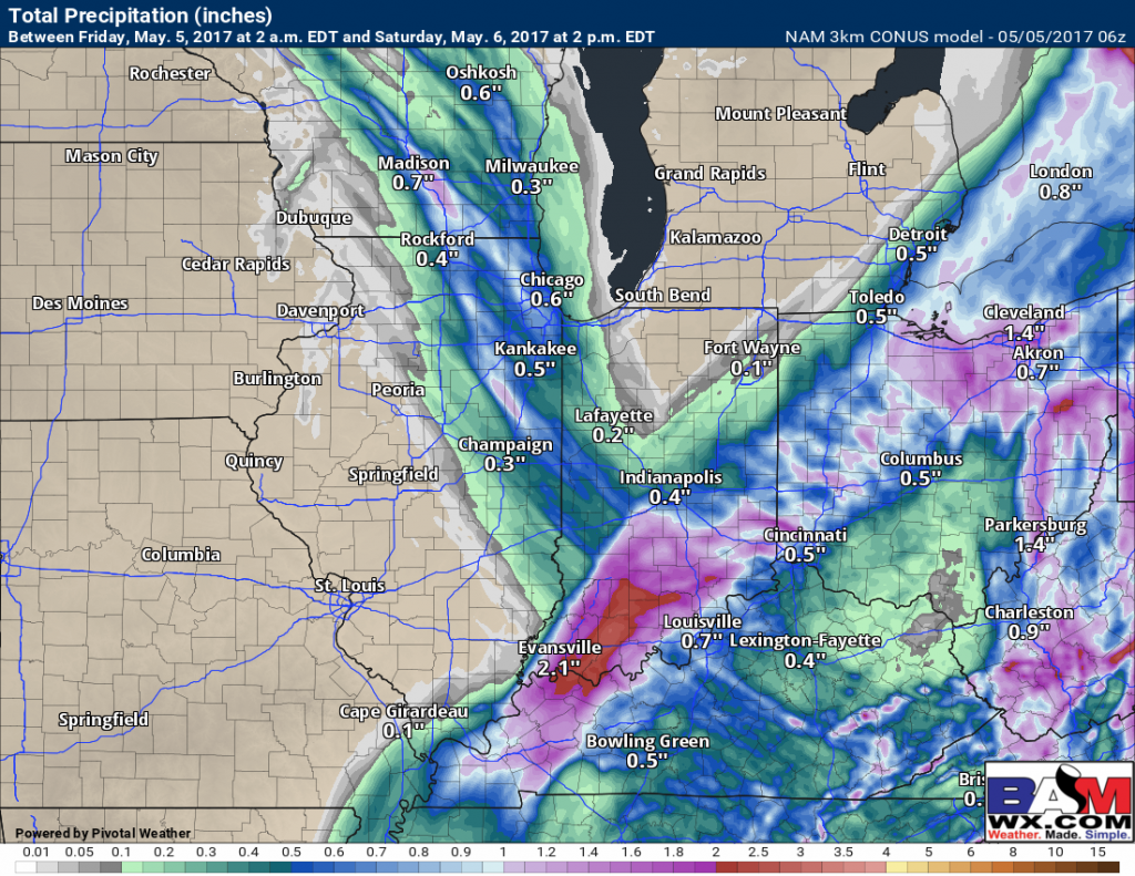
Current forecast total rainfall totals…still some heavy rains left for the southern half of IN into western OH.
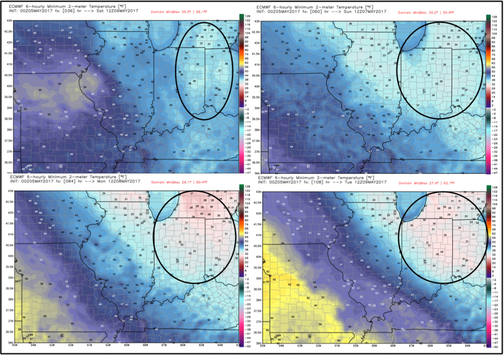
Continued hard frost, even a freeze threat Saturday through Tuesday mornings:
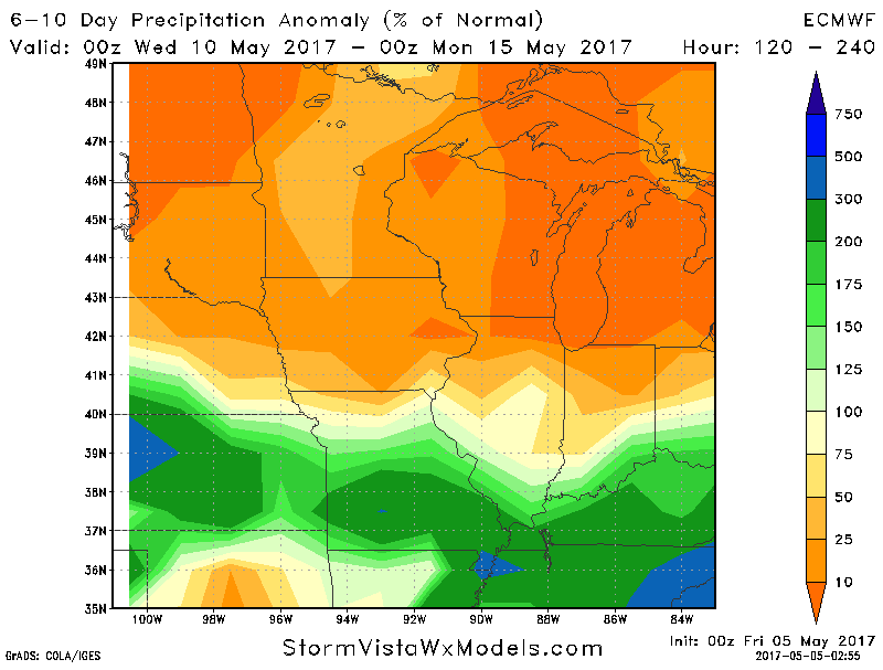
Pattern returns to active mid to late next week…I do think these above normal rainfall signals could shift further north if the ridge to the south strengthens:
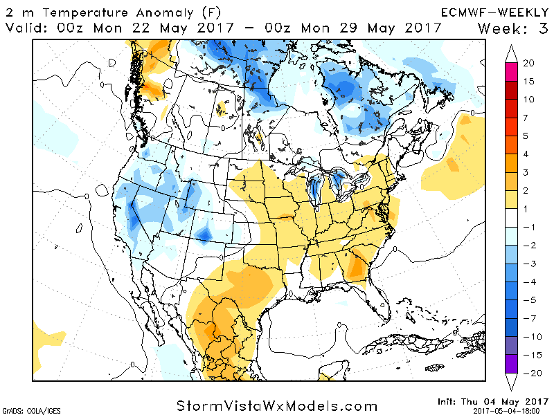
We continue to see a period of warmth to end May and potentially begin June, shown well here in the latest Euro Weeklies last night:
Confidence and Risk:
- Above average confidence some heavier rain showers will slowly pull off to the east throughout the day.
- Average risk for additional moderate showers moving south to north early Saturday morning.
- Above average confidence we stay clear of much weather later Saturday through early Tuesday.
- Above average confidence we overall we stay below normal in temperatures over the next week.
- Average risk for frost on vegetation this weekend into early next week.
Today’s video (7 min):
