#AGwx #NDwx #SDwx #MNwx #WIwx Storm Chances Through Early Next Week, Very Hot As Well. E.
Key Points: June 8, 2017
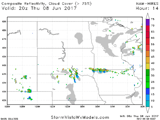
Synopsis: Good Thursday morning! We are tracking a few showers across eastern areas today along a weak surface boundary. A few strong storms are possible along this boundary this afternoon in southern areas, but coverage looks to be rather low. A more substantial storm threat arises tomorrow afternoon and evening across the Dakotas with all modes of severe weather possible – I touch on timing and threats in the video! Hot and windy weather is expected this weekend into early next week especially south with temperatures approaching or even surpassing 100° at times. Additional storm chances comes into early next week as a storm moves through bringing more seasonable temperatures by the end of next week. Have a blessed day!
- Showers continue across southeastern areas this morning.
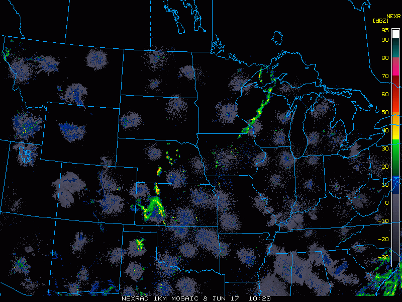
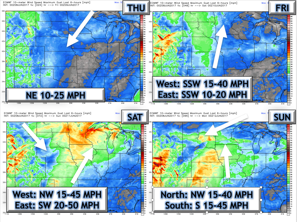
- Here’s a look at storm timing and location today through Friday evening.
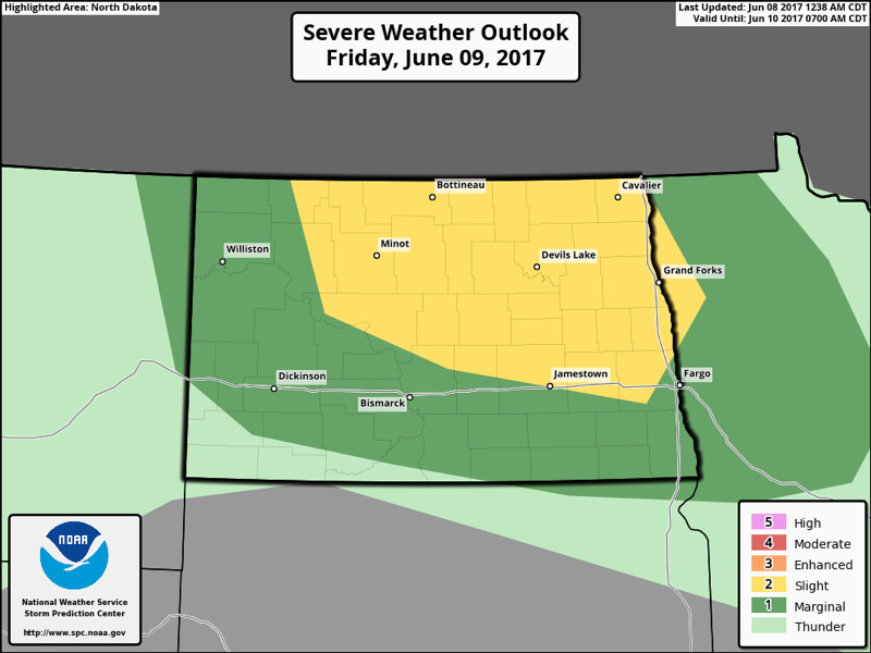
- The SPC has outlined the Dakotas for severe weather Friday evening.
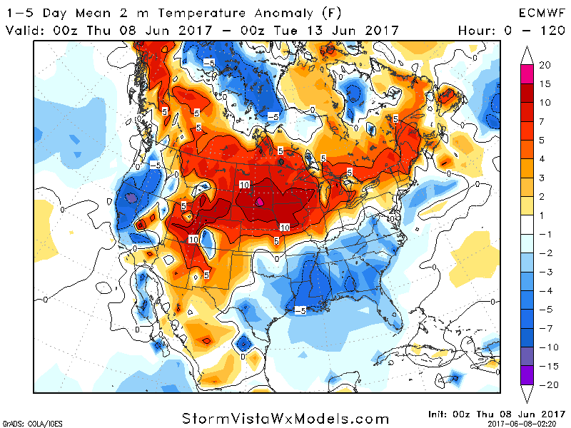
- Heat continues to be the real deal into next week. Temperatures look 8-15°F above normal.
- Winds will be strong this weekend as well. 4 day forecast is below.
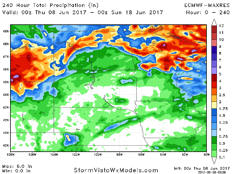
- Total rainfall through day 10 will be quite storm dependent with heaviest rainfall north.
Confidence and Risks:
- Above average confidence in hot conditions along with windy conditions through the weekend.
- Above average confidence in severe weather threats Friday and Monday across the Dakotas. However, exact location of storms is uncertain.
- Increasing confidence in cooler conditions developing later next week region wide.
Today’s Video (8 minutes):