#AGwx #MOwx #IAwx #NEwx #KSwx Severe Risks Through Friday. Details Here! E.
Key Points: June 29, 2017
Synopsis: Good Thursday morning! We are tracking a line of thunderstorms pushing through Kansas and Missouri this morning producing gusty winds, hail, and very heavy rain. Some places have seen 12″ of rain in northern Missouri! As we move through the afternoon, a boundary nearby combined with the heating of the day will spark severe weather across the entire zone. The video will have all the details on timing and threats. The boundary will linger Friday sparking additional severe thunderstorms as well. A dry and fairly comfortable day is expected Saturday before warmer and more humid air returns with a thunderstorm threat Sunday into next week. Have a blessed day!
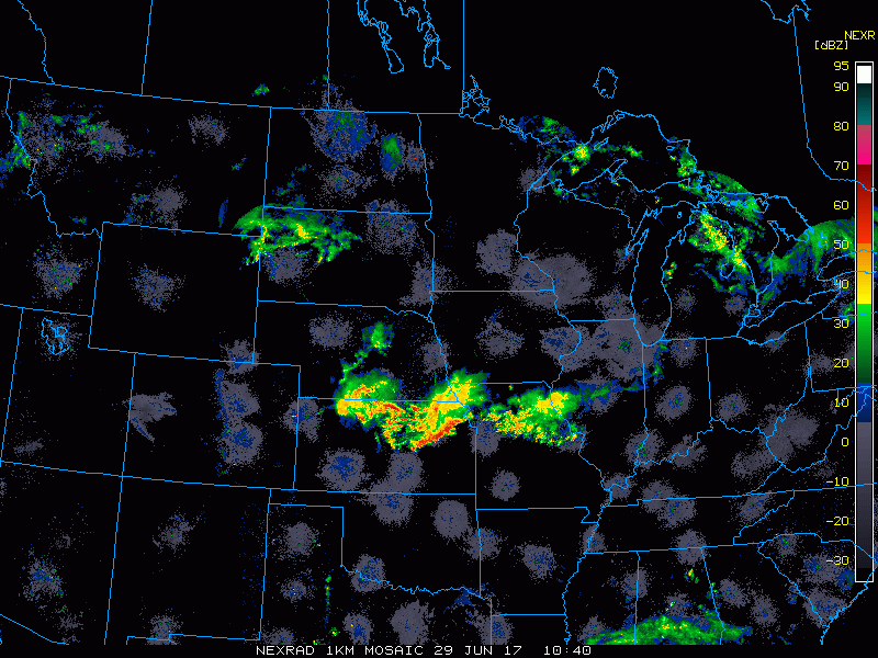
Current radar shows the line of storms moving through Kansas and Missouri.
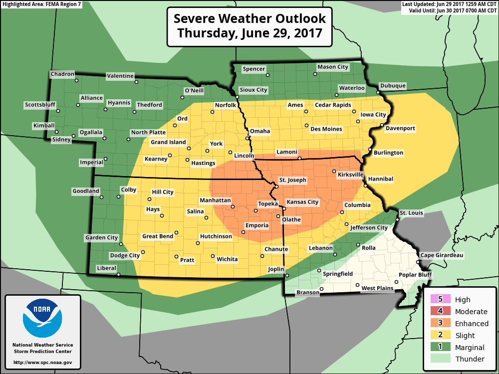
Additional severe weather is expected later today and the latest day 1 SPC outlook agrees.
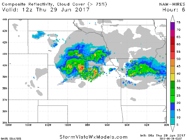
Projected radar shows how storms may evolve later on today. Additional details are in the video!
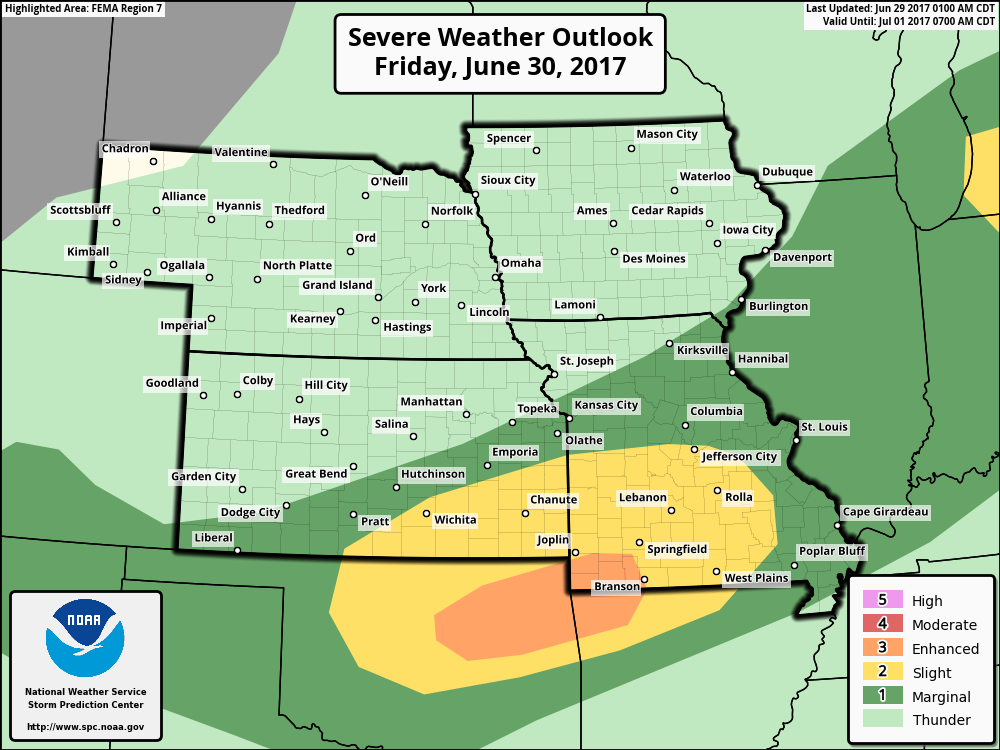
Additional severe weather is possible south Friday, discussed in the video. SPC day 2 outlook shown below.
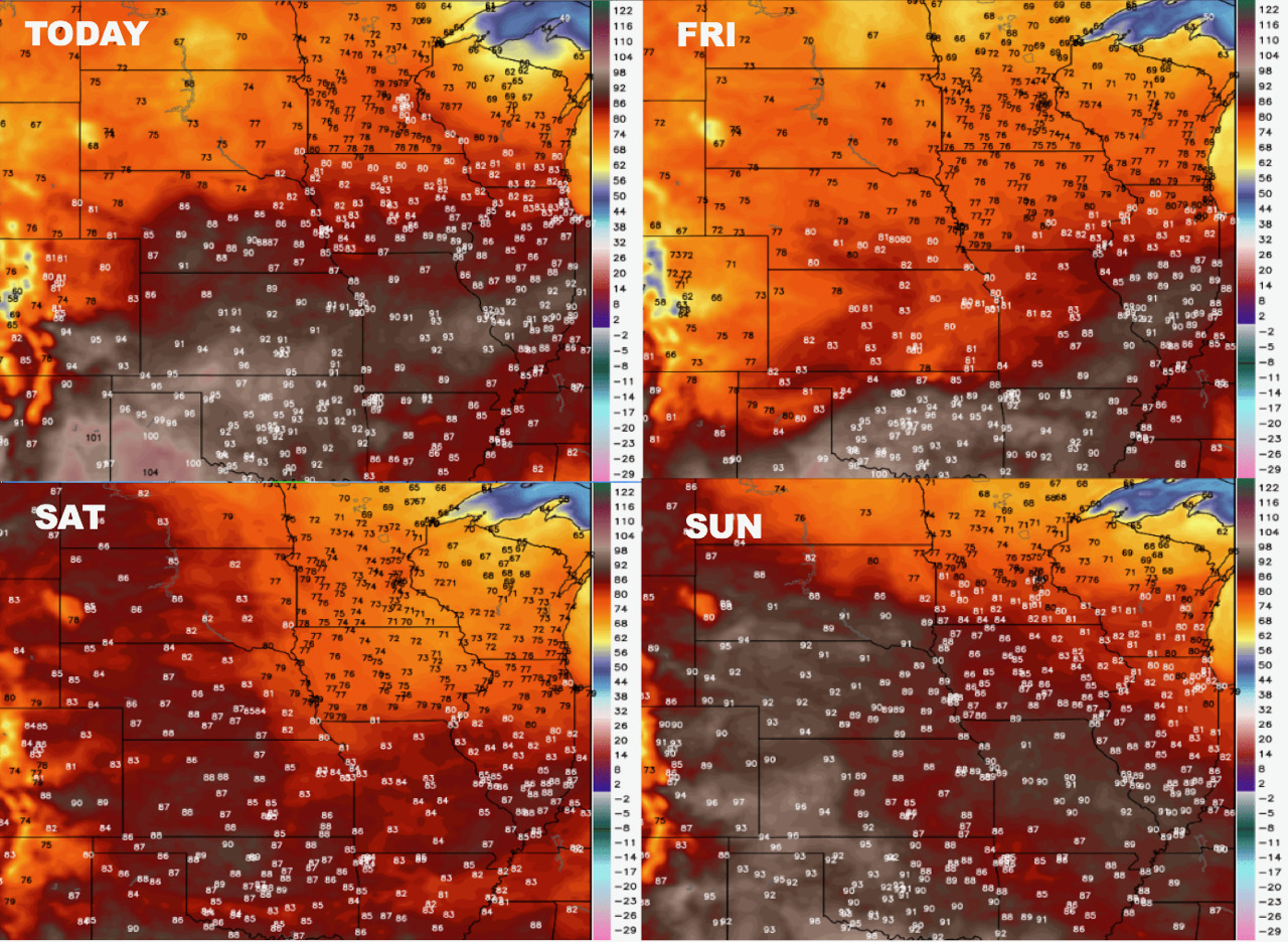
Temperatures over the coming days.
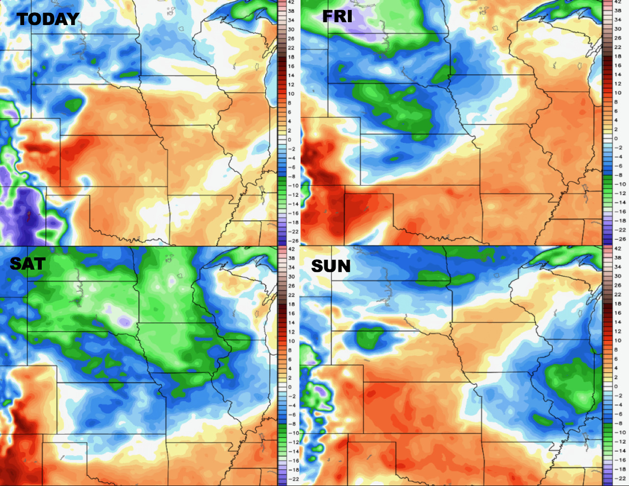
Briefly drier air is expected for Saturday, with more humid air returning Sunday.
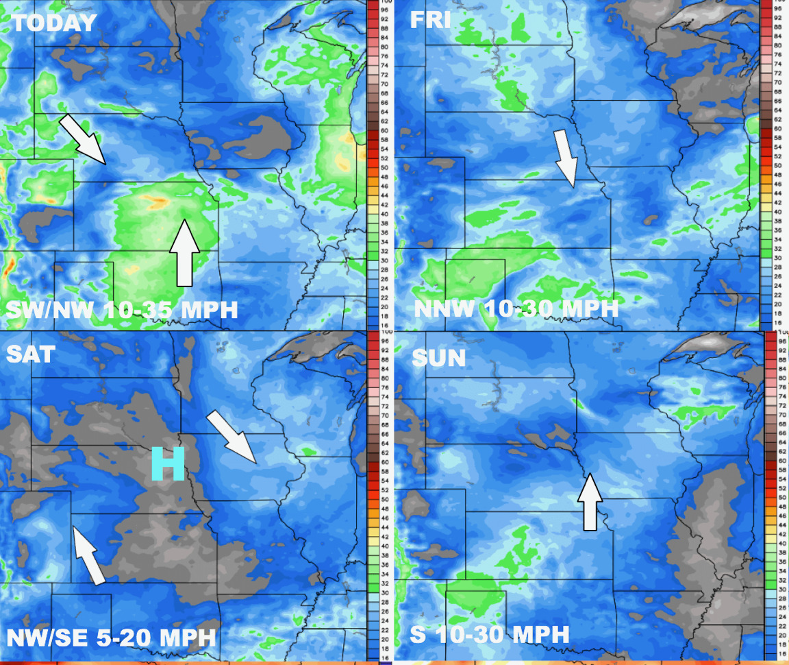
Winds over the next 4 days are shown below.
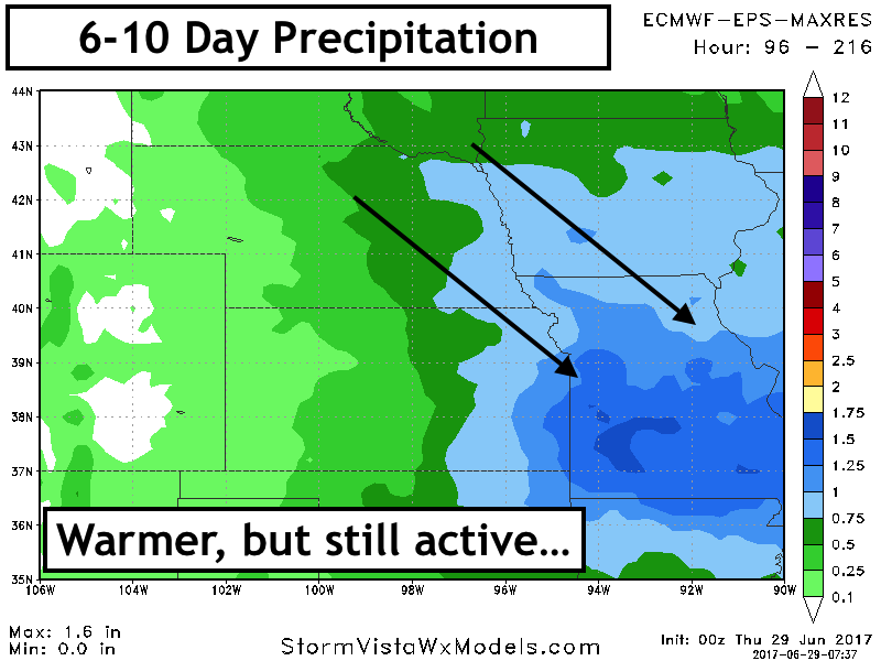
As warmer, more humid air arrive next week, clusters of storms are expected next week. 6-10 day precipitation is shown below.
The week 2 temperature forecast shows the warmer conditions.

Confidence and Risk:
- Above average confidence in severe weather this afternoon and evening, but morning storms may hinder afternoon threat across portions of Kansas…this must be watched.
- Above average confidence in a drier Saturday, but a quick return to active into next week.
- Increasing confidence in warmer than normal conditions into next week and beyond with drier risks showing up in Nebraska and Kansas as a ridge develops.
Today’s Video (8 minutes):