#AGwx #MOwx #IAwx #KSwx #NEwx Big Time Heat Coming Through Next Week! E.
Key Points: June 7, 2017
Synopsis: Good Wednesday morning! The big story over the 5-7 days will be the building heat across the region. A few storm chances will arise Thursday night into Friday, but coverage will be quite low. Temperatures will soar into the 90s and 100s this weekend into early next week thanks to a strong ridge of high pressure. Conditions look to turn more active toward the end of next week especially north and east – stay tuned. Have a blessed day!
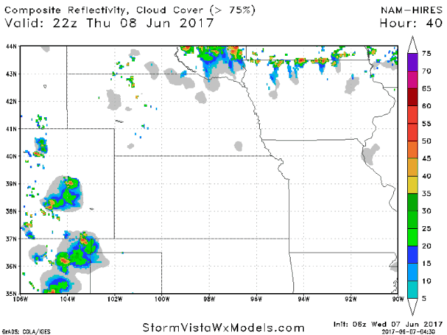
- The first threat for storms likely comes Thursday night into Friday in Nebraska and Kansas. A few storms are possible in Iowa as well.
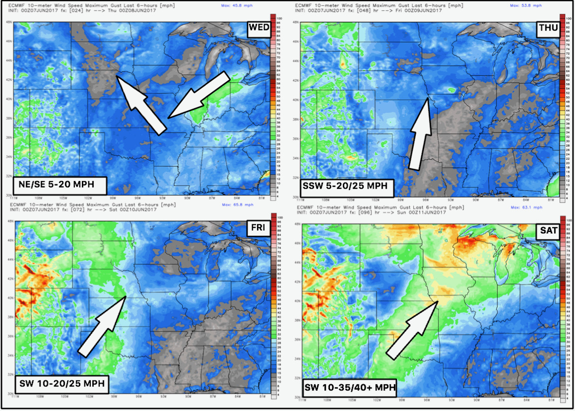
- 4 day wind forecast is below.
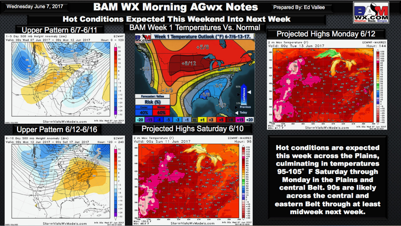
- The big story will be the heat developing into the weekend and next week. This slide from the Ag report explains the set up very well.
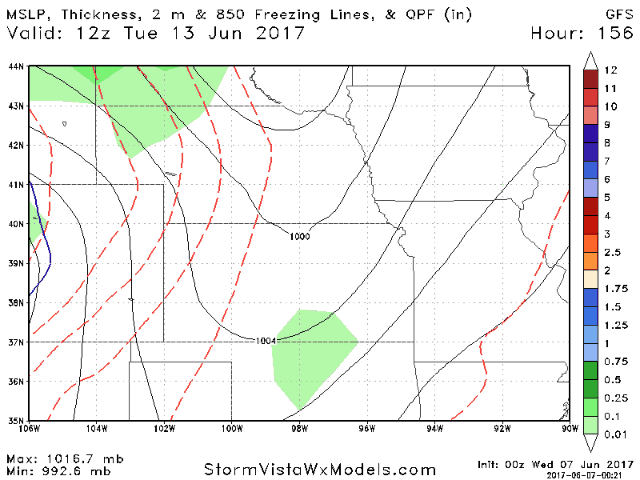
- Toward the middle of next week, a storm system will push through the northern Plains. This likely leads to a storm threat Wednesday onward but timing and intensity is a bit uncertain. Here’s the latest GFS model to give you an idea. As you can see, the convective nature of the storms will be tough to nail down, especially at this extended lead time, so check back!
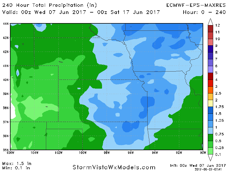
- Total rainfall through day 7 is pretty meager, but 10 day totals do show some promise especially north and east.
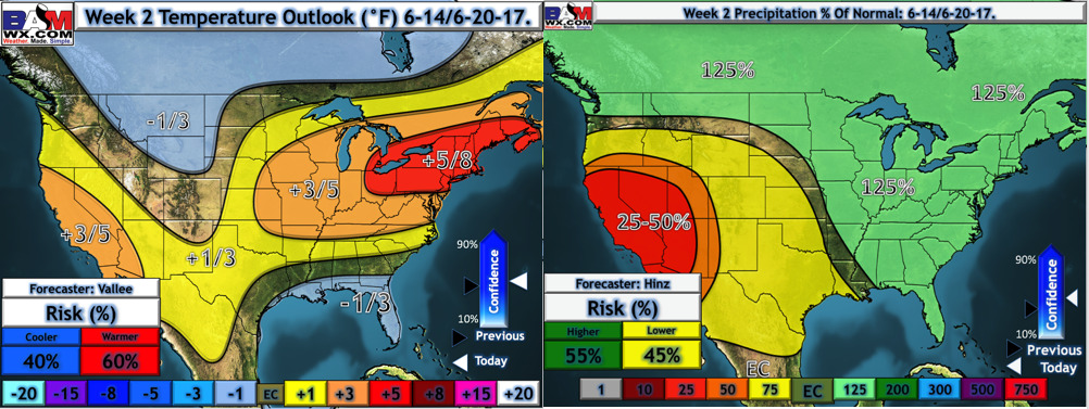
- Our week 2 temperature and precipitation forecasts still point to a wetter regime developing especially east. It still does look to remain above normal for temperatures.
Confidence and Risk:
- Average confidence in some spotty storms Thursday night into Friday, but coverage looks low.
- Above average confidence in very hot conditions this weekend into next week.
- Increasing confidence on more active times especially north and east in week 2.
Today’s Video (7:30):