#AGwx #MNwx #WIwx #NDwx #SDwx Severe Weather Possible Friday. Details Here! E.
Key Points: June 1, 2017
Synopsis: Good Thursday morning! Radar is quiet this morning as warmer air begins to enter the region. This will set the stage for some thunderstorms Friday afternoon across the Dakotas, pushing eastward into Minnesota and Wisconsin Friday night. These storms have the potential to be severe with damaging winds, hail, and even a few tornadoes. This threat will continue in Minnesota and Wisconsin Saturday with drier, cooler conditions developing across the Dakotas. Another ridge of high pressure will impact the region next week with only spotty shower and thunderstorm threats along with warm conditions. Have a blessed day!
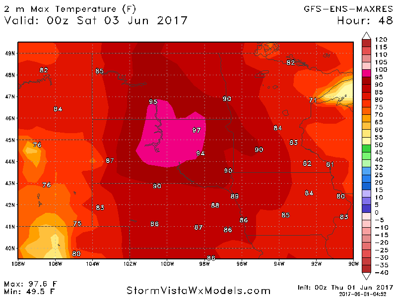
- Today looks like a quiet day, but Friday continues to look active with heat and storms. Here’s a look at possible high temperatures.
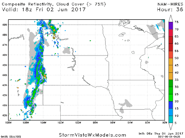
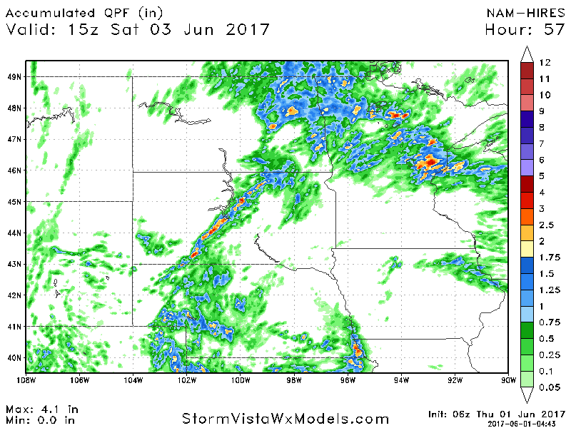
- A line of storms is expected Friday afternoon across the Dakotas, pushing east overnight into Saturday.
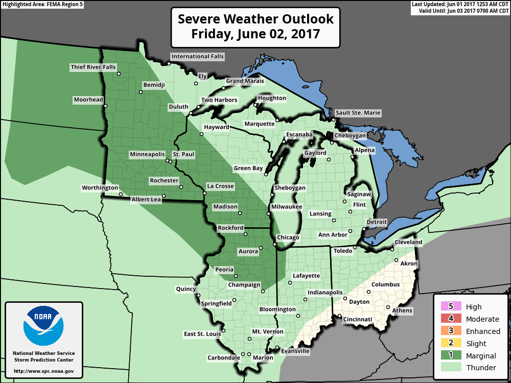
- The SPC has outlined the eastern Dakotas into Minnesota for a marginal risk of severe weather Friday night. I think a slight risk is certainly possible.
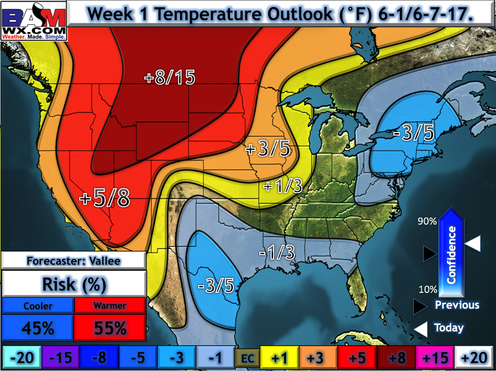
- Temperatures in week 1 look quite warm, averaging 5-15°F above normal.
- Total rainfall will be very storm dependent, ranging from hardly anything to potentially 2-3″ in the heaviest storms.
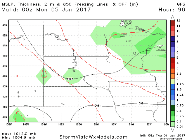
- Spotty rain chances will arise next week, but will be very dependent on exact track of storms, so stay tuned!
Confidence and Risks:
- Above average confidence in warmth and dryness today across the region.
- Above average confidence in a hot day west Friday.
- Average confidence in storm chances west Friday then east Friday night into Saturday. Very storm track dependent, so check back!
- Increasing confidence in more warmth and dryness developing in week 2 with only spotty storm chances.
Today’s Video (6 minutes):