#AGwx #MNwx #WIwx #NDwx #SDwx Severe Risk East Today, Much Cooler This Weekend! E.
Key Points: June 22, 2017
Synopsis: Good Thursday morning! We are tracking a cold front moving through the Dakotas this morning bringing some severe weather. This boundary will sag south today and tonight, bringing a severe threat to southern Wisconsin this afternoon and evening. Cooler air returns for the start of next week before we warm things up once again toward the end of next week. The next threat of more widespread rains after today likely comes next Wednesday. Some additional cooler, more active conditions may arrive once again in the 11-15 day. Have a blessed day!
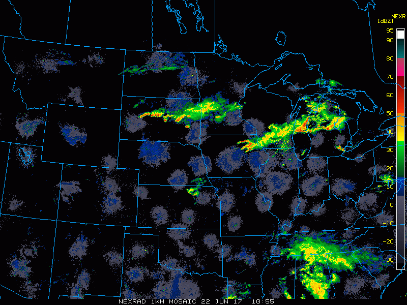
Current radar shows storms across the region.
SPC outlook today features the severe risk in Wisconsin. 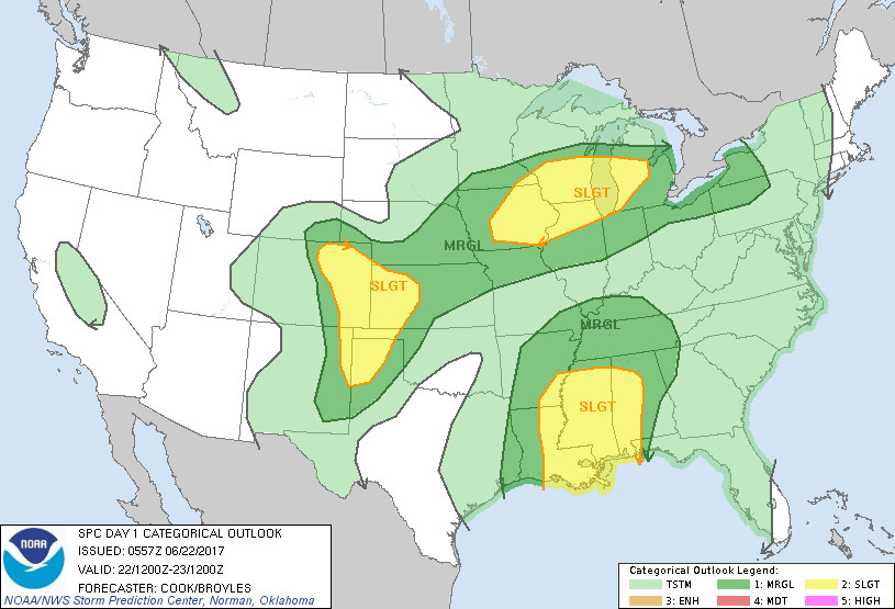
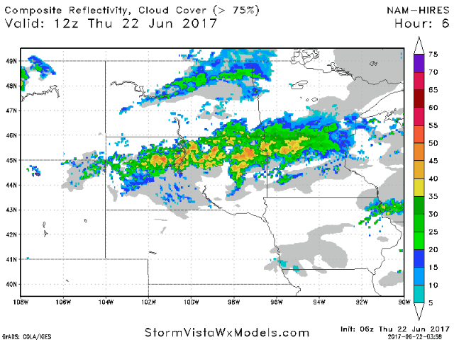
Projected radar through tonight.
Wind forecast next 4 days.

Cooler, drier air comes in for the weekend. Dew point anomalies show drier than normal air across the entire region.

Precipitation over the next week does look to run below normal despite cooler than normal temperatures.

Total rainfall next 7 days.

Confidence and Risks:
- Above average confidence on a severe weather threat this afternoon and evening east with gusty winds the main threat.
- Above average confidence on cooler than normal temperatures this weekend into next week.
- Average confidence in active times returning later next week and beyond.
Today’s Video (7 minutes):