#AGwx #MNwx #WIwx #NDwx #SDwx Active Into Next Week, Drier Trend Developing Week 2? E.
Key Points: May 24th, 2017
Synopsis: Good Wednesday morning! An upper level system is causing a few showers across Wisconsin. This will erode over the day today with western areas seeing some sunshine. Another disturbance will bring some showers and embedded thunder to the Dakotas tonight into Thursday. Spotty shower and storm threats will continue through the weekend into early next week before a drier and warmer trend arises to end next week. Have a blessed day!
- Current radar is quiet for most, with only a few showers far east.
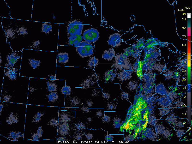
- A disturbance will move through the Dakotas tonight into Thursday with some showers and embedded thunder.
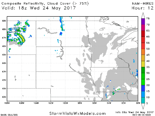
- Our next threat for storms will be in extreme southern areas as a cluster of energy moves through Thursday night into Friday. There is some uncertainty as to whether it stays south of the region or not, so stay tuned!
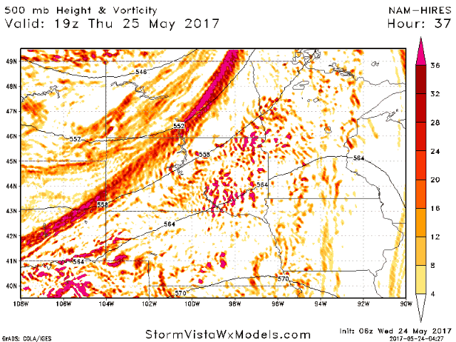
- The pattern through the weekend will continue to support spotty showers and storms thanks to an upper trough nearby.
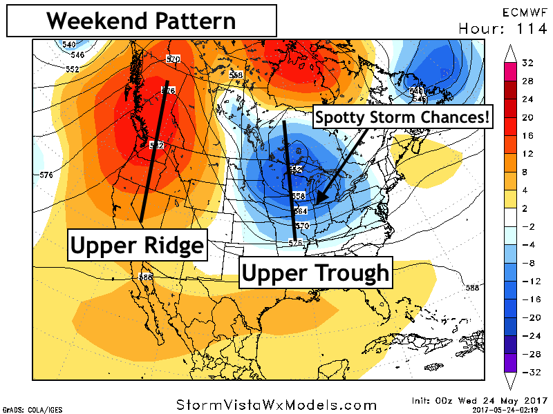
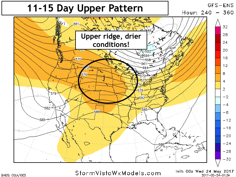
- Into next week, an upper ridge will slowly push eastward into the forecast area promoting a drier, warmer trend later next week and beyond.
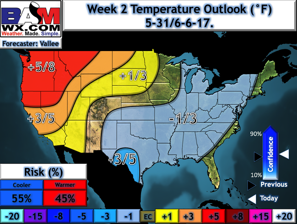
- Our week 2 temperature forecast shows this warmer trend well!
Confidence and Risks:
- Above average confidence for showers and storms tonight into Thursday in the Dakotas.
- Average confidence in a storm threat south Friday morning, but exact track remains uncertain – check back!
- Above average confidence in spotty storm chances through early next week with an upper trough nearby.
- Increasing confidence in a drier, warmer trend developing next week and beyond.
Today’s Video (6 minutes):