Key Points – Thursday, May 4, 2017:
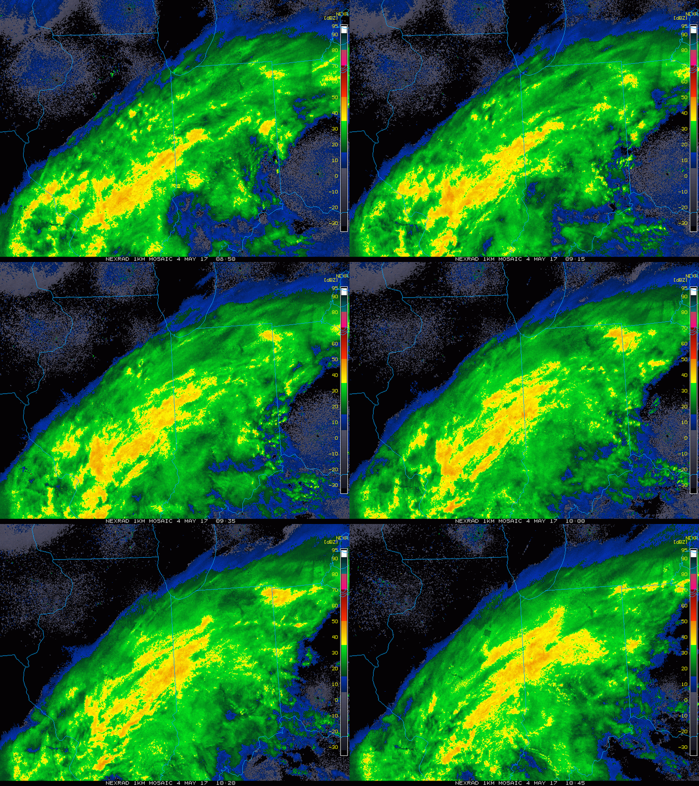
Synopsis: Good Thursday morning! Heavy rains working in this morning across much of the Ohio Valley this morning, it’ll be a cold and wet day with nearly a 100% chance of rain throughout the day for most locations…can’t rule out localized flash flooding today as well. The rains slowly move south and east on the day on Friday before our next little wave of showers moves through the first half of the day on Saturday. We will see some sunshine late weekend into early next week which is good news, the not so good news is we are still watching for a hard frost threat late weekend into early next week. Details in the video, have a blessed day!
Current Radar:
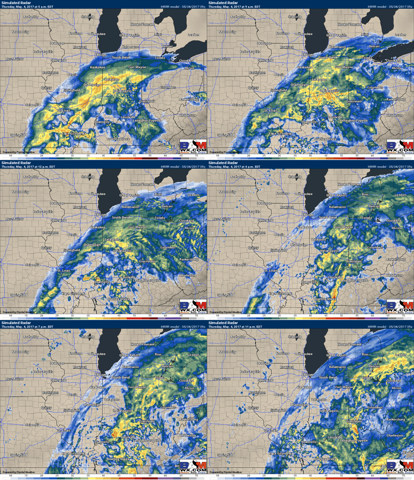
Simulated Radar today, heavy rainfall (and possibly some thunder) at times from the southern half of Illinois through most of Indiana and western Ohio. There may be a slight periods of dry time later this afternoon, but we aren’t 100% sold on this yet.
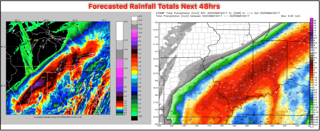
Total rainfall forecasted over the next 48 hours via the European models who have been performing the most consistent. A swath of 1-3″ of rain exists, with isolated higher amounts possible across central IN into northwest Ohio.
Still watching a little wave of energy that will produce some showers early Saturday morning, mainly focused across the western and southern half of Indiana at this time:
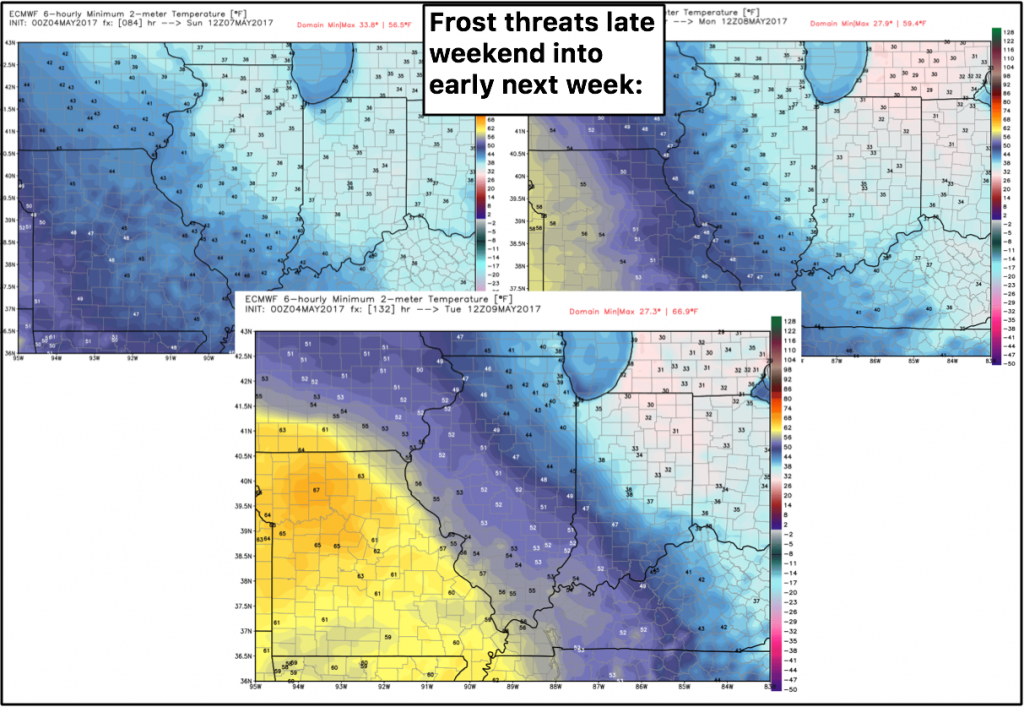
Will see plenty of sunshine late weekend into early next week, however, still watching for frost threats Sunday – Tuesday mornings:
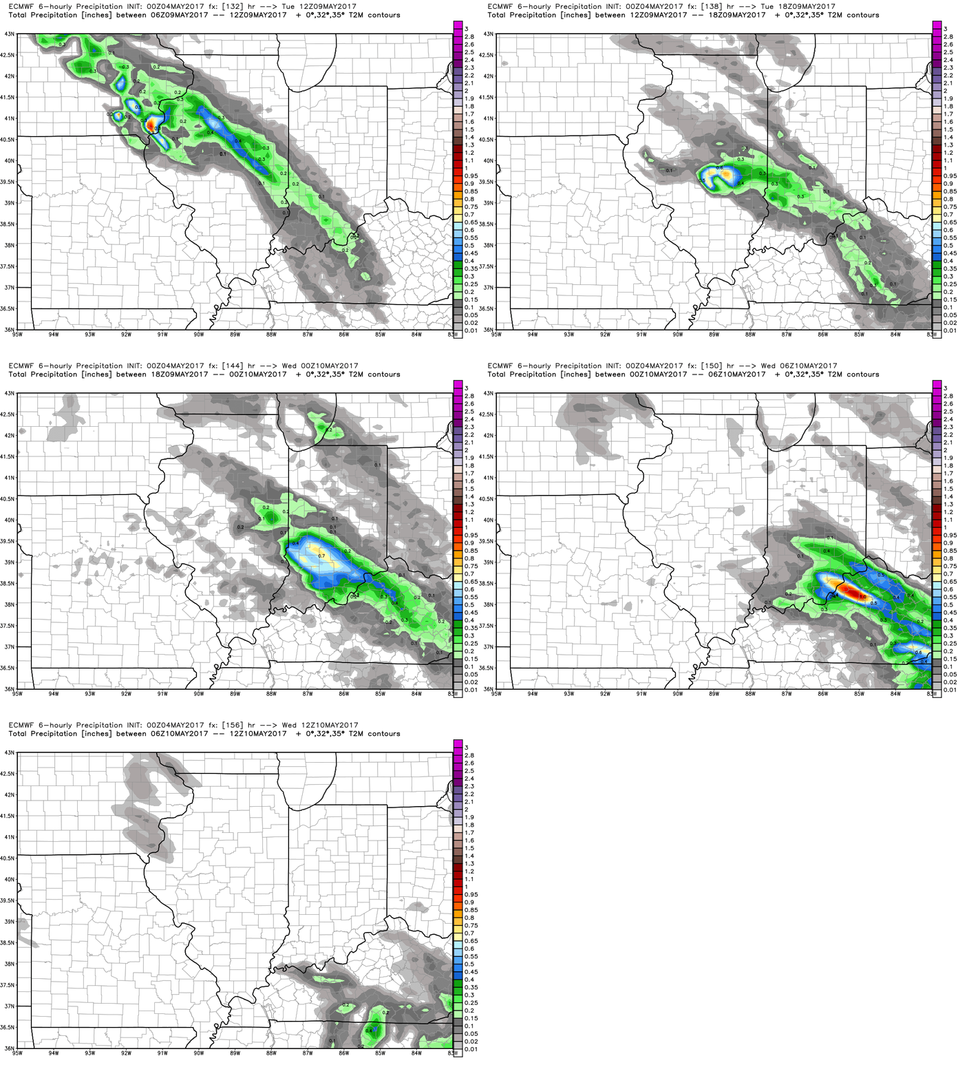
Next disturbance looks to work in Tuesday into Wednesday next week:
Confidence and Risk:
- Above average confidence most of Indiana into western Ohio sees over an 1″ up to 3″+ over the next 2 days.
- Average risk for flash flooding today as well.
- Still average risk in exactly where the early Saturday disturbance moves through, but confidence is increasing that it stays west of Ohio.
- Average risk for hard frost threats Sunday-Tuesday mornings into early next week.
Today’s video (6 min):
