Key Points: May 5, 2017
Synopsis: Good morning and happy Friday! We are finally seeing the heavy rains that occurred across southern an central Illinois moving off to our east this morning. In return, we will see increasing sunshine throughout the day today along with temperatures into the 60s. We are tracking some light rains tonight into very early Saturday, but otherwise a nice weekend is in store with some sunshine! We are still concerned about a frost threat Sunday and Monday morning as well. High temperatures will progressively warm closer to normal into next week, but with that comes some shower and thunderstorm chances. Have a great day!
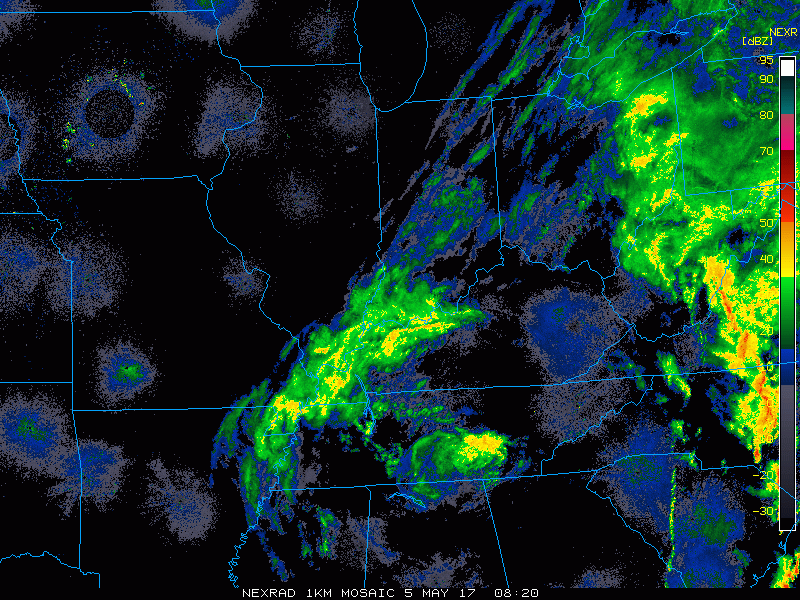
- Current radar shows rains collapsing off to our south and east.
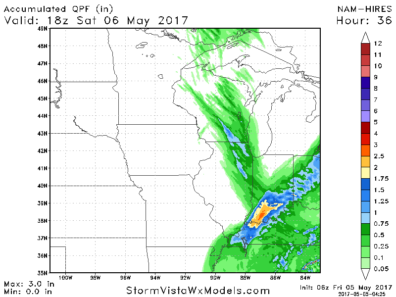
- Showers and a few rumbles of thunder make a comeback overnight tonight into early tomorrow morning.
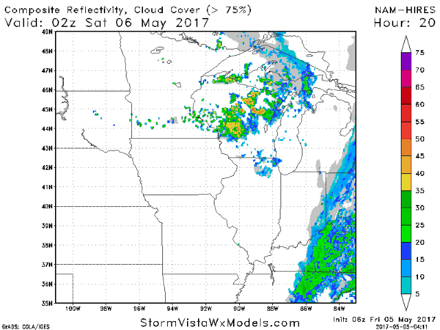
- Most see around 0.25″, but some areas may see upward of 0.75″ in the most persistent showers.
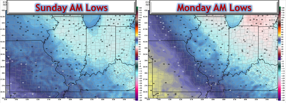
- We are still watching a frost threat Sunday and Monday morning as well with low temperatures dipping into the low to mid 30s in the north.
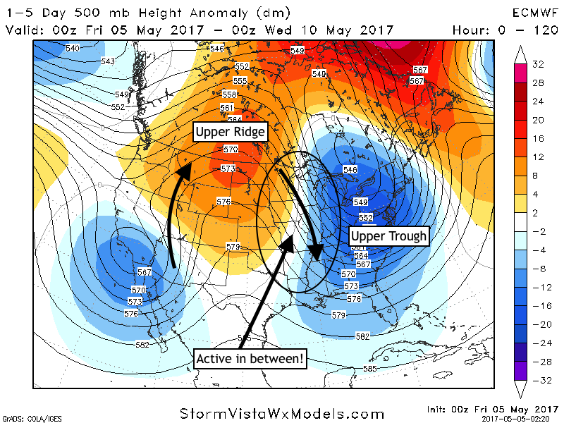
- Our upper pattern into next week will be active thanks to a ridge to our west and a trough to our east.
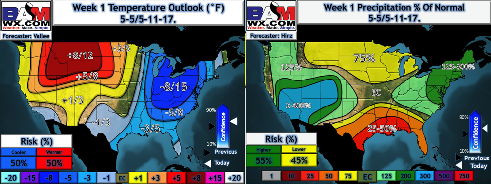
- This is shown well in our week 1 precipitation and temperature outlooks.
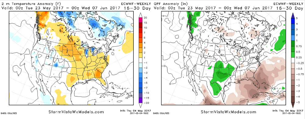
- Looking a bit further out into weeks 3 and 4, the new European weeklies came out last night. They are highlighting a warmer time to end May and open June, similar to what we discussed in our long range thoughts yesterday.
Confidence and Risks:
- Above average confidence in some additional rains tonight into very early Saturday.
- Above average confidence in some sun for the remainder of the weekend, but also a frost threat Sunday and Monday morning.
- Above average confidence in an active week next week with some shower/storm chances. Not a wash out, but not dry either.
- Average confidence in cooler than normal temperatures persisting through week 2.
- Increasing confidence in warmer times to close out May.
Today’s Video (5 minutes):