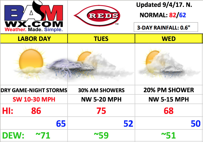
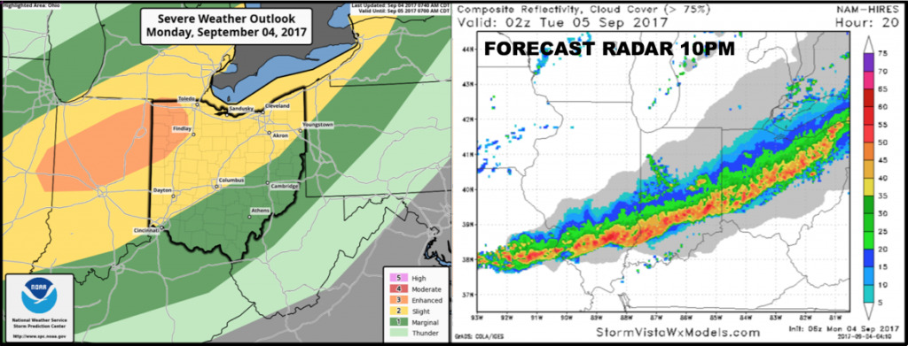
Good Monday morning, and happy Labor Day! The weather is shaping up to feel much more summer-like today, but the warmth is brief! A strong cold front will usher in a big change for mid-week as an unseasonably cool air mass for early September moves in. Along that cold front, storms will be likely tonight.
This afternoon looks dry, windy, and warm for the Reds. We should see a mix of sun and clouds with temperatures warming quickly today, into the 80s this afternoon. Southwest winds will increase throughout the day, gusting 20-30 mph at times this afternoon! Those southwest winds also bring in an increasingly “humid” feel.

Conditions will change tonight as a line of thunderstorms looks to work in beyond after 10pm with gusty winds and a brief burst of heavy rain. Cannot rule out strong to severe storms with isolated damaging wind/hail, but the greatest severe risk will stay just to the north. A model average gives the area ~0.6″ of rain.
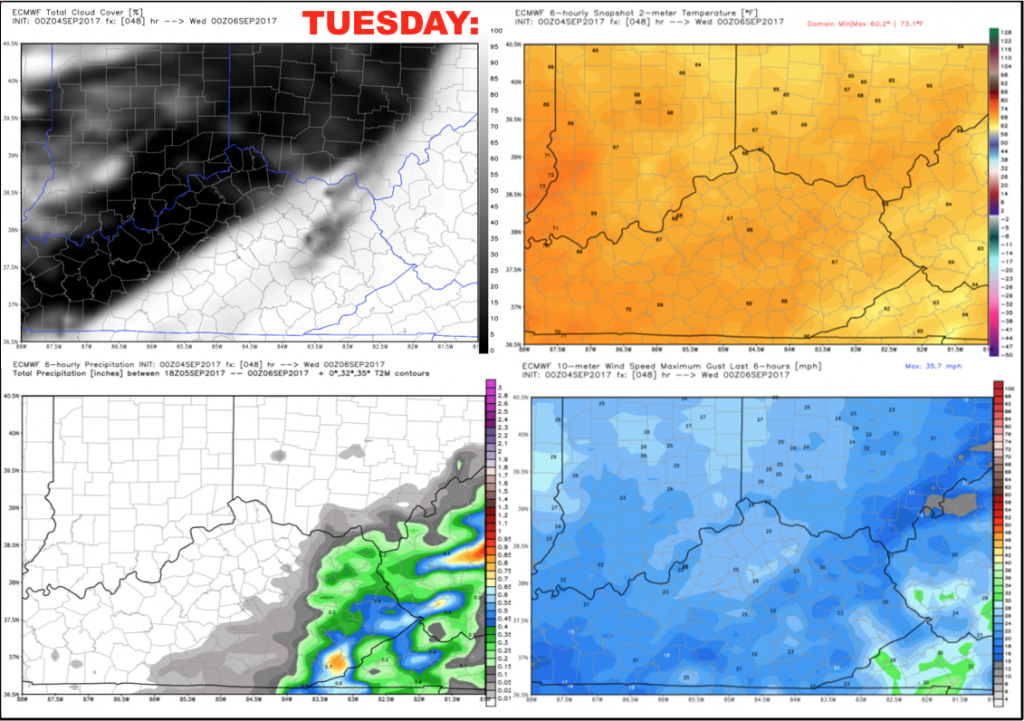
Any rain should clear out rather quickly early Tuesday, with some sunshine working in during the afternoon and evening. Overall, it’s a nice and much cooler day setting up with highs only in the middle 70s, falling to the 60s during the game. No weather issues are expected. Winds will be northwest 5-20 mph.
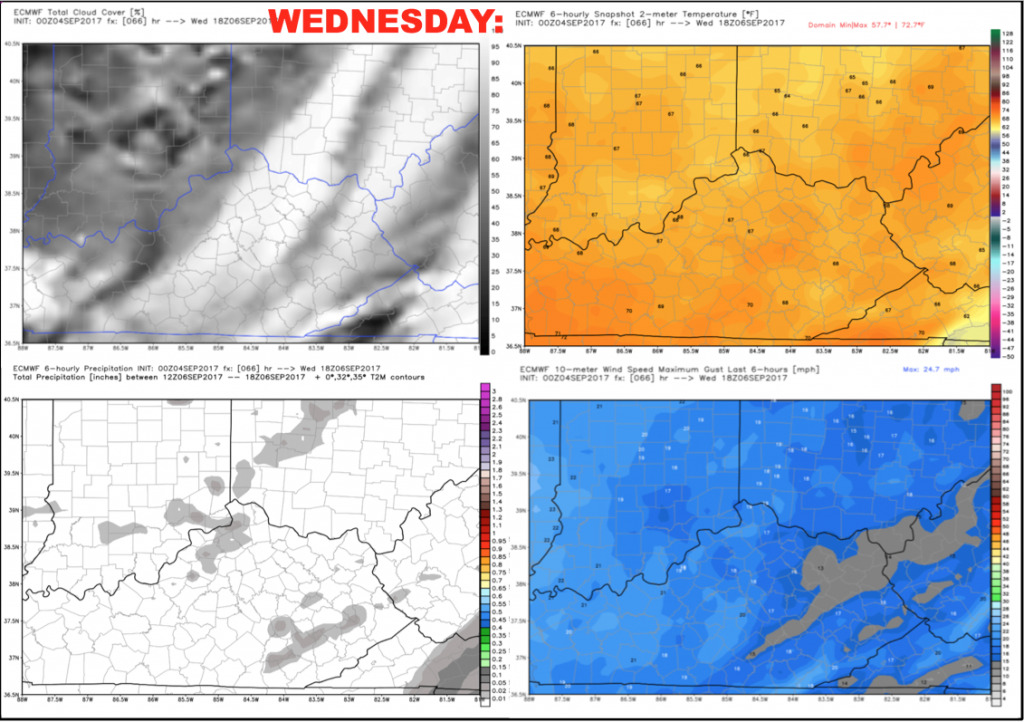
Wednesday should start out rather sunny with a decent cumulus cloud deck building during the afternoon, with an anomalous cold upper-level trough over the region. We will keep the potential for a few spotty showers to develop (especially north), but the chance of any shower impacting the game looks rather low. It will be quite the cool day for early September with highs not expected to get out of the 60s!
Have a great Labor Day, and let us know if you have any questions!