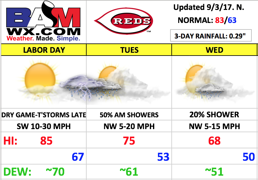
Good Sunday morning! This update will cover the forecast as we go into the 3 day home-stand. The big weather feature in this period will be a strong cold front moving through Monday night into Tuesday. We will see quite the temperature transition from a brief burst of summer warmth on Monday to an unseasonably cool, fall-like feel filtering in late Tuesday and certainly on Wednesday.
Much of Labor Day looks dry with a mix of sun and clouds. It will be quite breezy, warmer, and more humid with southwest winds of 10-30 mph during the afternoon, generally look for gusts in the 15-25 mph during the afternoon game. Temperatures will warm well into the 80s.
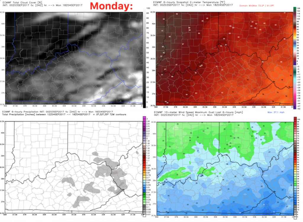
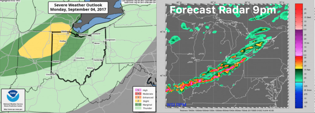
T’storms look to move in after 9pm Monday evening, with a risk for a few strong/severe storms north of Cincinnati.
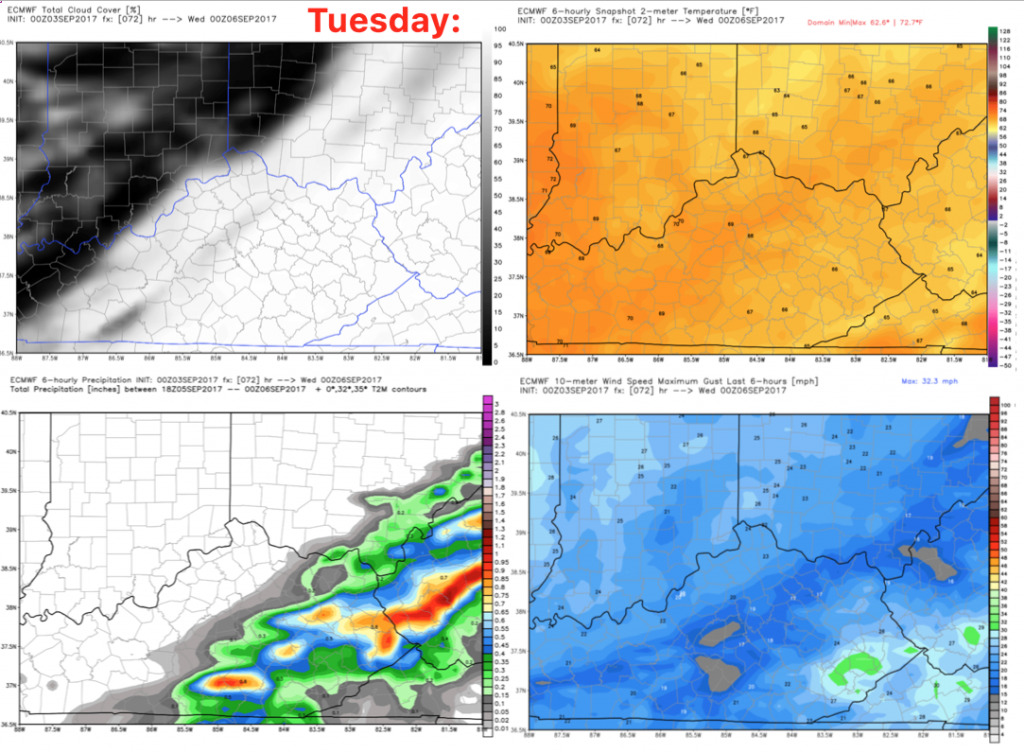
The front will continue to push through on Tuesday, with shower chances remaining during the first half of the day. Showers should clear during the afternoon with a mainly dry evening game expected, outside of a small shower chance early, especially south. Winds will be out of the northwest 5-20 mph with afternoon highs in the middle 70s. Temperatures will fall into the 60s for the game.
Wednesday will feature morning sunshine giving way to afternoon clouds with a few showers possible. Coverage should be ~20%, so expect the game to be mainly dry. It will be quite cool with afternoon highs only in the upper 60s. Winds will be northwest 5-15 mph.

Have a great day, and let us know if you have any questions!