Good Tuesday afternoon! A disturbance moving across the Ohio Valley has triggered scattered showers and storms through the day. This update will cover the very latest trends regarding storm chances this evening.
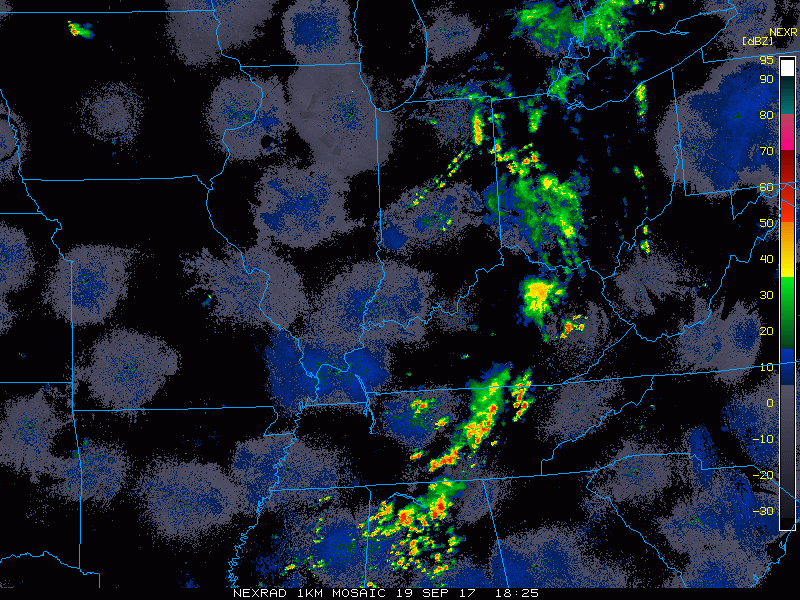
Radar loop from 2:30-3:10pm was showing rain moving away from Cincinnati, with the area catching a lull. Additional scattered storms developing in central Indiana.
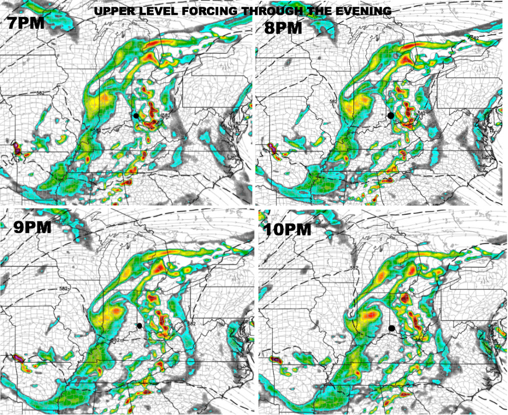
Looking at the upper-level energy forecast, we find a lull moving into the region throughout the evening hours off the latest HRRR model.
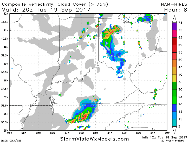
The hi-res NAM seems to have the best handle on the current set-up. The future forecast radar from 4pm-11pm is posted below. We need to keep a ~30% storm chance in the forecast through the evening, but we think much of the game will be storm-free. It will be important to watch latest radar trends over the next couple of hours, as some late day sun may trigger pop-up storms around game-time. If this occurs, it could lead to weather delays if they develop near Cincinnati. Coverage will very hit and miss, but something to monitor.
Have a great evening, and let us know if you have any questions!