Good Saturday morning! This forecast is very summer-like over the next week with highs well into the 80s, along with a good deal of humidity. A few storm chances coming in during the first half of next week, then it looks mainly dry late week as an ridge of high pressure strengthens overhead.
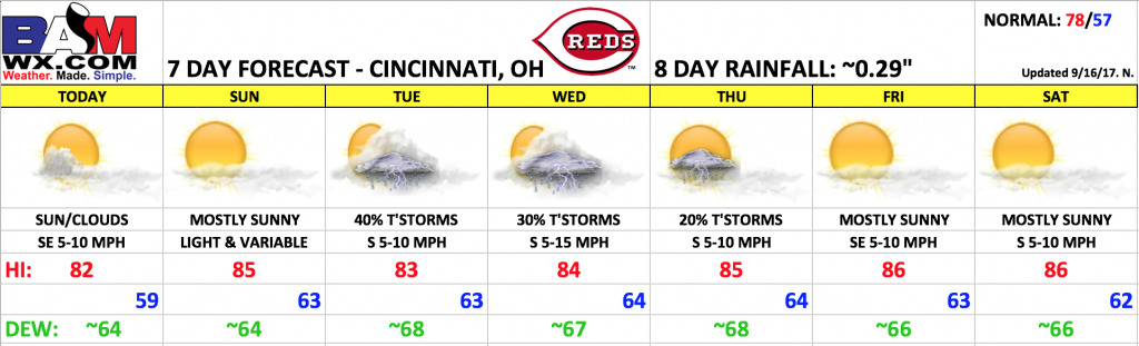
Today looks very similar to yesterday, likely a degree or two warmer. Once the patchy fog dissipates, expect a mix of sun and clouds throughout the day with temperatures warming into the lower half of the 80s this afternoon, falling into the middle 70s by the end of the game. Winds will be light out of the southeast, generally 5 mph or less. Some data tries to hint at a stray shower chance, but think it will stay dry.
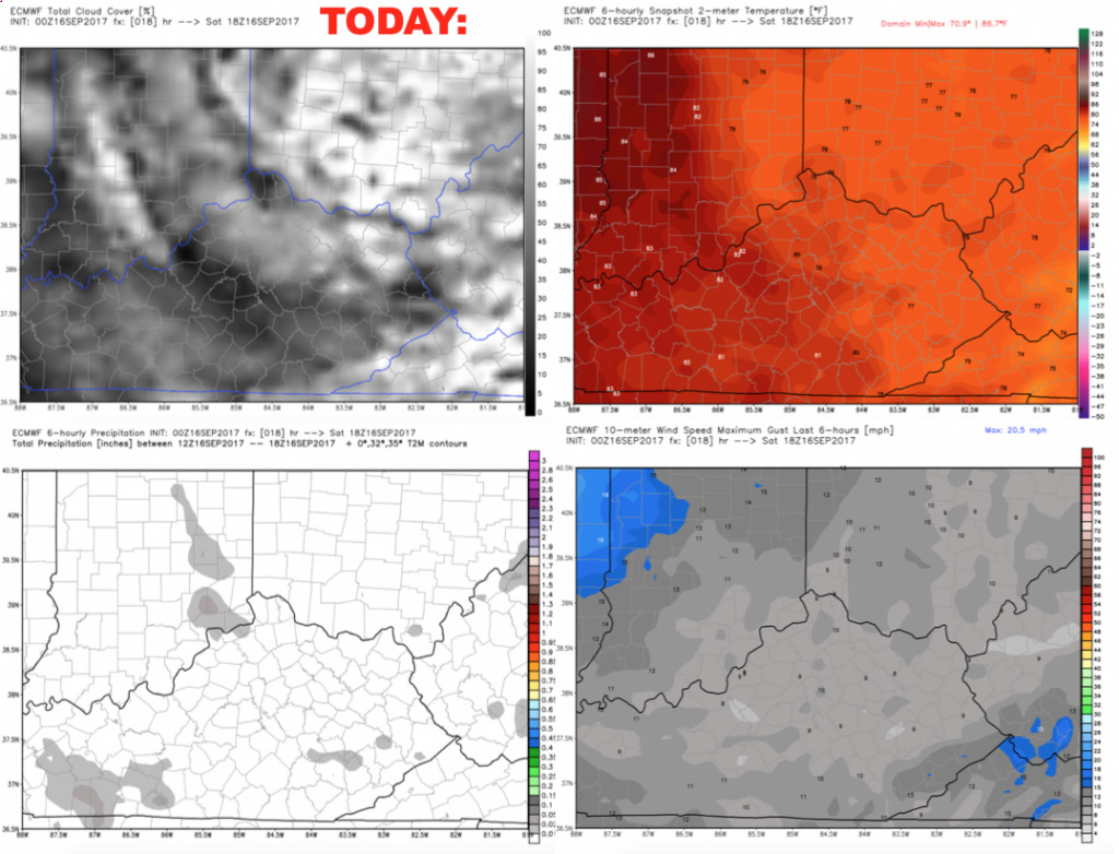
Expecting a mostly sunny and warm day on Sunday, with temperatures warming into the middle 80s during the afternoon. Winds look nearly calm through the day.
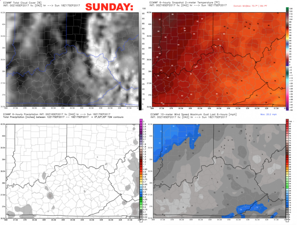
Tuesday will feature ~40% threat for scattered storms mainly during the afternoon into early evening. Can’t rule out a weather delay (especially early on). Coverage of storms will be better pinned down as we get closer. Winds will out of the south 5-10 mph.
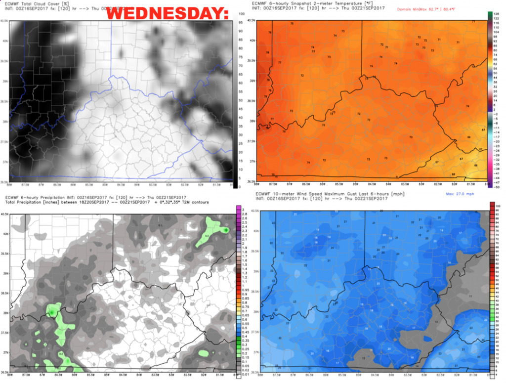
Wednesday we will keep a ~30% storm chance in the forecast as a weak front overhead continues will spark a few additional storms. Thinking coverage will diminish during game-time. Winds will be out of the south 5-15 mph.
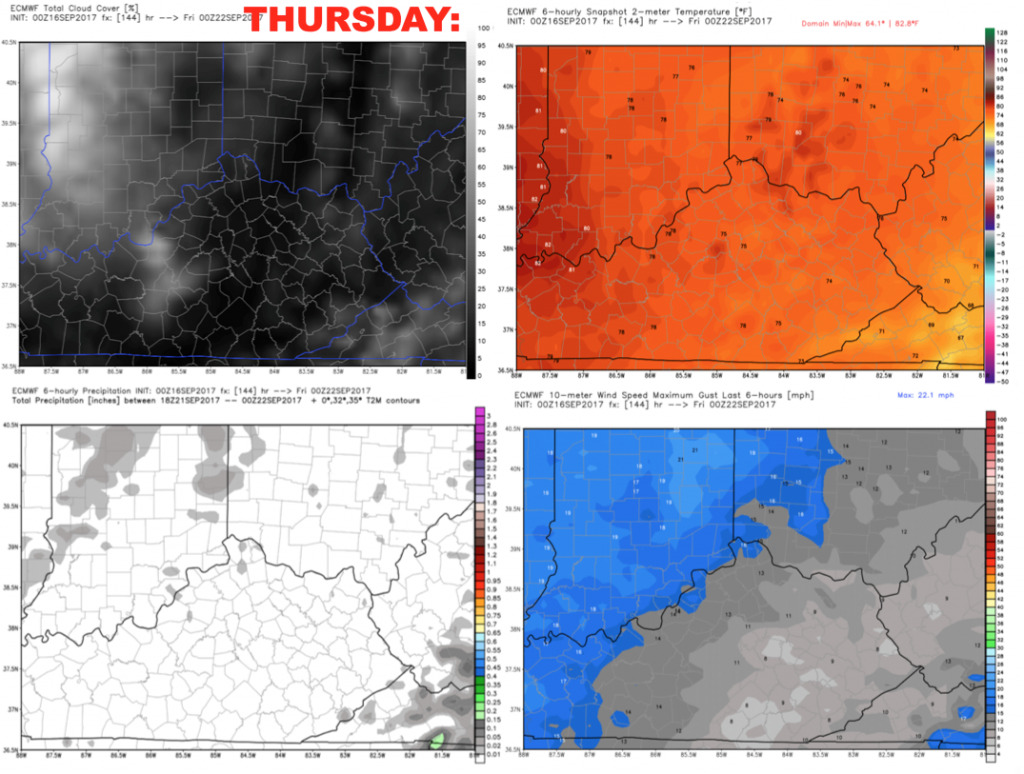
I kept a ~20% spotty storm chance in the forecast for Thursday, but the game should be dry. Winds will be out of the south 5-10 mph.
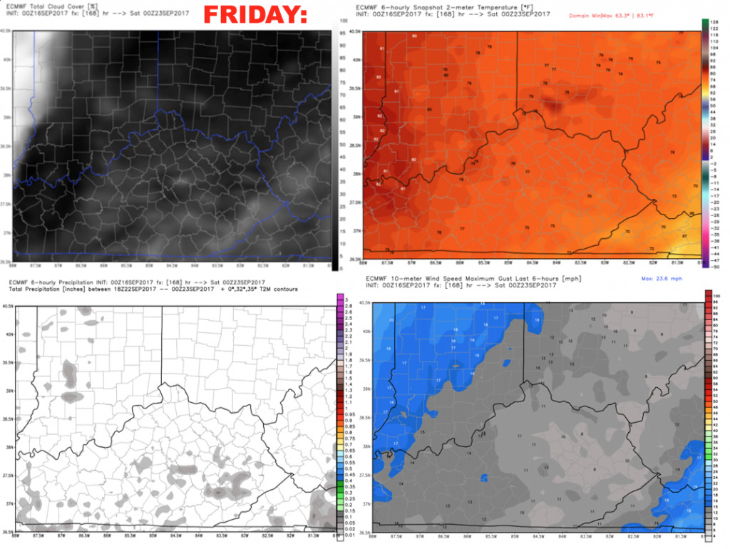
Friday looks mostly sunny and dry. Highs will be well into the 80s, and will only slowly fall during the evening into the 70s. Winds will be southeast 5-10 mph.
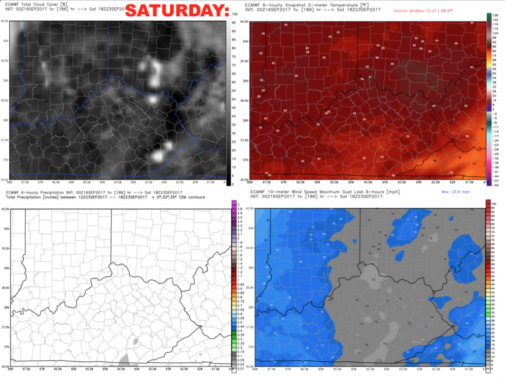
We will keep a dry forecast for next Saturday, and continued very warm with highs in the middle to upper 80s.
We will fine-tune this forecast over the coming days, overall it’s not a bad forecast. Have a great day, and let us know if you have any questions!