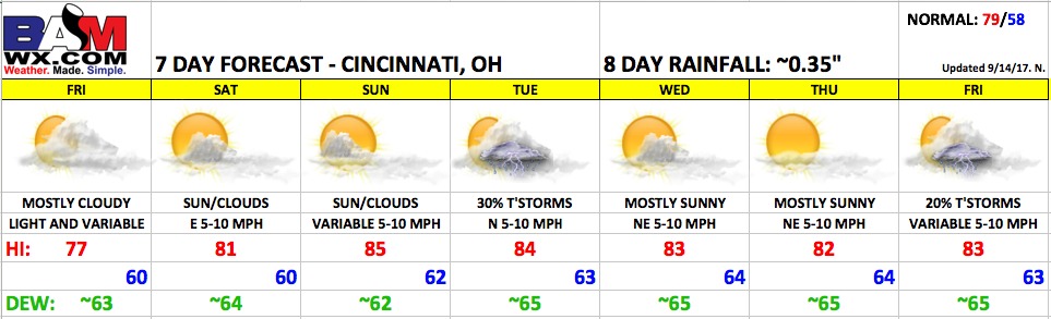
Good Thursday morning! As we reach the final home-stand of the season, temperatures will start to heat up this weekend with a summer-like feel coming throughout next week. After the showery conditions of the past few days, conditions will improve just in time for the weekend!
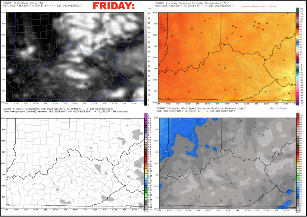
Friday’s game should be in good shape. Expect a decent amount of clouds to linger, but it should be dry. Winds will be nearly calm. Temperatures will fall from the lower 70s to the upper 60s through the game.
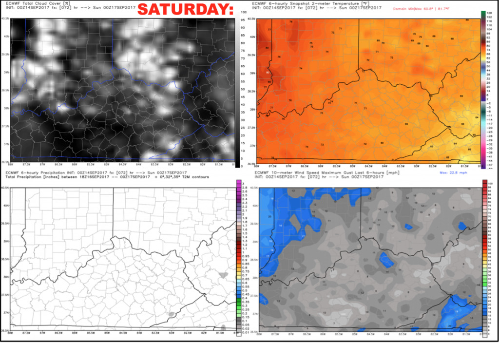
Saturday looks dry with a mix of sun and clouds. Highs will reach into the lower 80s with light east winds 5-10 mph.
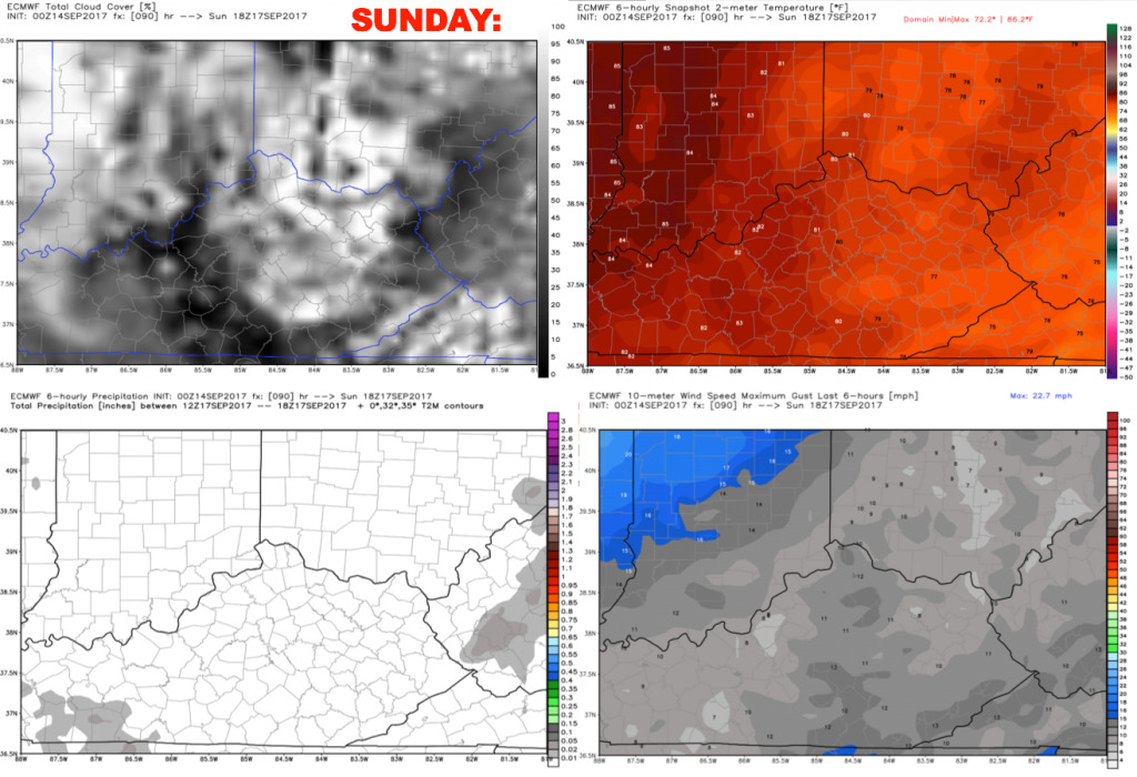
Sunday looks dry as well with a mix of sun and clouds with high temperatures warming into the middle 80s during the afternoon. Plan on a warm afternoon.
Heading into next week, temperatures will be above average with highs consistently in the 80s and lows in the 60s. Confidence is lower heading into Wednesday and beyond on rainfall chances as the models diverge on solutions. We sided towards the more consistent European model heading into late next week, which is also drier than other data.
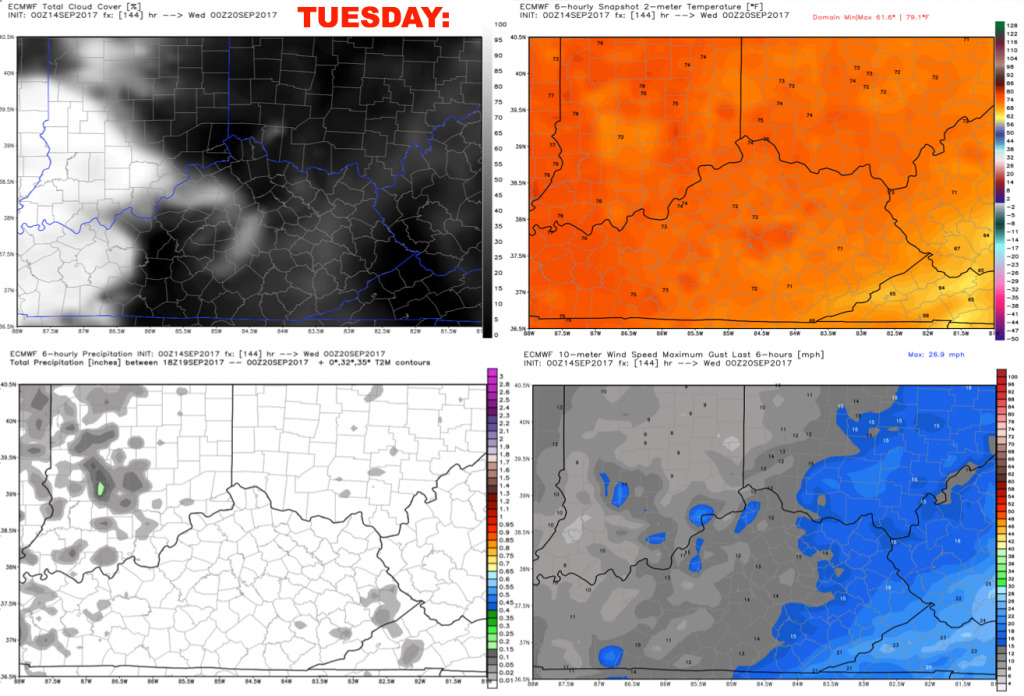
Tuesday will feature the chance for a few widely scattered storms. At this point, coverage does not look overly impressive with a forecast of ~30%. Winds will be out of the north 5-10 mph.
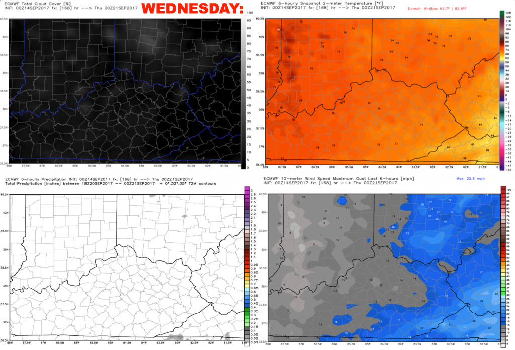
Right now we will keep Wednesday dry as high pressure builds in from the Great Lakes. Winds look light out of the northeast 5-10 mph.
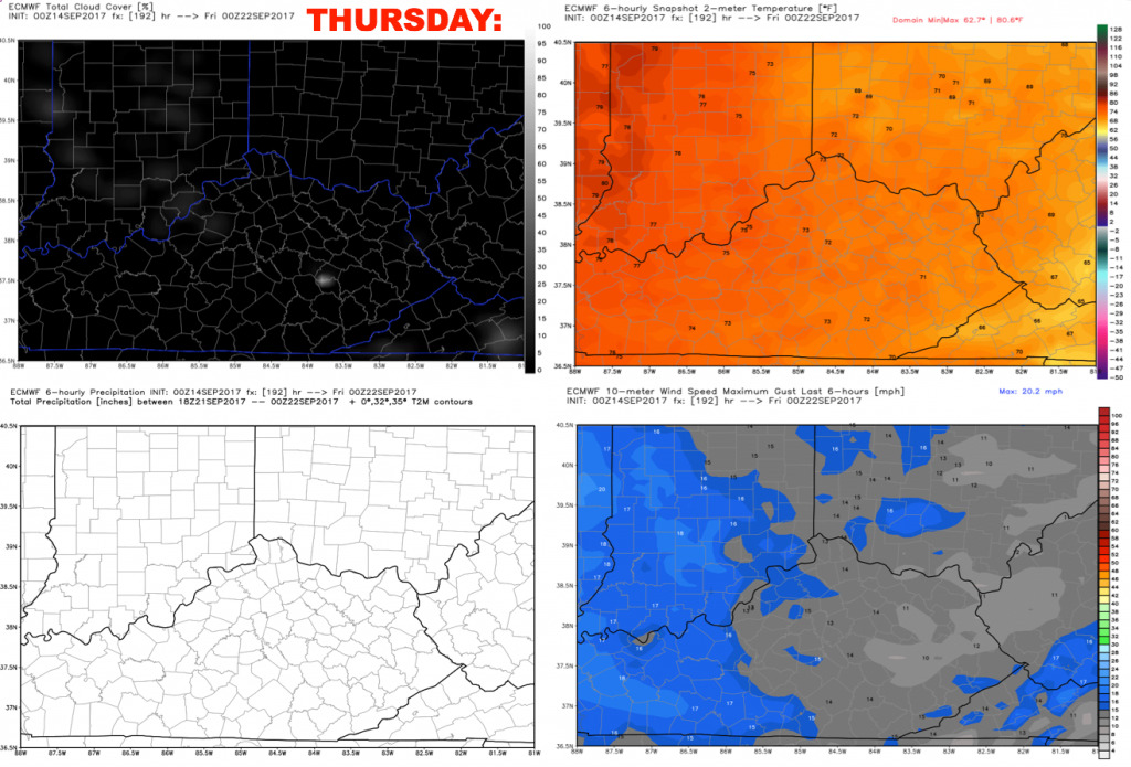
We are forecasting dry conditions for Thursday as well with warm temperatures and moderate levels of humidity. Winds are forecast to be light out of the northeast 5-10 mph.
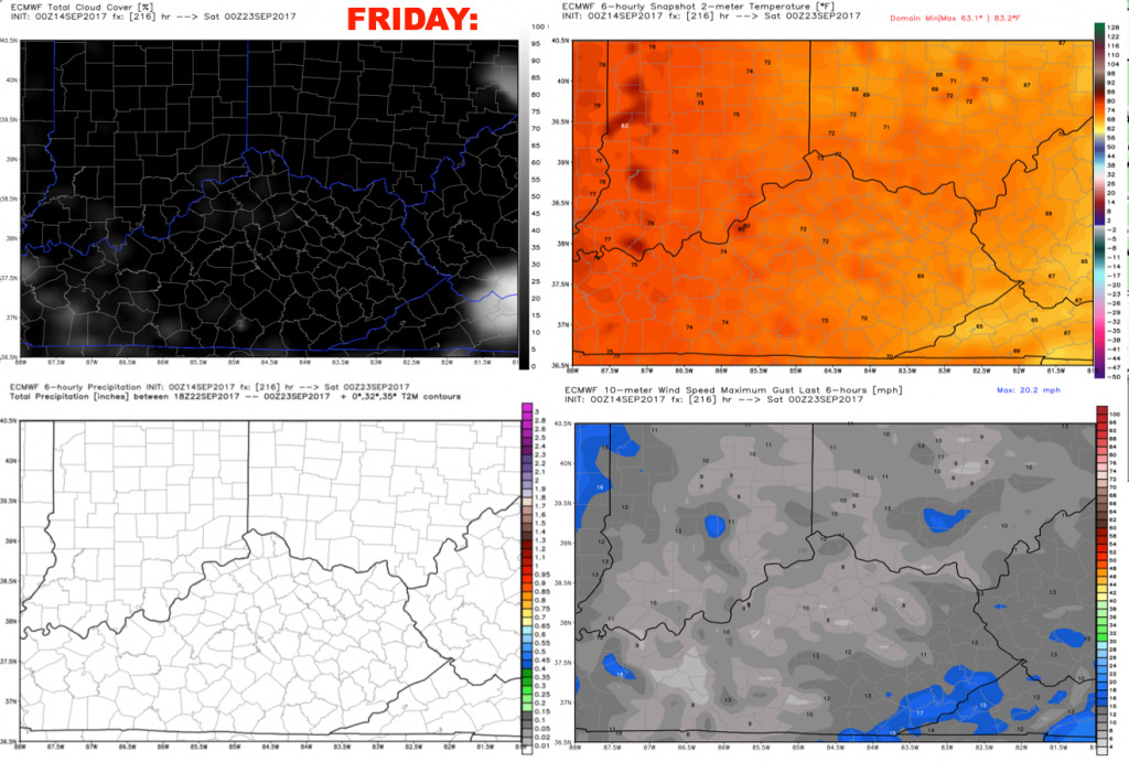
We will add a ~20% storm chance next Friday as more moisture builds in from the west. Winds are forecast to be variable 5-10 mph.
We will continue to fine-tune this forecast over the coming days. Have a great Thursday, and let us know if you have any questions!