Good evening everyone, below is your latest Week Ahead Outlook:
Week 1:
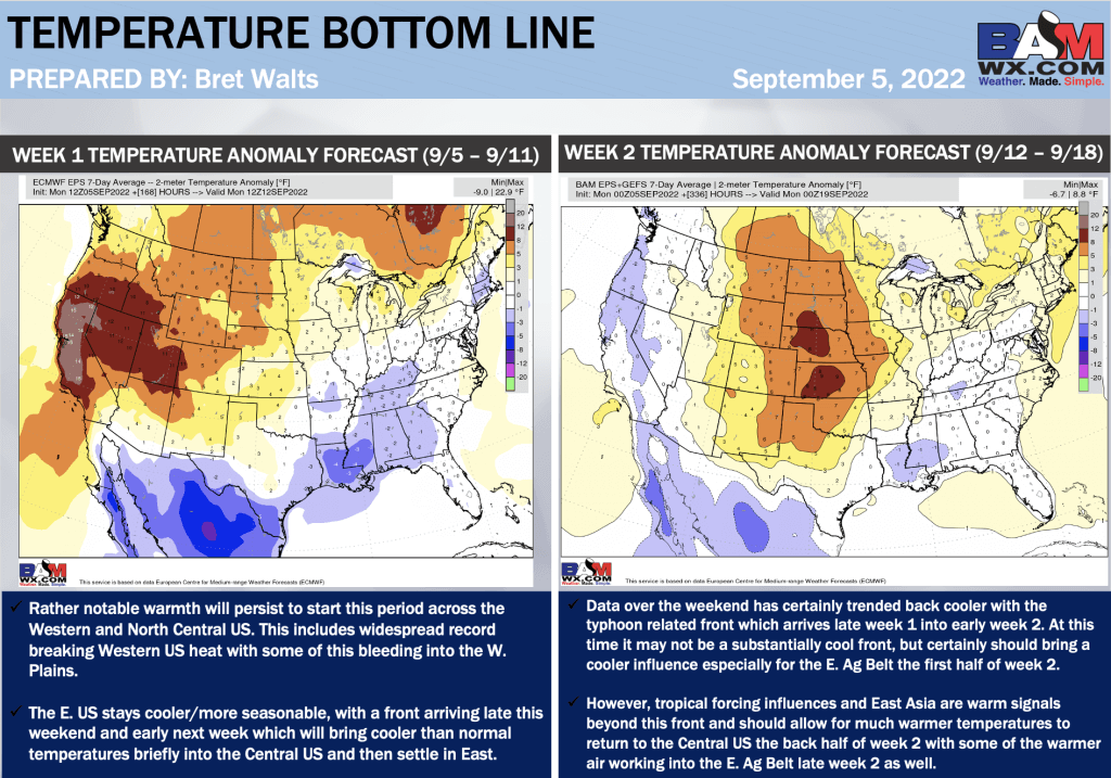
From the Ohio Valley into the Mid-Atlantic / Southeast, cooler more seasonable temperatures are expected to start the week due to the passage of the cold front. Toward the end of week 1, temperatures will gradually warm as the upper-level ridge extends further eastward.
Week 2:
Data over the weekend has trended to a more widespread, warmer solution across the Central Plains in the Midwest to begin the Week 2 Period. Some uncertainty still exists with tropical forcing in the western Pacific, which could influence the exact extent and timing of this above average pattern.
A Cold front is anticipated to sweep across the Ag Belt towards the end of the week 2 period. While magnitude of event will depend on East Asia/Tropical forcing influences, a cooler risk will gradually work its way across the Rocky Mountains into the far W Plains.
Week 1:
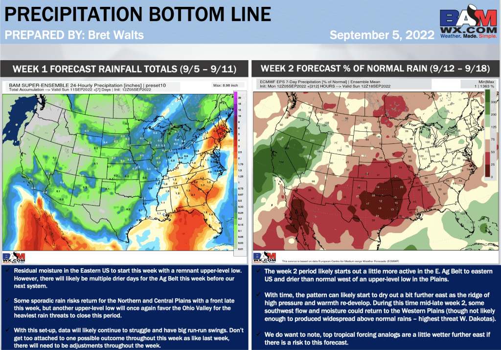
Excessive Moisture associated with an upper-level low will continue to increase rain chances to start the week for the Great Lakes region. As system pushes eastward and exits the northeast by mid week, drier conditions overall are favored across much of the Ag Belt into the Deep south and Eastern US.
üTowards the end of week 1, a weaker frontal system will bring some limited, scattered rain chances to the N Plains, Upper Red River Valley.
Week 2:
As tropical forcing over the Pacific begins to influence the jet stream, increasing widespread rain chances will be possible towards the beginning of week 2 across the C Plains into the lower Great Lakes region. Tropical analogs are suggestive this pattern may become more progressive and shorten the dry risk into Week 2.
While lower confidence in exact placement and magnitude of these chances, will continue to favor below normal precipitation for the Southeastern US due to eastern ridging progressing eastward.