
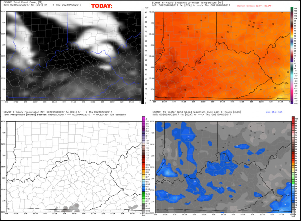
Good Wednesday morning! After a spectacular weather day on Tuesday, today is basically a carbon copy as high pressure remains in control of the weather. Some changes arrive by Thursday with increasing humidity which will lead to a small storm chance.
Expect mostly sunny skies today with highs warming into the lower half of the 80s this afternoon. Humidity remains very low for this time of year, so it will feel very nice. Temperatures will cool back into the 70s by first pitch this evening, as dry air cools readily once the sun goes down. Winds will be out of the east 5-10 mph.
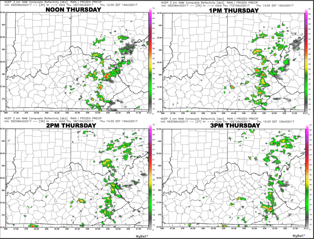
We continue to keep small storm chances (~20-30%) in the forecast on Thursday, but as mentioned yesterday, the best chances continue to set-up southeast of Cincinnati. Here is a snapshot of the hi-res NAM future radar from noon-3pm Thursday. Notice it keeps the scattered rain/storms just east, keeping the game dry.
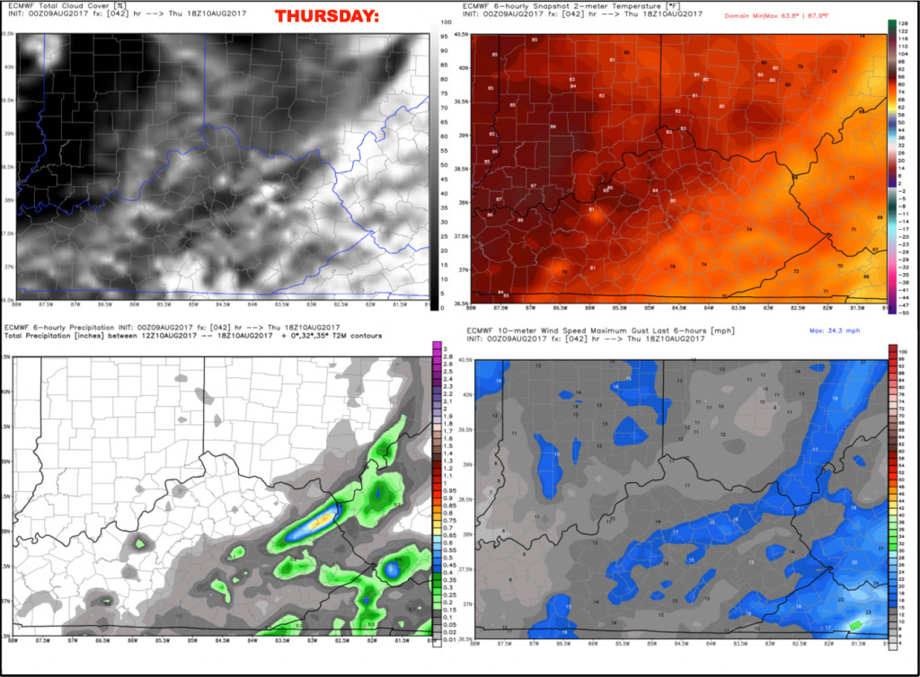
Temperatures will quickly warm into the lower 80s during the early afternoon, with more of a “muggy” feel to the air as dew points climb into the middle 60s. Winds will be light out of the south 5-10 mph.
Have a great day, and let us know if you have any questions.