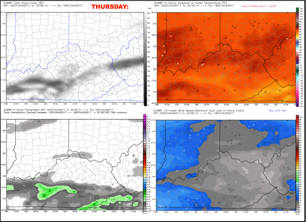
Good Thursday morning! High and mid-level clouds are streaming into the region associated with tropical depression Harvey currently situated in the lower Mississippi Valley. This will have a much bigger impact on our forecast heading into tomorrow.
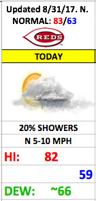
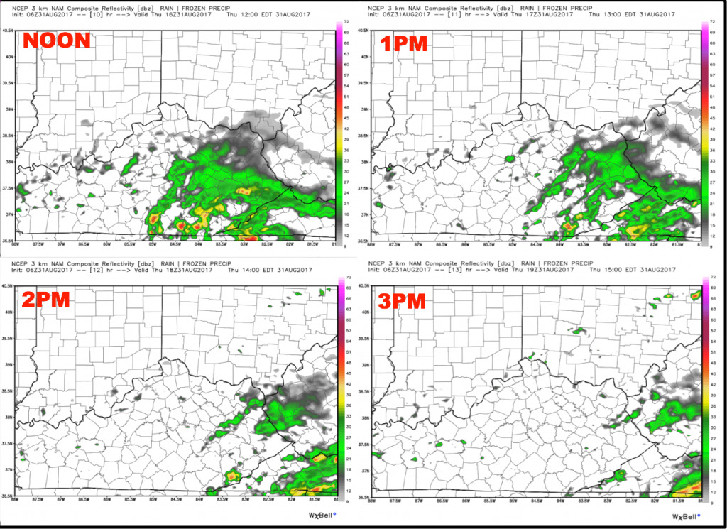
Expect more clouds than sunshine today with a weak front bringing a small shower threat this afternoon. The main chance for any brief shower looks to be after 2pm, and coverage will be isolated to widely scattered. Thinking is the game should get in dry. Here is a panel showing the latest hi-res future radar off the NAM model from noon to 3pm today:
Temperatures should warm from the upper 70s to the lower 80s during the game with light north winds of 5-10 mph.
Have a great Thursday, and let us know if you have any questions!