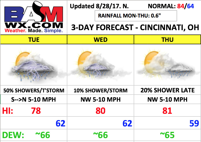
Good Monday morning! After all the nice weather for the weekend, some changes work in this week. An upper level disturbance will move through the region today through Tuesday night. This will spark scattered showers and storms today and Tuesday, then a mainly dry forecast is anticipated for Wednesday and Thursday.
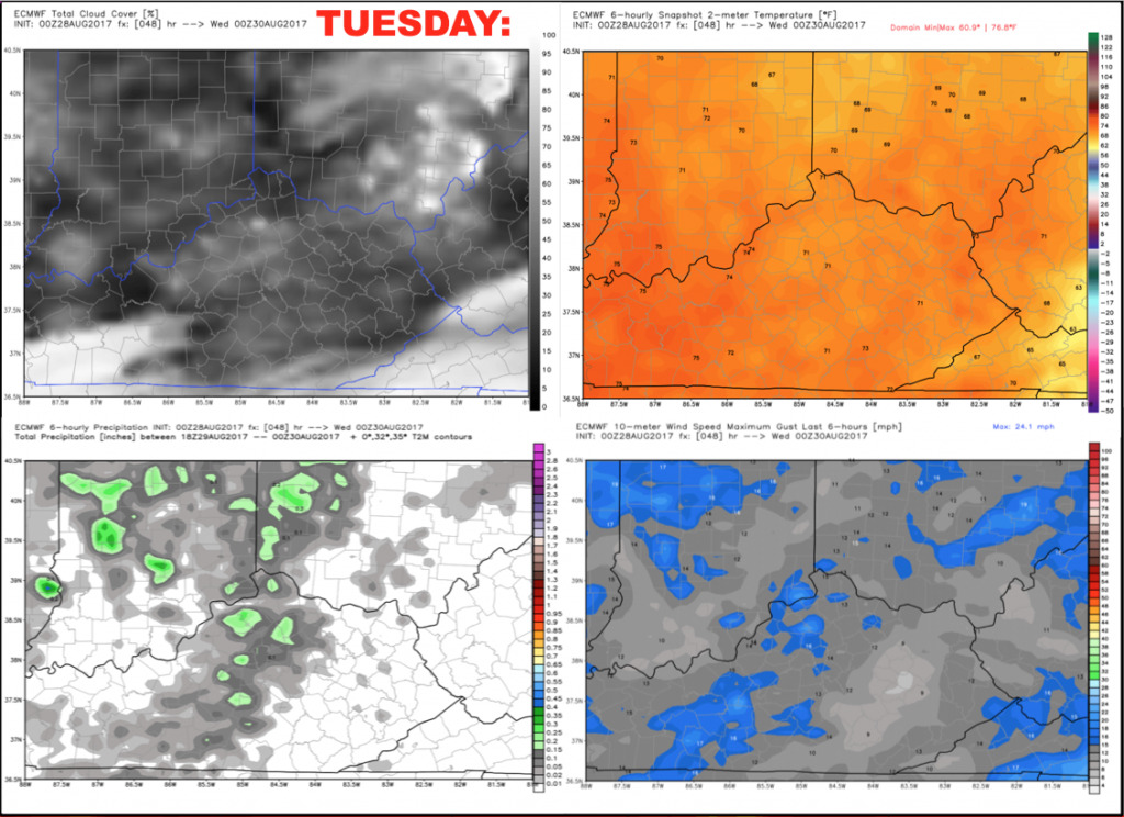
We expect a scattering of showers and storms on Tuesday, becoming most numerous during the afternoon. Coverage will be ~50% with hit and miss nature. Coverage should gradually decrease through the evening, but there is the threat for a few downpours to impact the game, especially early on. Here is a panel of the NAM hi-res model from 7-10pm, showing a few scattered showers around.

Here is a look at temperatures/clouds/wind.
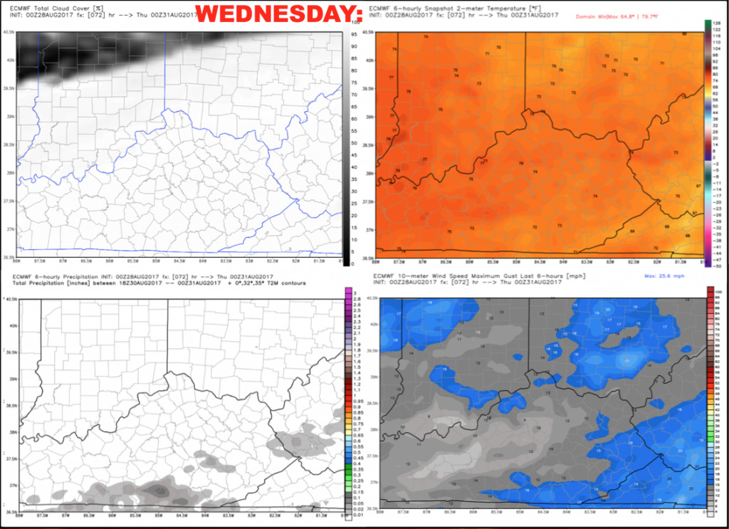
Wednesday should trend mainly dry with partly to mostly cloudy skies. Highs are forecast to reach near 80 with light northwest winds 5-10 mph. We cannot rule out a spotty shower or storm, but the evening game should be dry.
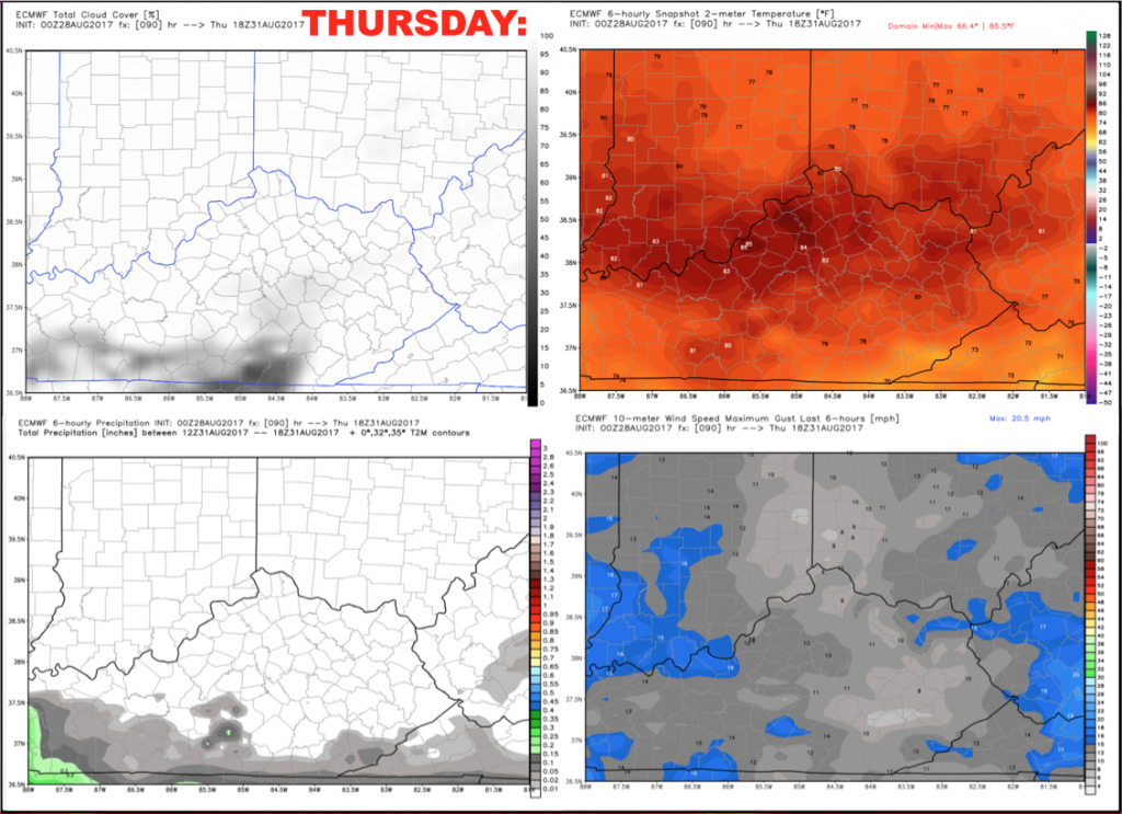
Thursday afternoon’s game looks to stay dry as well. A front will approach from the north by evening, along with the remnants of Harvey lurking to the south. Cincinnati looks to stay squeezed in between these features during the day. Temperatures during the game will warm from the middle 70s to lower 80s with moderate humidity. Northwest winds 5-10 mph.
Have a great day, and let us know if you have any questions!