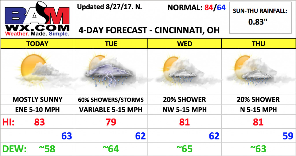
Good Sunday morning! Another very nice forecast for today, as we round out what has been a very nice stretch of weather. Changes work in for the first part of the upcoming week with the return of rainfall chances, possibly having some impacts for Tuesday evening. Drier weather should build in by mid-week, although we can’t completely rule out spotty showers.
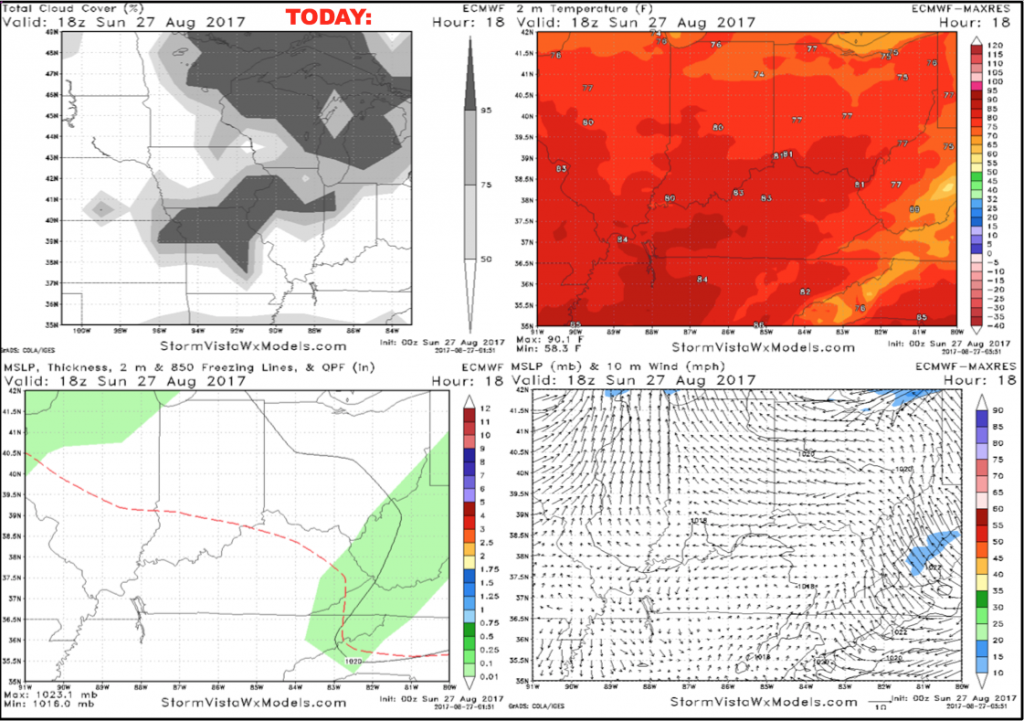
Today will be a mostly sunny day with a few additional clouds working in this afternoon. Temperatures will run a few degrees warmer than Saturday, with upper 70s by first pitch and lower 80s by the seventh inning stretch. Winds will be light out of the east-northeast 5-10 mph.
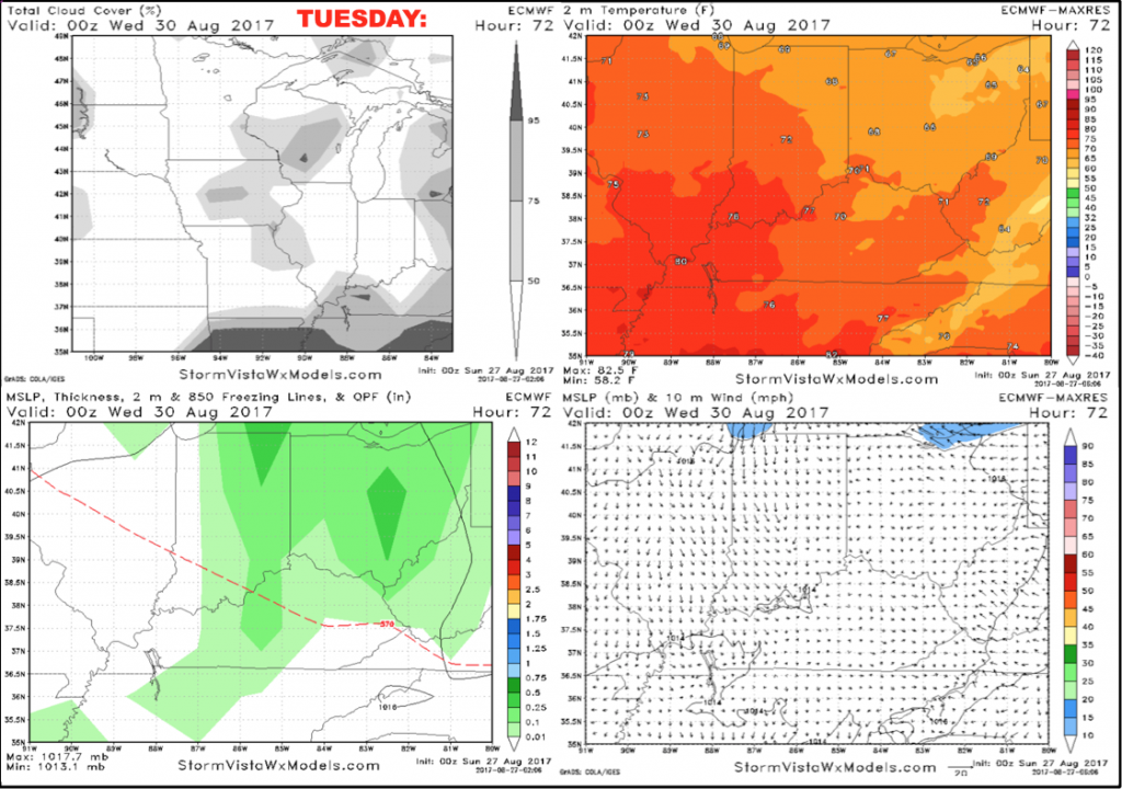
A slow-moving upper-level disturbance will bring scattered showers and some storms to the region tomorrow through Tuesday. For Tuesday, we are forecasting ~60% coverage of showers and some storms throughout the day. The good news is that coverage should decrease during the evening hours, although plan on some scattered rain sticking around. Severe weather is not expected, and any lightning activity should be little to none. Winds will be variable through the day and evening 5-15 mph. An average of multiple computer models put down ~0.83″ of rain in Cincinnati from Monday-Tuesday night.
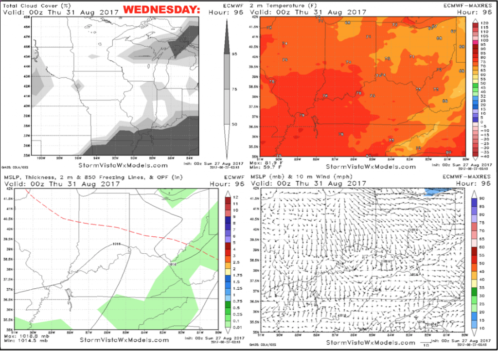
We should trend mostly dry on Wednesday. We will continue to include a ~20% shower chance during the afternoon and early evening with a few day-time driven pop-up showers. Most areas should remain dry. Winds will be out of the northwest 5-15 mph.
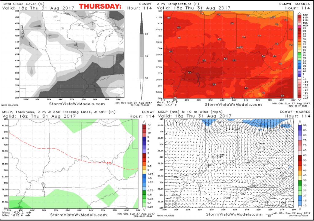
A backdoor cold front will approach the region Thursday afternoon, with a few spotty showers possible. Once again, not expecting a lot of coverage here with a mainly dry forecast. Temperatures will from the upper 70s to the lower 80s during the afternoon with northerly winds 5-15 mph.
Have a great Sunday, and let us know if you have any questions!