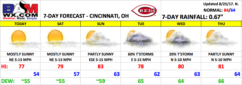
Good Friday morning! Fantastic weather continues through the upcoming weekend with comfortable temperatures and humidity levels. Changes work in early next week with decent rain chances on the table for next Tuesday, with drier conditions by mid/late week.
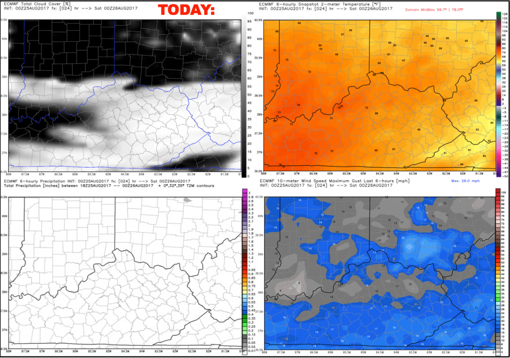
Today is going to be another very nice day with mostly sunny skies and highs in the upper 70s. Winds will be out of the northeast at 5-15 mph. Temperatures falling from the lower 70s at first pitch down into the 60s by the seventh inning stretch.
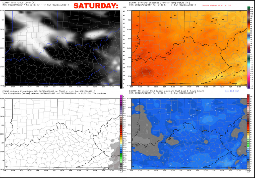
Saturday should be a mostly sunny day, with a few high clouds working in during the evening. High temperatures will warm to just shy of 80º, falling rather quickly once again beyond sunset.
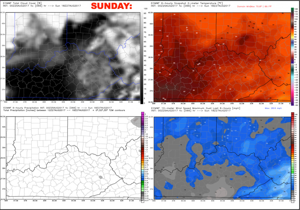
Sunday will feature a bit more cloud coverage, along with slightly warmer temperatures. Temperatures during the afternoon should warm into the 80-85º range but with low humidity. It will stay dry with no weather issues expected. Winds will be east-southeast 5-15 mph.
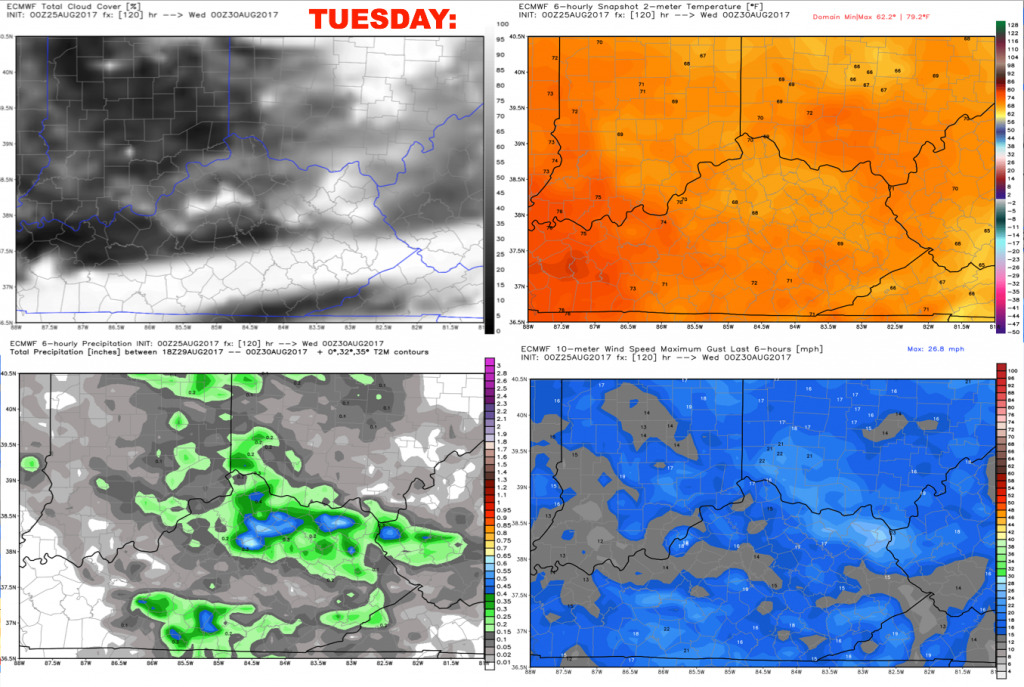
Tuesday is looking a bit unsettled with scattered rain showers and storms around. This will be a slow moving disturbance that meanders in the region early in the week. Not thinking it will be a washout type of deal, but expecting ~60% rain/storm coverage. Timing the highest rain chance remains a bit tricky, but current data is honing in on a decent coverage of rain Tuesday afternoon lasting through the evening.
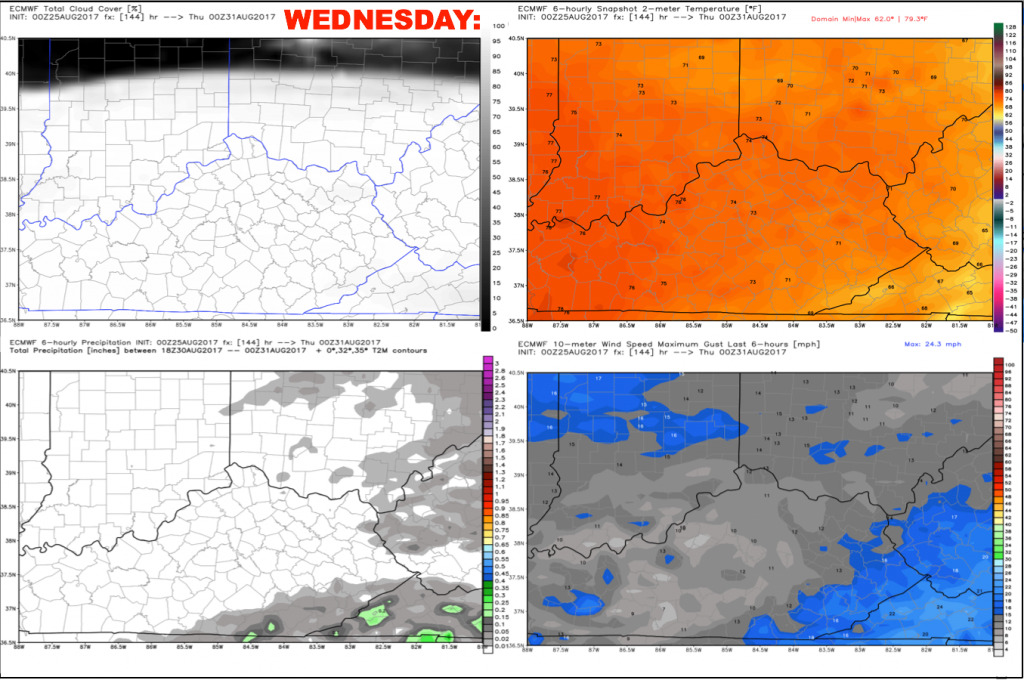
We should see a drying trend Wednesday into Thursday. Keeping a ~20% spotty storm chance on Wednesday, with highs near 80. Winds will be north 5-10 mph.
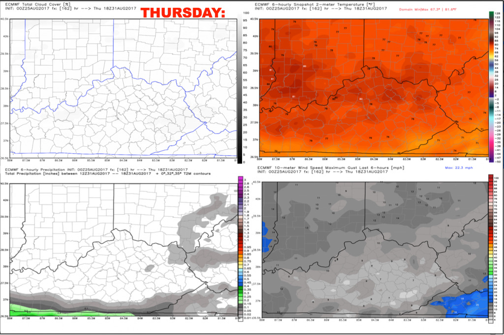
For now we have taken the rain chances out of Thursday’s forecast. We may eventually see the remnants of Hurricane Harvey work its way into the region by Friday/next weekend, but data continues to delay the arrival of this system. Forecasting partly sunny skies Thursday afternoon with highs in the lower 80s.
Have a great day, and let us know if you have any questions!