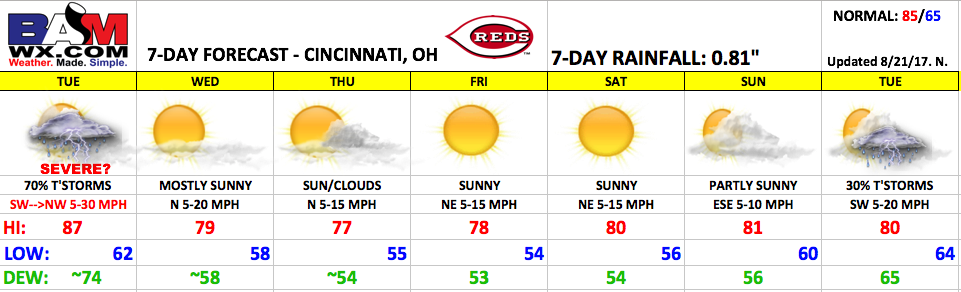
Good Monday morning! Unsettled forecast on the way for the first day of the upcoming homestretch on Tuesday, then great weather settles in for the rest of the week as high pressure brings unseasonably cool temperatures and low humidity.
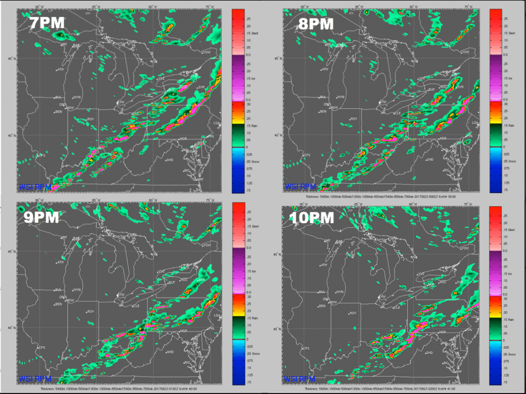
Tuesday will feature scattered storms with ~70% coverage, most likely during the afternoon into early evening. There is a slight risk for severe thunderstorms with isolated damaging wind gusts and hail the biggest threat. Outside of storms, it will be quite breezy with west winds 10-30 mph. Below is a 4-panel of the forecast future radar off the RPM model showing the progression of storms through the game. Storms will be most likely during the first hour of the game, pushing southeast of the area by mid/late evening. Plan on possible weather delays.
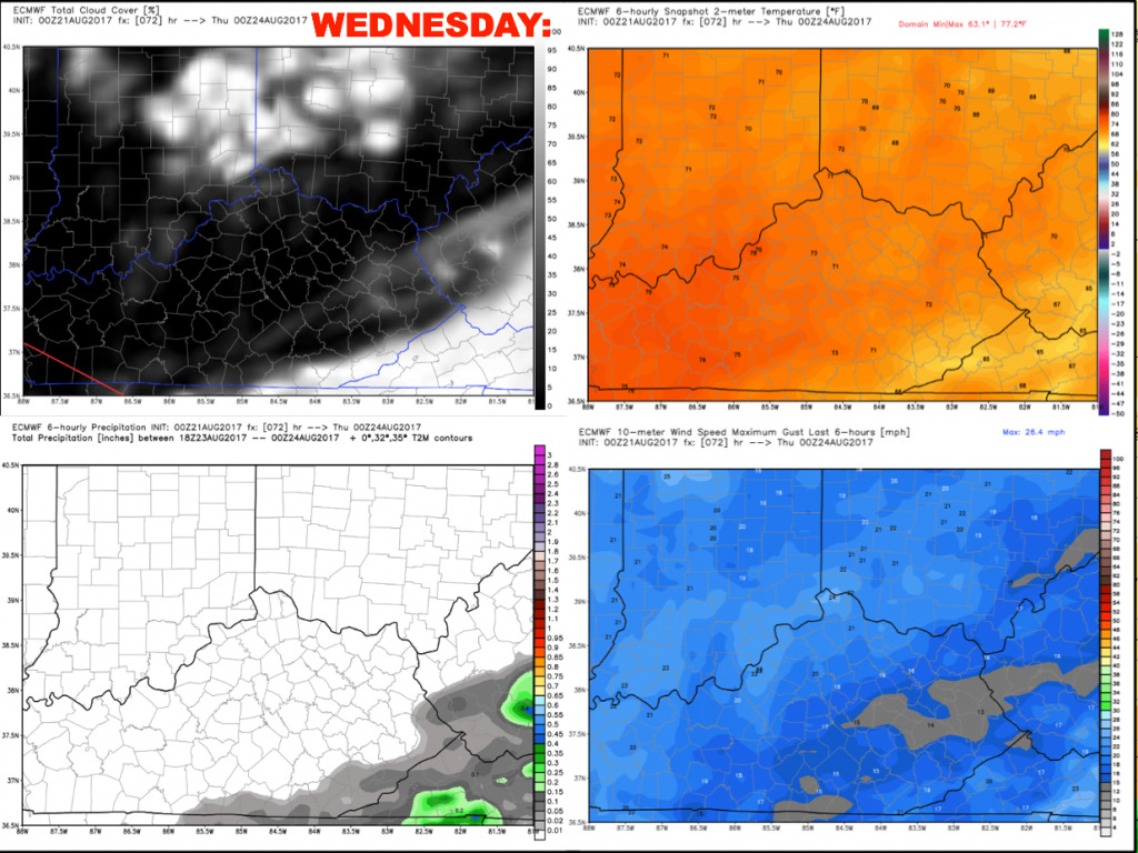
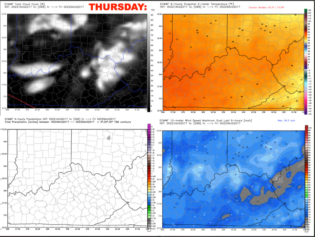
Here is a more detailed look at the wind gusts/temperatures/sky cover during the evening.

Wednesday will feature mostly sunny skies behind the cold front, with humidity levels falling through the day. Winds will be out of the north 5-20 mph.
Another great day on Thursday with mostly sunny skies, low humidity, and north winds of 5-15 mph.
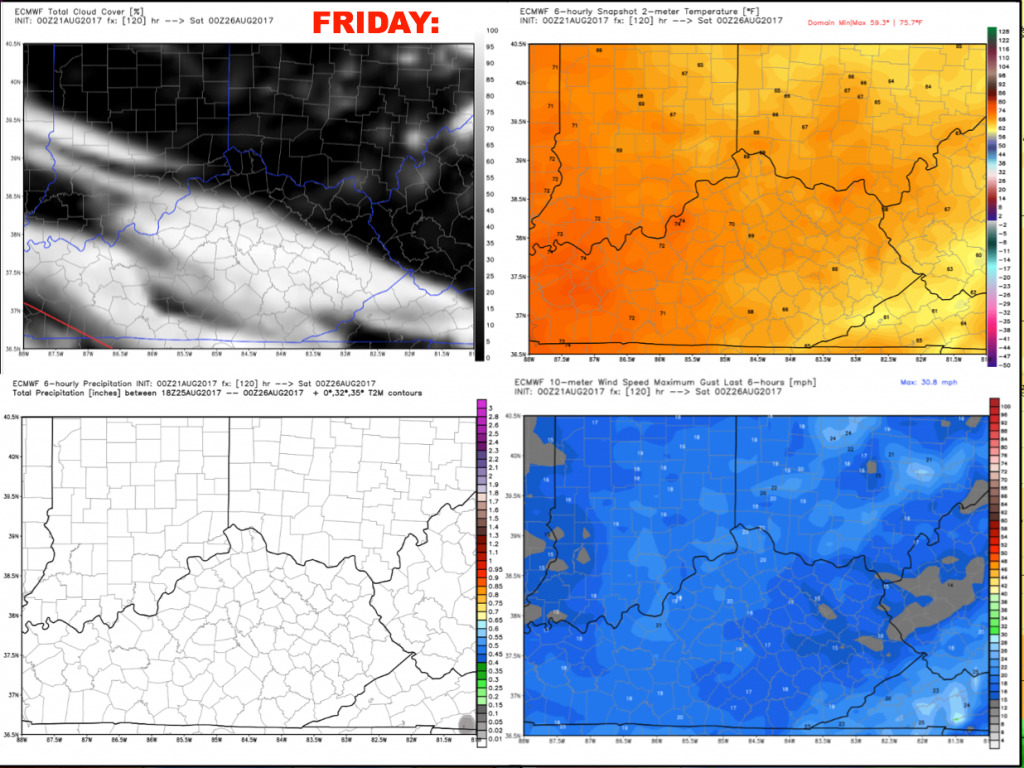
Friday will feature more of the same with mostly sunny conditions, low humidity, and comfortable temperatures.
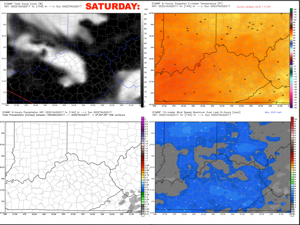
Saturday looks to feature another repeat of Friday with lots of sunshine and pleasant temperatures. Light northeast winds 5-15 mph.
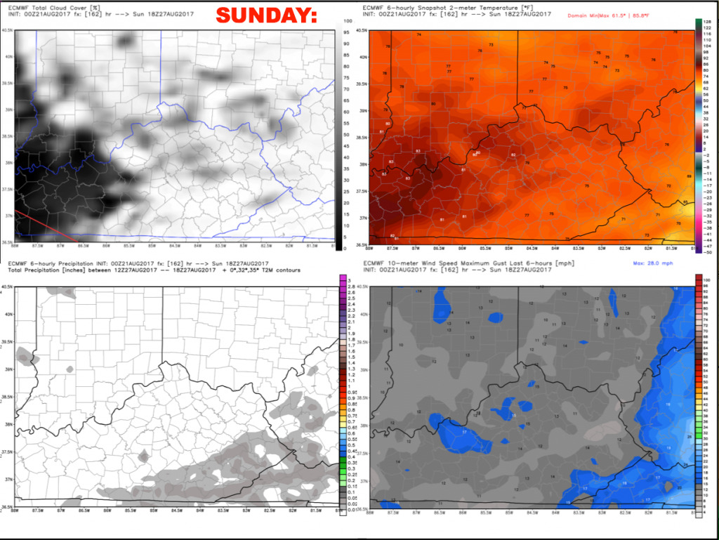
Sunday will feature more clouds, but for now we will continue to keep the forecast dry. Temperatures warm to near 80 during the afternoon with comfortable humidity levels. Winds look light out of the east-southeast 5-10 mph.
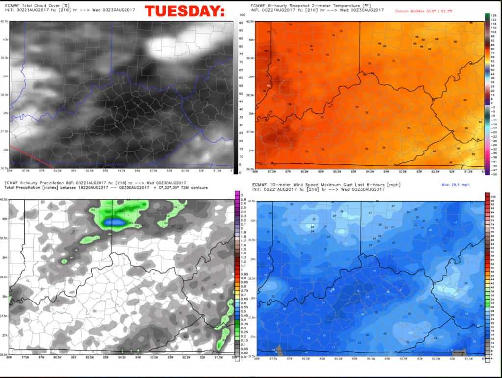
Heading into next Tuesday, we will mention a ~30% storm threat for now with a disturbance moving through early in the week. Moisture levels spike up a bit, but still remaining overall pleasant for late August.
We will continue to monitor tomorrow’s storm threat. Have a great day, and let us know if you have any questions!