7:30 PM
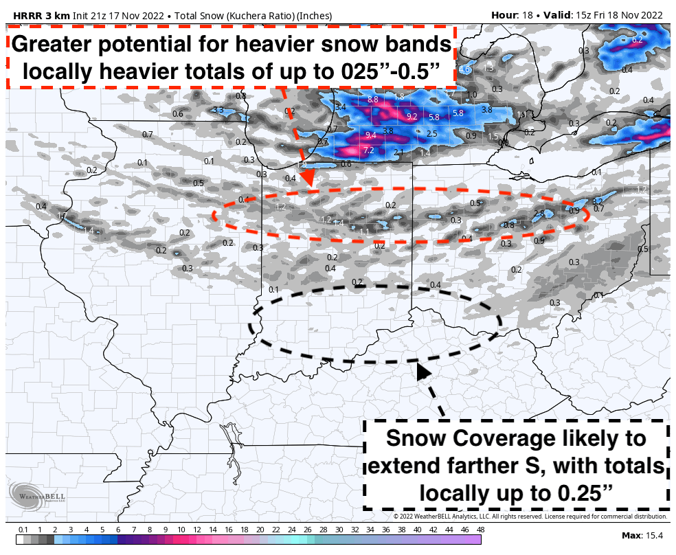
Good Evening, scattered snow showers will once again be possible this evening, with heavier snowfall rates at times allowing for a quick coating of up to 0.25″ for all surfaces. A narrow corridor of locally heavier totals of up to 0.5″ will exist across N Central Indiana and Ohio due to slightly better energy (See favored snowfall totals graphic). Greater coverage will likely increase across C Indiana into W Ohio after 8PM-ET, zero tolerance lots will need to be monitored for additional treatment as pavement temperatures to remain below freezing through the overnight.
Please see our favored simulated radar for thoughts on timing for this activity. In addition, I do think just enough moisture and energy will exist for flurries to continue in isolated pockets across C Indiana and Ohio through daybreak after main activity passes to the east.
Reach out if you have any questions!