Good Saturday afternoon! In this update we are going to take a look at the latest data regarding the thunderstorm potential this evening and overnight.
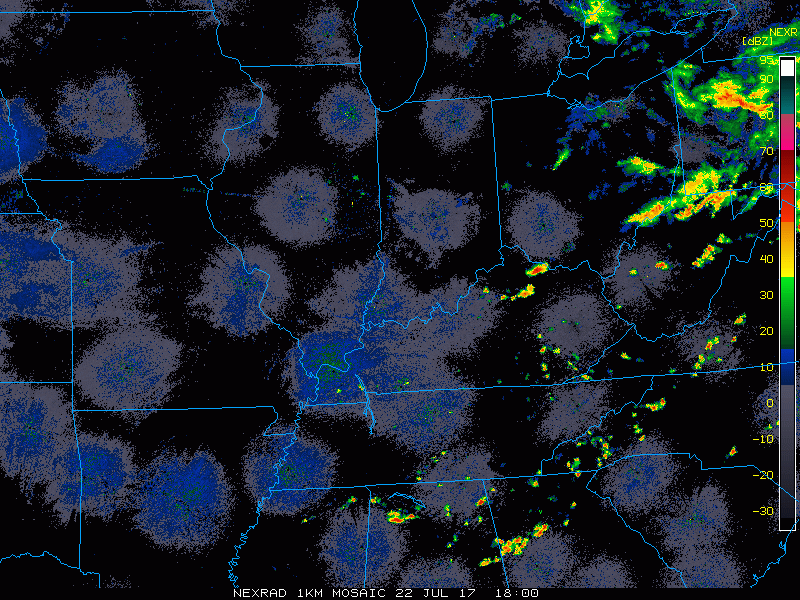
The current radar shows some scattered storms developing to the north and east of Cincinnati across central Ohio. It is another sultry afternoon with current temperatures near 90º, with a heat index of 100º! It is also breezy with southwest winds of 10-25 mph this afternoon.
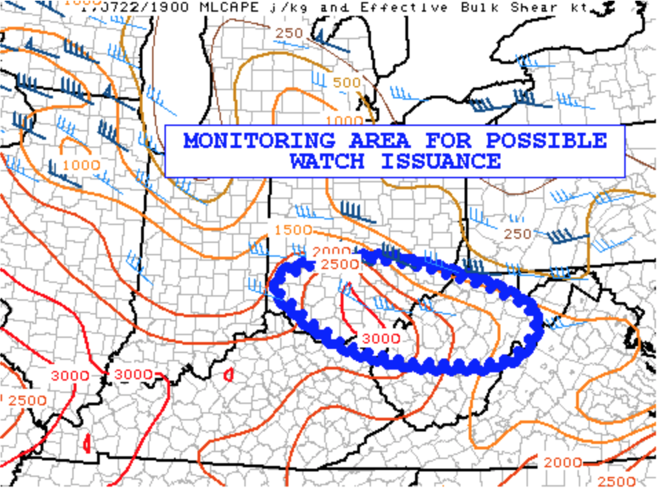
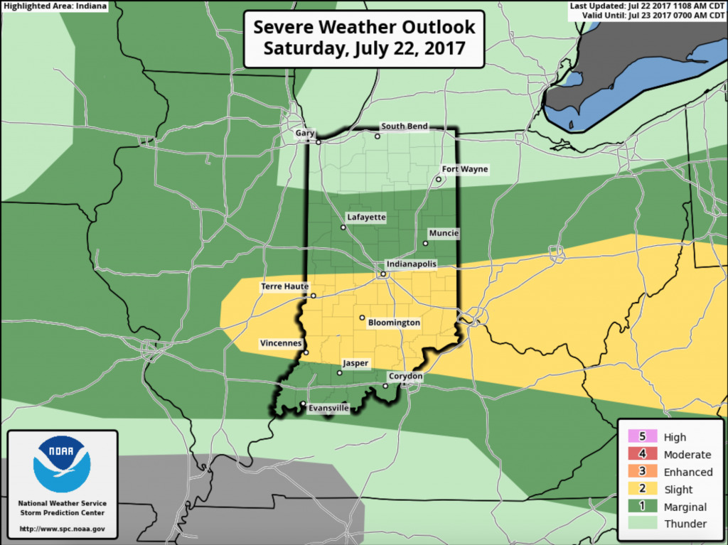
The Storm Prediction Center is monitoring southern Ohio for the potential of a severe thunderstorm watch to be issued this evening.
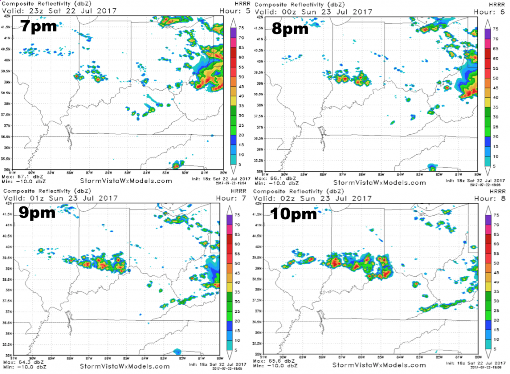
As we head through the evening, storm activity will start to increase. Here is what the latest HRRR model is indicating radar should look like during tonight’s game. It indicates scattered storms bubbling up over central Indiana by 7pm, then sliding southeastward and becoming more numerous by late evening. IF this model is correct, that would mean the higher storm coverage would hold off until after the game.
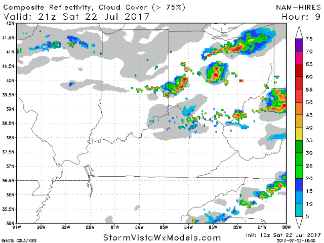
The hi-res NAM is a bit more aggressive, showing scattered thunderstorms developing overhead and increasing as we go through the late evening and overnight hours. The animation below goes from 5pm – 1am.
The take-away here will be for the potential for scattered storms to develop overhead by game-time, sparking along a left-over boundary from the storms earlier today. Storms will become more numerous the further we get into the evening and overnight hours. There is also the potential of a few severe storms, with damaging winds the main threat. The Storm Prediction Center has placed Cincinnati under the slight risk.
It should also be noted that heavy rain will be a possibility with the potential for storms to train over the area for several hours tonight. Let’s hope we can manage to keep the storms away until after the game, but it will be very important to monitor the latest radar trends and be weather aware. Have a great evening, and let us know if you have any questions.