Good Saturday morning! We have an unsettled weekend forecast with rounds of thunderstorms along with very hot and humid conditions. Let’s discuss!
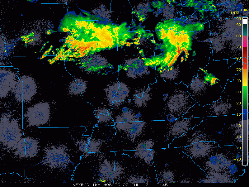
Current radar as of 7:30 am is showing a couple complexes of storms moving across IL/IN/OH.
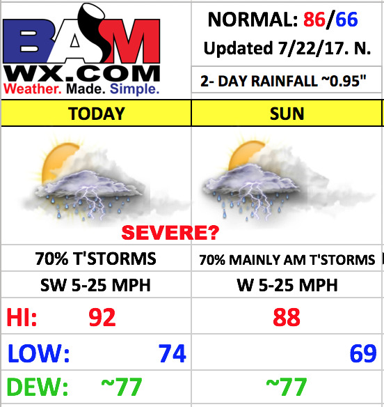
As we head through the day, the storms this morning should exit with a lull developing this afternoon. This will allow temperatures to skyrocket and combined with very high humidity levels, the National Weather Service has issued an excessive heat warning for Cincinnati which will be in effect until 8pm this evening. Heat index values of 100-104 are expected. It will be important for all the players and fans to stay hydrated.
The forecast confidence becomes lower heading through the evening, as a second round of storms will get going to the north and drop southward. The big forecast questions right now are 1)where do these storms initialize, and 2)how quickly do they make it to Cincinnati? I am going to post 4-panels of the HRRR and hi-res NAM models, with time stamps between 7pm and 10pm.
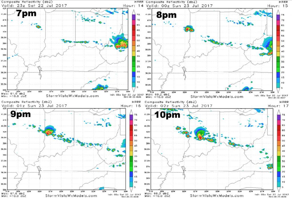
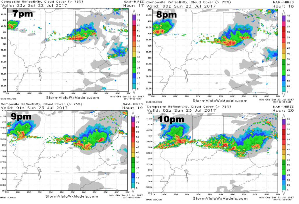
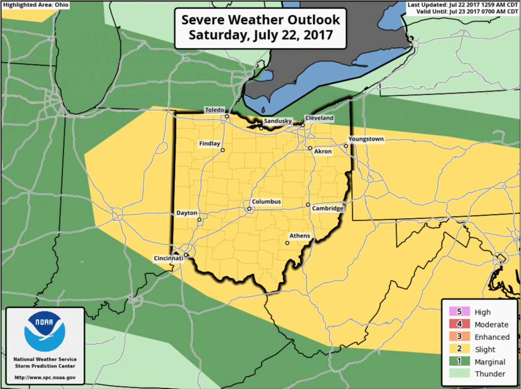
It should be noted that the previous run of the hi-res NAM held the storms off until midnight, and would mean a mostly dry evening game. I think that solution is still a possibility. I am not 100% sold on the latest run of the NAM posted above, which shows a stormy set-up for the evening game. That said, it should be noted that both models show the potential of some storm activity around for the game. Let’s keep our fingers crossed that we can keep these storms away until after the game, but just be aware that storm chances will be in place. Another important thing to note is the potential of severe storms tonight. The Storm Prediction Center has placed Cincinnati under the standard slight risk. Damaging winds/hail the main threats.
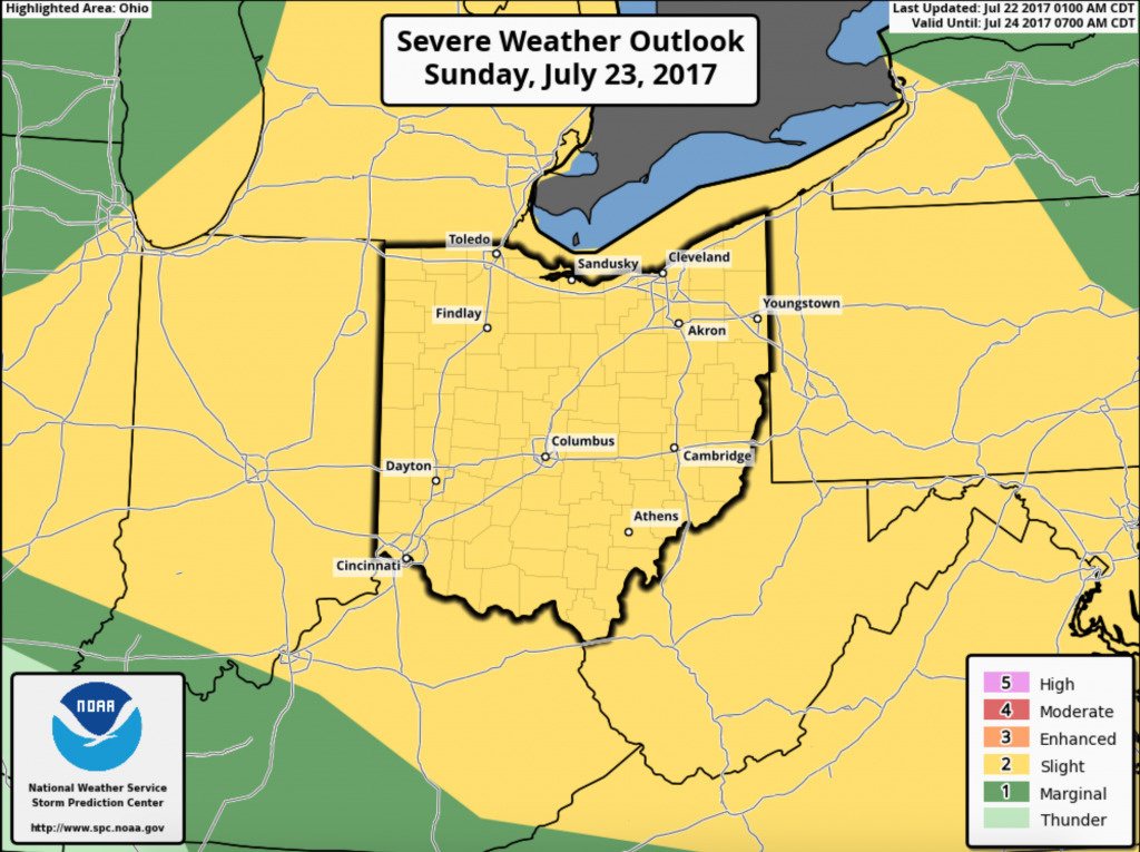
As we move into Sunday, storm chances will decrease heading through the morning, then additional widely scattered storms develop in the afternoon and evening. Skies will be mostly cloudy through the day, with a westerly wind 5-25 mph. Once again, severe storms will be on the table with the Storm Prediction Center placing the area under a slight risk. Damaging wind/hail the greatest concerns.
We will continue to monitor these storm risks as we go through the weekend. Have a great day, and let us know if you have any questions.