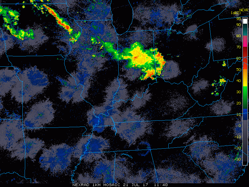
Good Friday morning! Here is the current radar this morning showing a complex of storms pushing through the Cincinnati area, certainly a stormy start to the day.
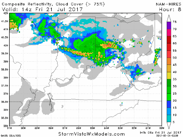
As we head through the day, expect the current storms to move through with additional scattered storms possible this afternoon into the evening. However, expect many dry hours. The high temperature forecast is tricky dependent upon storms and cloud coverage, but expecting a high near 90. Winds will be variable with a frontal boundary in the area, but generally from the southwest 5-15 mph. A heat advisory is in effect from noon to 7pm this evening. Humidity levels will be oppressive, with afternoon heat indices of 100-104. Expect heat indices to remain in the 90s during the game tonight, so it will be important for everyone to stay hydrated. Here is an animation of the hi-res NAM model going through the day and evening. The good news is that the data continues to indicate storm coverage greatly diminishing by game-time and there-after. Overall, coverage looks isolated for tonight’s game.
A marginal risk for severe storms is in place today.
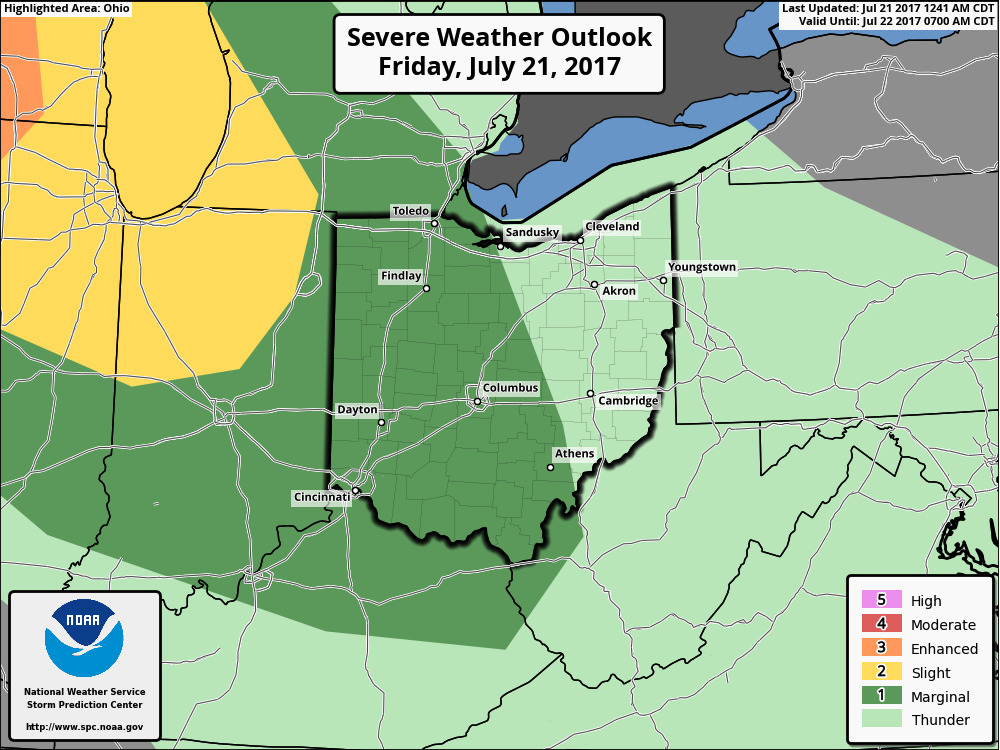
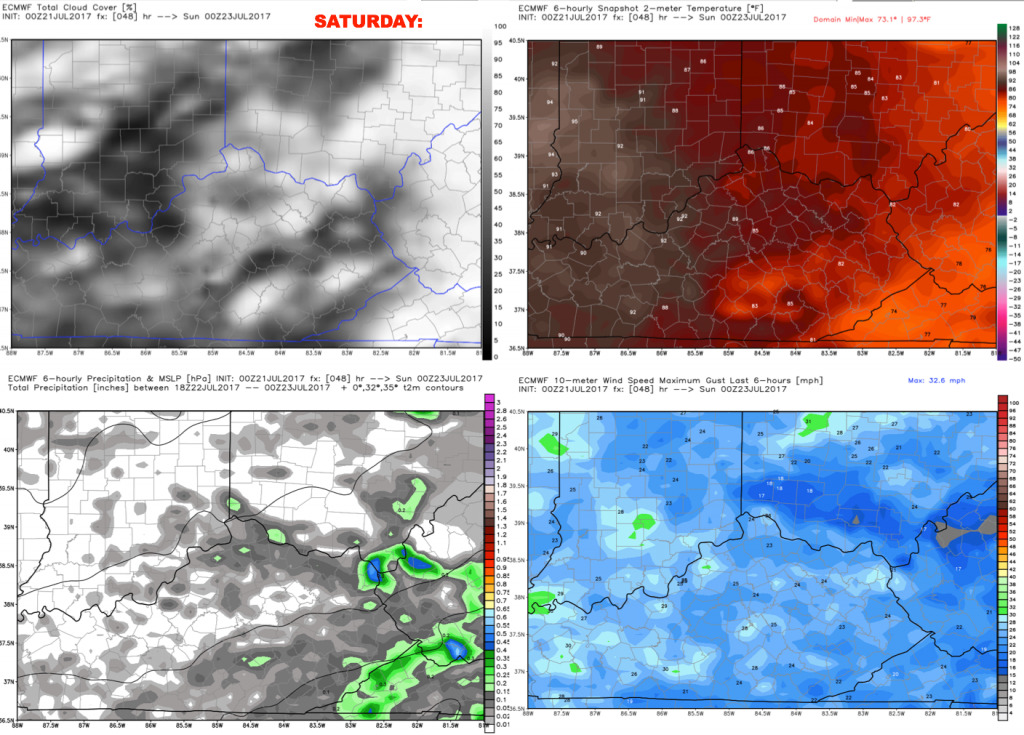
Saturday will feature more of the same with a round of storms possible in the morning (especially north) then expect many dry hours with a few scattered storms into the afternoon and early evening. It will be a breezy day with southwest winds 5-25 mph. Highs are forecast to reach the lower 90s with heat indices 100-105. We will have to watch the radar for additional storms developing to the north during the evening, sliding southward Saturday night. Right now, the data holds the main round of storms until after the evening game. Let’s hope it stays that way. For now, we will keep in the threat for some scattered storms. Tomorrow night’s round of storms will also have a greater potential of producing severe weather.
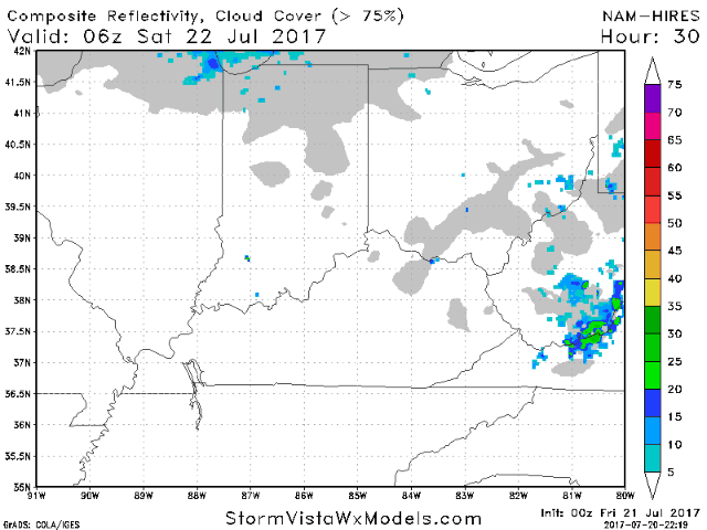
Here is an animation of the hi-res NAM model showing a potential round of storms in the morning, then another round tomorrow night.
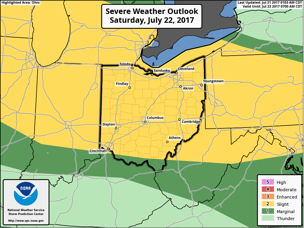
Here is the NOAA Storm Prediction Center outlook for Saturday night.
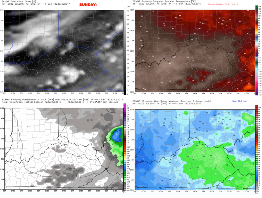
Heading into Sunday, we are looking at a ~40% storm chance early in the day, then a mainly dry afternoon. Most of the data is showing a mainly dry picture for Sunday’s afternoon game, which is great news. However, it will remain hot and humid with temperatures near 90 and elevated heat indices.
Have a great day, and let us know if you have any questions!