Good Thursday morning! Here is a look at current radar this morning. We are watching a weakening complex of storms to the northwest. While the thunderstorm activity has decreased, the rain shield is still maintaining itself for now.
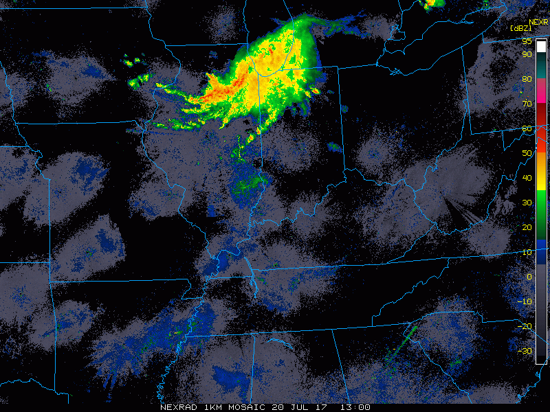
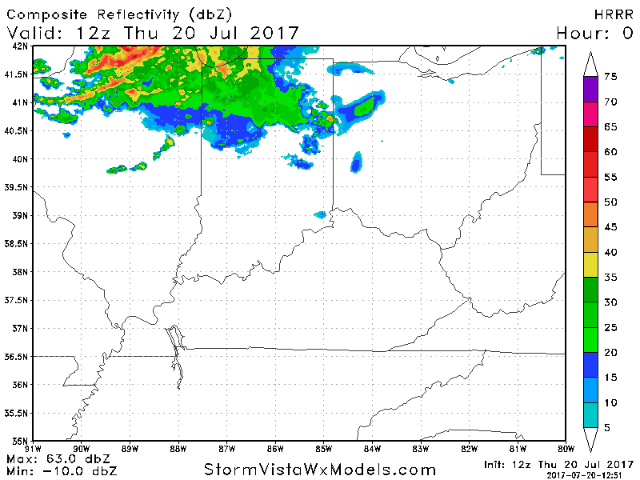
We expect this system to gradually weaken as it moves towards Cincinnati into the afternoon. However, there may still be some rain showers associated with this feature as it moves in during the early to mid afternoon. Here is an animation of the HRRR model going through the day. The increased clouds alone from this will help hold temperatures down today.
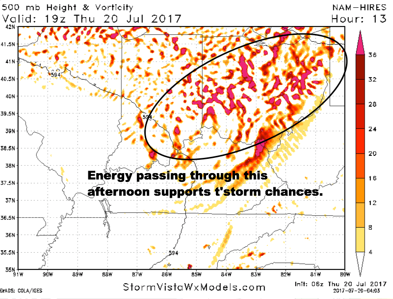
Areas of upper level energy will be passing through during the afternoon, which supports a t’storm risk.
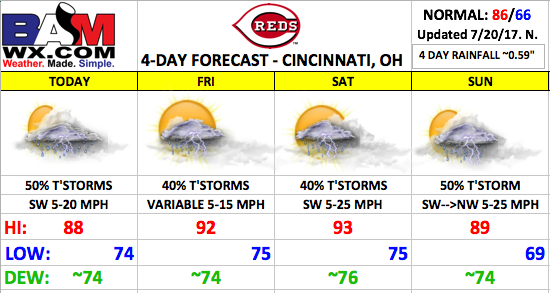
We will put a ~50% storm risk in today’s forecast with high temperatures warming well into the 80s to near 90, depending on cloud coverage through the day. With the high humidity, plan on elevated heat indices.
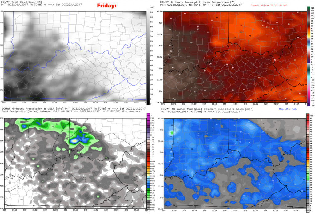
Friday will feature partly cloudy skies with ~40% storm risk. Certainly not looking at an overwhelming storm threat for the evening game, but the chances will be there. Wind direction will vary through the day at 5-15 mph.
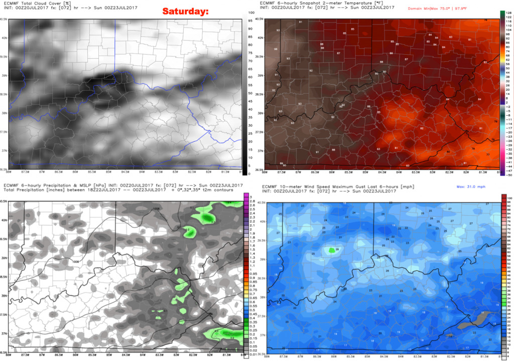
Saturday will feature more of the same, with ~40% t’storm risk through the day. Expect partly to mostly cloudy skies. Highs will reach the lower 90s with elevated heat indices, and a breezy southwest wind 5-25 mph.
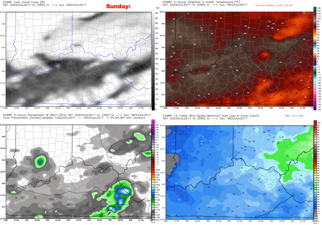
Sunday will feature a continued storm threat as a front continues to move through the area. We are forecasting ~50% storm coverage. This should keep the temperatures a bit lower, along with mostly cloudy sky conditions. Winds will shift from the southwest in the morning to northwest by the evening, generally from the west 5-25 mph during the afternoon game.
Have a great day, and let us know if you have any questions.