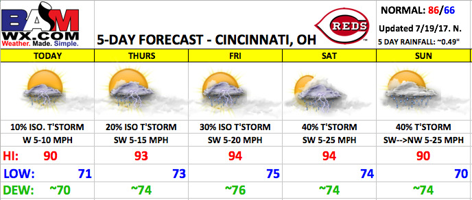
Good Wednesday morning! The hottest stretch of the summer season is on the way for the rest of the week with high heat and humidity. Small storm chances are in the forecast, with the best chances arriving this weekend.
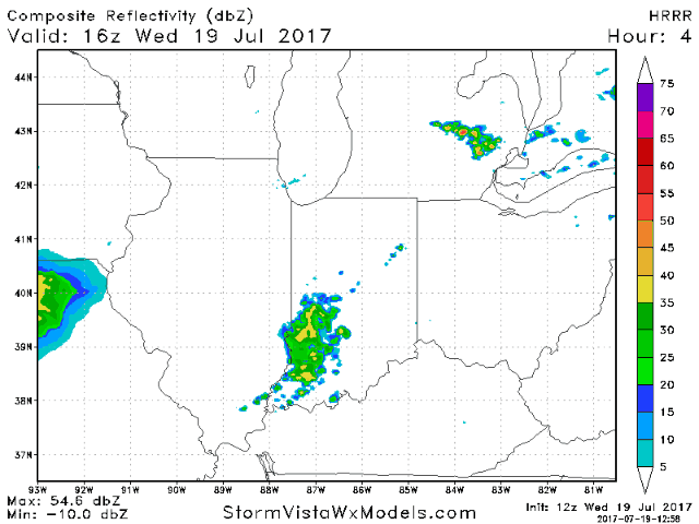
Today looks mainly dry with mostly sunny skies and a small chance of a pop-up t’storm this afternoon. Highs will be near 90 with light west winds 5-10 mph. Below is an animation from the HRRR model future radar going through the day into the evening hours.
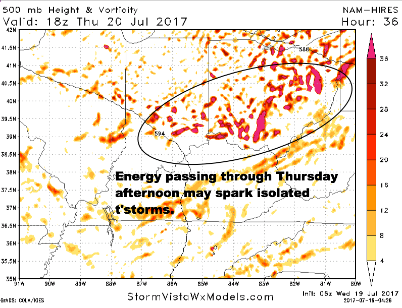
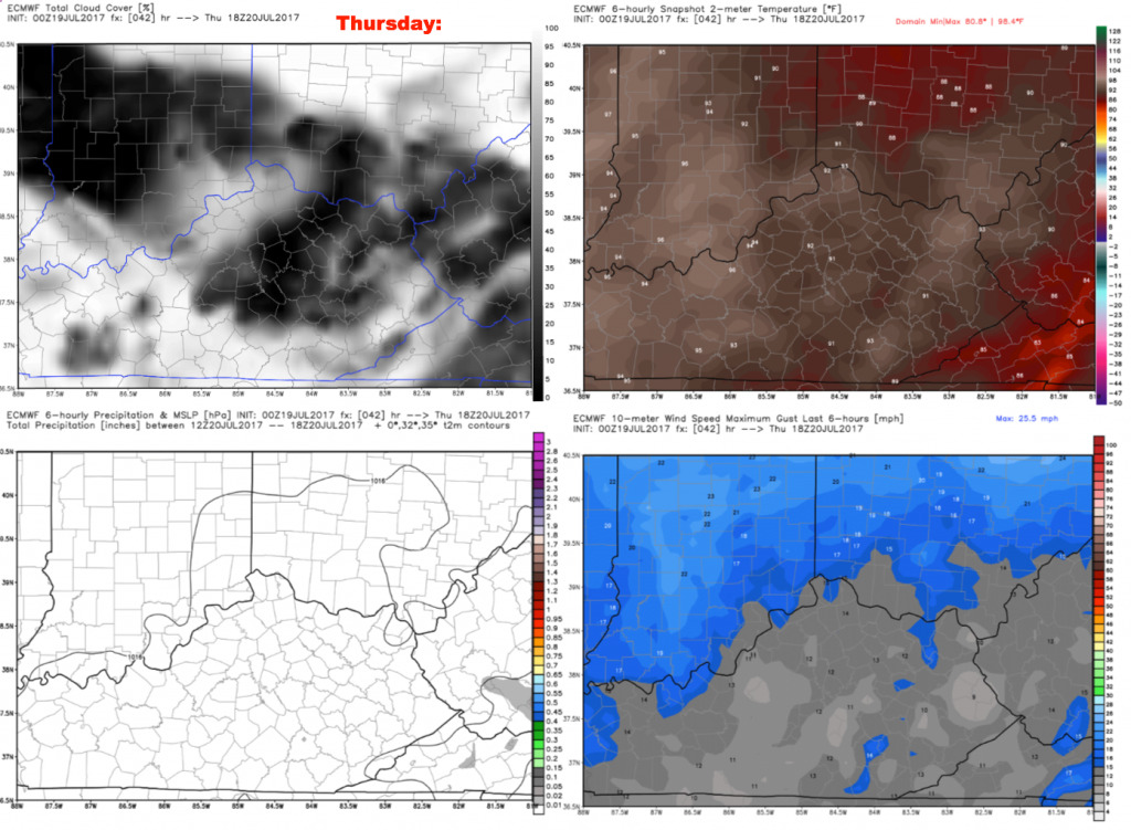
Thursday will be similar to today, with a slightly higher threat of isolated storms. There will be some upper-level energy moving through during the afternoon, which could spark isolated storms. Temperatures by first pitch will already be near 90 with elevated heat indices.
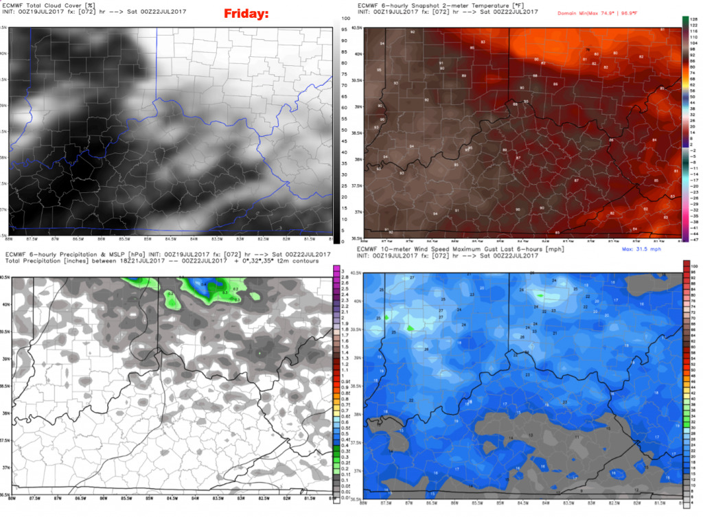
Friday will be very similar to Thursday, with slightly higher storm chances up to ~30%. Expect a mix of sun and clouds through the day. Winds will generally be from the southwest 5-20 mph. Highs are forecast to reach the middle 90s with elevated heat indices.
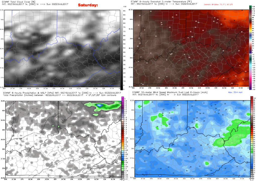
Saturday will be another very hot and humid day, with storm chances increasing to ~40%. Right now, it appears the best chances will come during the afternoon, then chances continue heading through Saturday evening/night. Clouds will gradually increase during the day. It will be a bit breezy with southwest winds 5-25 mph.
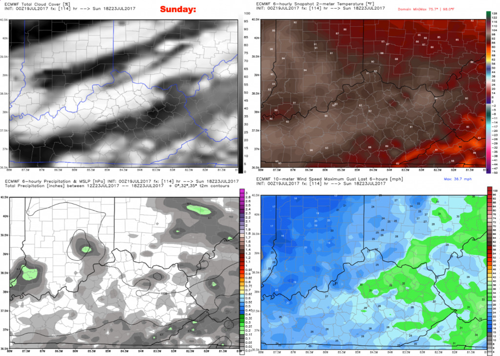
Scattered storm chances continue on Sunday, with coverage ~40%. Due to more cloud coverage, highs will be closer to 90. We are looking at a breezy day Sunday with southwest winds in the morning shifting to northwest by the evening at 5-25 mph. Winds during game-time should generally be from the west.
Have a great day, and let us know if you have any questions.