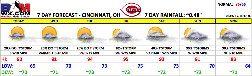
Good Tuesday morning! Heat and humidity will continue to build as we go throughout the rest of the week. Storm chances look to remain low until the end of the week and going through the upcoming weekend.
Expect a mix of sun and clouds today with just a small chance of an isolated pop-up storm this afternoon. Highs will be near 90, with a light south wind 5-10 mph. Any storms that develop will quickly fade out this evening. Below is an animation of the HRRR model, showing isolated pop-up storms this afternoon.
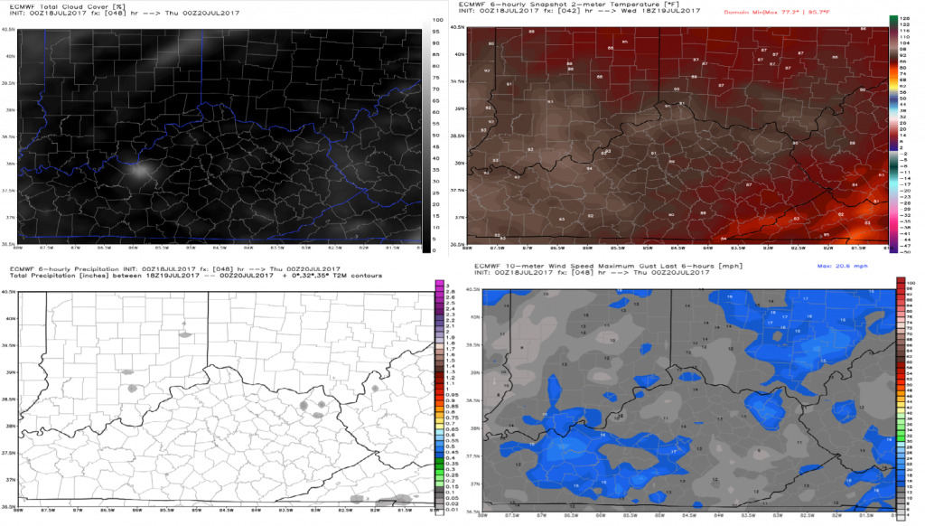
Wednesday will feature more of the same with an isolated afternoon storm possible. Highs will reach the lower 90s with elevated heat indices. There will be plenty of sunshine during the evening game, with pop-up storms dissipating as the sun goes down. Winds will be variable 5-10 mph.
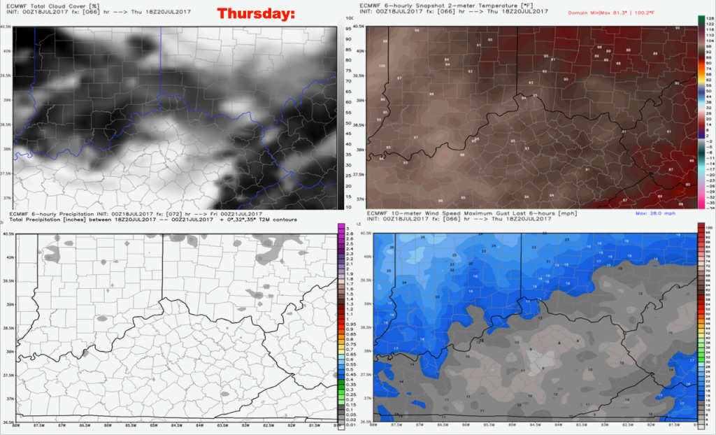
Thursday will feature a few more clouds along with high heat and humidity. Once again, we will keep isolated storms in the forecast. High temperatures will flirt with the middle 90s during the afternoon with elevated heat indices. Winds will be out of the southwest at 5-15 mph.
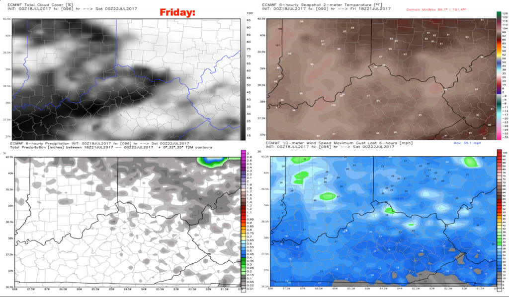
Friday will feature a slightly higher thunderstorm risk, with afternoon highs reaching the middle 90s. It will be a breezier day with southwest winds 5-25 mph. Highs will reach the middle 90s with elevated heat indices.
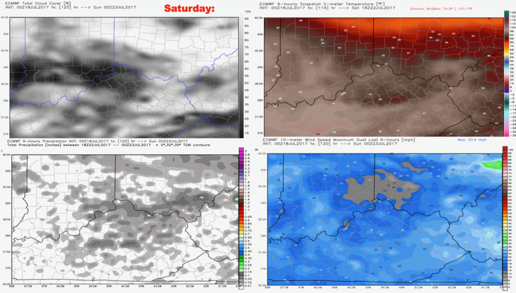
Saturday storm chances will go up to ~40%. High temperatures will be dependent upon storm coverage, but lower 90s are forecast for now along with high humidity sticking around.
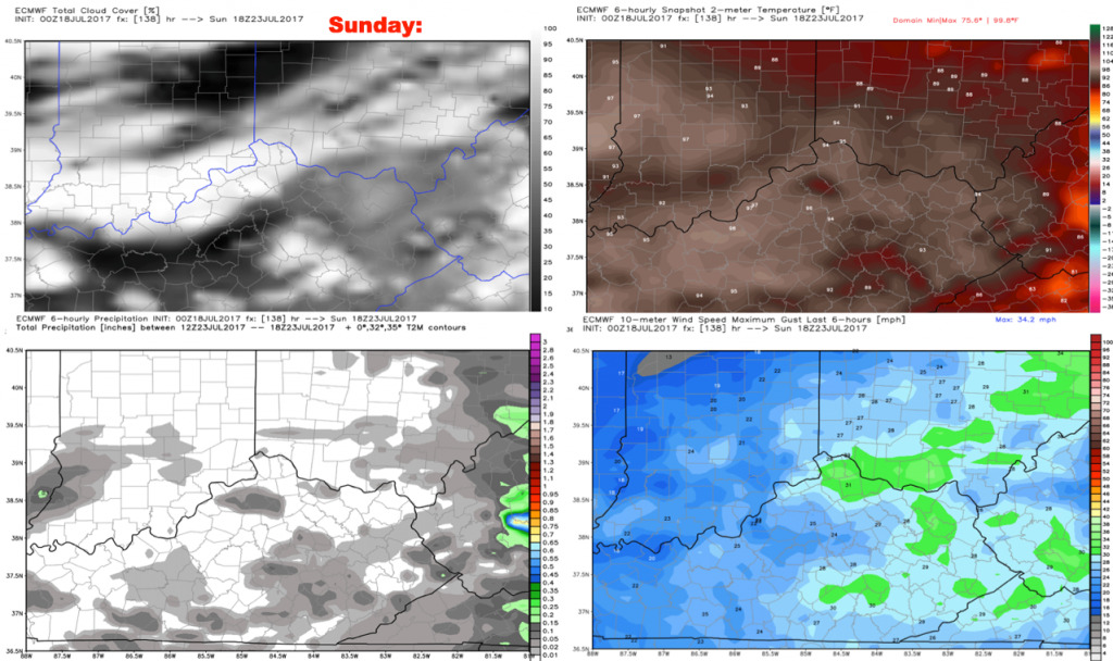
Scattered t’storms will be possible once again on Sunday, with mostly cloudy skies. Winds will be out of the west 5-20 mph. It will turn slightly cooler thanks to the increased clouds.
Have a great Tuesday, and let us know if you have any questions!