Good Monday morning!
The week ahead will feature building heat with a stretch of 90s on the way along with high humidity levels. Storm chances for much of the week will remain rather limited, with chances inching upward as we head into the upcoming weekend.
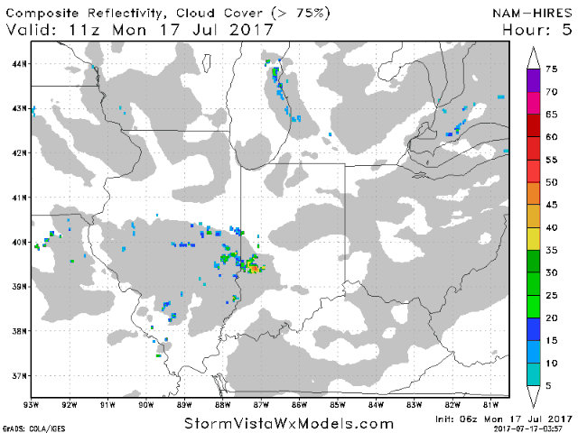
For today, expect a mix of sun and clouds with the risk for a few isolated storms. Coverage is expected to be ~30%. Winds will be light and variable once again, but generally a light north wind 5-10 mph. Temperatures will warm into the middle 80s this afternoon with moderate humidity. While we have to include an isolated storm risk for today’s game, chances are higher that it will stay dry. No severe storms are expected. The animation below is from the hi-res NAM model from 8am this morning to 7pm this evening.
Tuesday will feature mostly sunny skies and a small chance of a pop-up storm in the afternoon. Similar theme of light and variable winds, and highs a touch warmer reaching the mid/upper 80s. Temperatures will fall into the lower 80s by game-time.
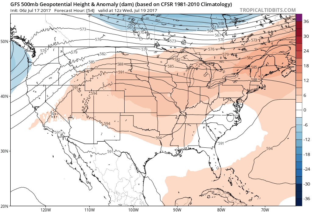
Temperatures will continue to climb mid to late week as a large upper-level ridge expands across the area. This will lead to highs possibly in the middle 90s by Thursday and Friday. Add in the high humidity, expect peak heat indices in the triple digits. The trickiest part of the forecast will be pinning down storm chances. It appears the best focus for storms will remain to the north initially, then chances will gradually increase heading into the weekend. The animation below shows the upper level height anomalies from Wednesday-Sunday. Notice that the upper level ridge expands into the region late week, then starts to flatten out over the weekend. We will continue to fine-tune the forecast over the coming days.
We hope you have a great Monday, and let us know if you have any questions.