Good Sunday morning!
After a picture-perfect Saturday, much of today is looking great as well. The week ahead will feature a front moving into the area tonight and lingering through Monday. Mainly dry conditions and building heat will be the theme through mid-week, then the pattern will become more conducive to t’storms by the end of the week into next weekend.
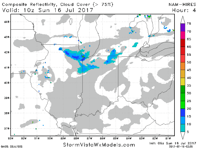
There is some very weak upper-level energy moving through this morning into mid-day. It would not be impossible to see a very isolated shower pop-up this morning, but generally this will just mean a few more clouds. We should see a mostly sunny afternoon. Highs will reach the middle 80s by late afternoon with a calm wind this morning becoming west 5-10 mph this afternoon. Here is a future radar animation from the hi-resolution NAM model. You can see the model indicating a few clouds into early afternoon and possibly a stray shower, then a mostly sunny afternoon with the main front still well to our north. The models indicate a rather strong capping inversion aloft through the day, further increasing confidence for a dry game today.
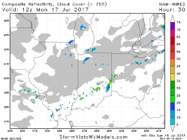
This weak frontal boundary will park itself over the area on Monday. We are looking at ~30% storm coverage through the day with some widely scattered storms. Chances will go up a bit heading into the afternoon with the help of daytime heating. Skies will be partly cloudy with afternoon highs once again in the middle 80s. It will also be rather humid, with dewpoint temperatures around 70. Winds will be light and variable.
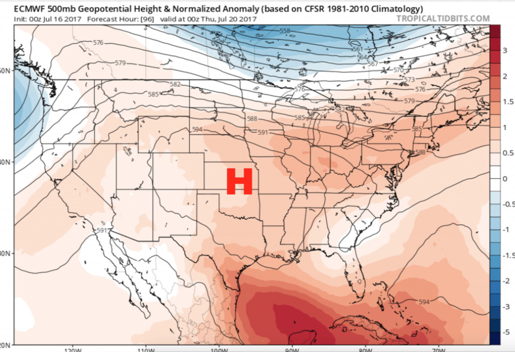
A building upper-level ridge will send our temperatures up through week. This looks to be the hottest week we have felt all summer. The “core” of the heat dome remains to our west, with the area still on the eastern periphery. This means weak energy will still attempt to move through, but storm chances look limited at this time. The ridge will start to weaken heading into the end of the week and next weekend with a stormier pattern returning.
Have a great Sunday, and let us know if you have any questions.