Good Thursday morning!
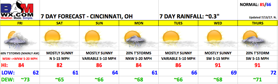
Synopsis: A cold front will move through the area on Friday with t’storm chances moving out, then expect a quiet weekend with high pressure in control. Another boundary will bring the risk for a few thunderstorms late Sunday into Monday, but overall a fairly quiet pattern heading into the middle of next week with temperatures expected to rise.
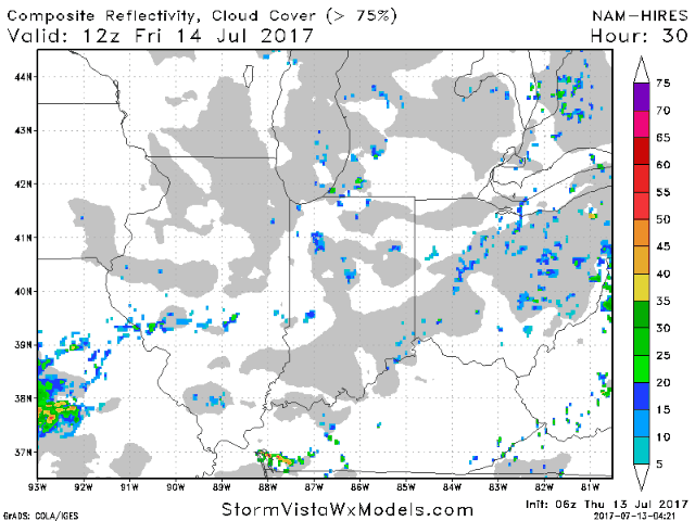
A cold front will gradually shift southeast of the area Friday. Scattered t’storms will remain in the forecast into mid-afternoon. Right now, all indications are that the weather will be dry for the game. Winds will be out of the northwest at 5-20 mph. Dewpoints will also start to fall during the evening hours. Here is an animation of the high-resolution NAM model on Friday.
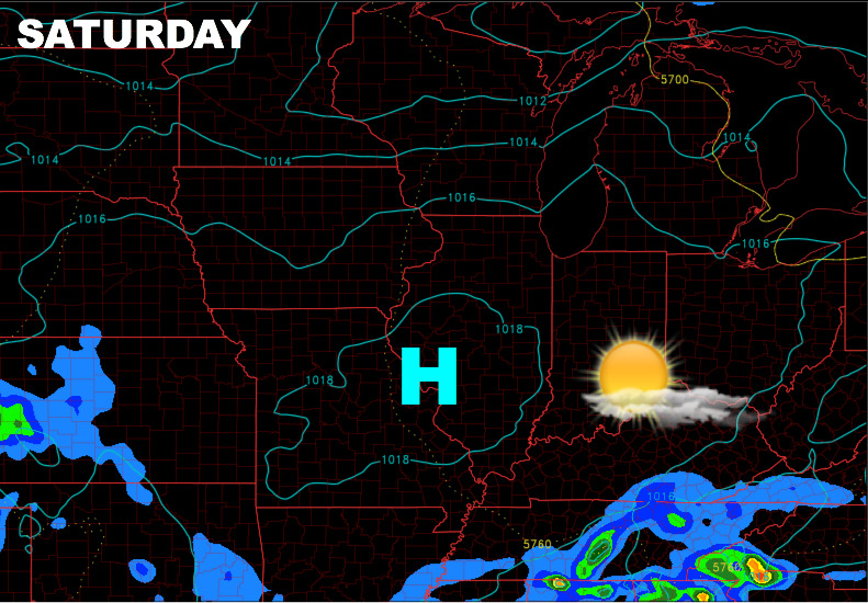
Great weather anticipated for Saturday with high pressure in control. Winds will be light out of the north at 5-15 mph.
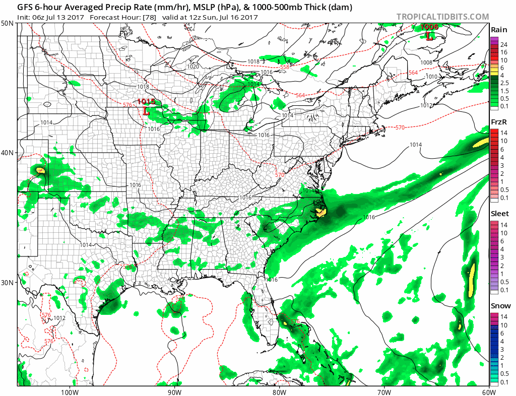
The Sunday afternoon game is looking good to go as well, with a mix of sun and clouds. Winds will be light and variable. A front will move through Sunday night and Monday, giving the area a risk for a few widely scattered storms on Monday. This is not looking to be a big deal at this time.
The middle of next week looks quiet overall with temperatures expected to increase. Let us know if you have any questions regarding the forecast. Have a great day!