Good Saturday morning! A cold front will slowly sag southeast into the area as we make our way trough the day today, but since it will slow moving, this means thunderstorm chances will remain in the forecast for today.
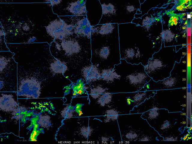
Here is a look at the radar loop early this morning from 6:30am to 7:15am. The Cincinnati area is catching a nice break from any precipitation, but notice a batch of showers and storms over western Kentucky. Some of that activity may affect the area by mid-day and early afternoon hours, along with some additional development.
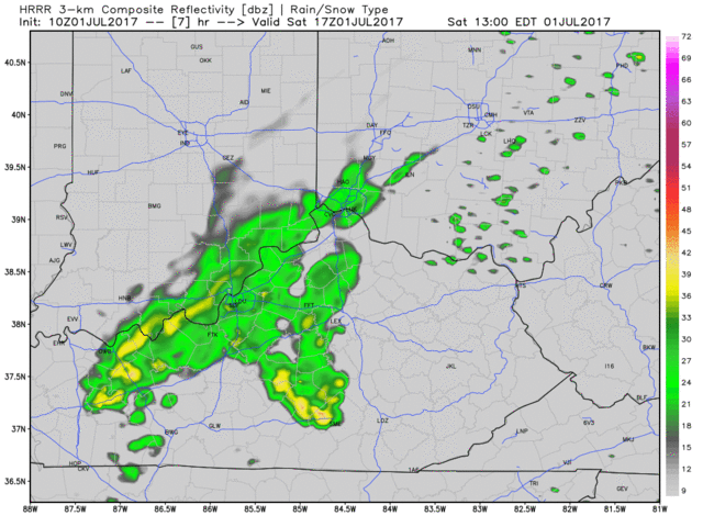
Much of the morning hours should remain dry, then a chance of widely scattered thunderstorms arrives mainly after noon and continues this afternoon with a cold front in the area. Chances should peak around mid-afternoon, then shifting off mainly to the southeast by early evening. Humidity will remain high through the day, with high temperatures reaching the lower 80s. Winds will be mainly out of the west, anywhere from 5-15 mph with gusts around 20 mph. Posted below is an animation of the hi-resolution HRRR model from 1pm to 9pm. Notice how the activity will be very hit or miss, and the trend by the all-important game-time and thereafter is for coverage to continue to decrease, and push more to the southeast. That means there is a decent chance the entire game stays dry, and the storms that do effect the area should not last too long. Coverage of the storms should be ~40%. It appears any thunderstorm chances should exit after 7pm.
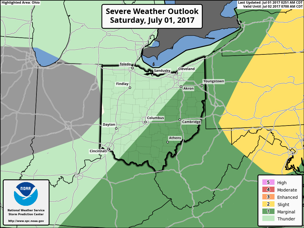
The latest severe weather outlook for today keeps the severe weather chances off to our east.
Overall, not a bad forecast for today’s game. Let us know if you have any additional questions about the forecast. Have a great day!
-Nathan