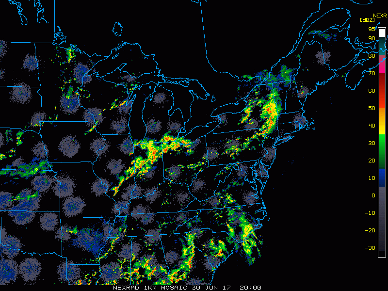
Good afternoon! A few scattered storms have developed this afternoon across the area, with much greater storm coverage off to the west and north of the area across northwest Ohio and central Indiana. Those storms continue to move to the northeast. Here is a radar loop between 4-4:3opm:
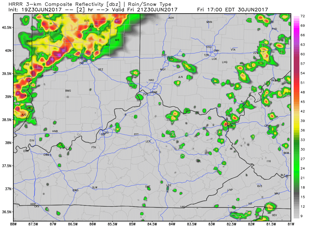
The latest hi-res models are in very good agreement regarding the timing and nature of the storms as they move into Cincinnati this evening, which increases forecast confidence. The timing has sped up somewhat from the update this morning. The HRRR model seems to have a good handle on the current thunderstorm activity and how it will evolve when it moves in this evening. The model animation below goes in hourly increments from 5pm – 1am. This model, along with the other data is bringing in the storms by 10pm, with very limited storm activity ahead of that. That would mean much of the game may get in storm-free. Notice how the storms approach by 9pm, then may take some time to spread across the metro region. The exact angle of the storm complex will determine how quickly they arrive into the area.
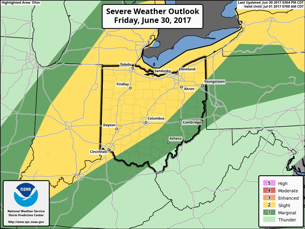
It is important to note there is a SLIGHT risk for severe thunderstorms this evening per the NOAA Storm Prediction Center. Damaging wind gusts and hail are the biggest threats.
BOTTOM LINE: All the data is indicating a complex of thunderstorms to our west moving in by roughly 10pm. This means much of the game should be good to go, but it will be important to monitor radar trends through the evening, especially since we have the risk for some storms reaching severe criteria. Have a great evening, and let us know if you have any questions about the forecast.
-Nathan